Download

1 / 29
290 likes | 513 Views
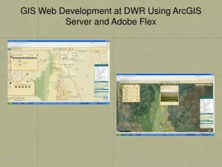
2009 Ohio GIS Conference September 17, 2009. Developing a GIS Portal Using the Flex API. Joe LaCombe System Architect Woolpert, Inc. What I will talk about…. What is Flex? What is the ArcGIS Server Flex API? Discuss ESRI’s Sample Viewer and the widget programming model

E N D
2009 Ohio GIS Conference September 17, 2009 Developing a GIS Portal Using the Flex API Joe LaCombe System Architect Woolpert, Inc.
What I will talk about… • What is Flex? • What is the ArcGIS Server Flex API? • Discuss ESRI’s Sample Viewer and the widget programming model • Case Study: Extending the Sample Flex Viewer • Integration with other platforms - Show how you can consume .Net WCF services via REST from the Flex environment • Benefits of Flex • How it compares with other API’s?
What is Flex? • Adobe Flex is a software development kit released by Adobe Systems for the development and deployment of cross-platform rich Internet applications based on the Adobe Flash platform. Flex applications can be written using Adobe Flex Builder or by using the freely available Flex compiler from Adobe
What is Flex? Flex= .Net MXML= HTML ActionScript= JavaScript + VB/C# Flex Development Kit MXML Markup ActionScript scripting/core programming .SWF file OR
Flex Development Environment • Adobe Flex Builder • Built upon eclipse • Could develop in notepad, use Adobe’s free compiler • Various open source IDE’s, even a plug-in for Visual Studio • But, Flex Builder is the recommended option • Relatively cheap
ArcGIS Server Flex API JavaScript API SilverLight API Flex API REST API HTTP/JSON SOAP API HTTP/XML Web ADF DCOM ArcGIS Server
ArcGIS Server Flex API • http://resources.esri.com/arcgisserver/apis/flex/index.cfm?fa=home • Samples • API Reference • Community/Code Gallery • Sample Viewer
Sample Flex Viewer • FlexViewerDevelopersGuide.pdf • Provided by a group from ESRI but ESRI “technically” does not support • Nice looking GUI Widget programming model • Architected efficiently and in a way so don’t need to worry about the plumbing • Easy to extend
Sample Flex Viewer • liberates programmers from having to deal with: • the programming complexity of managing maps • map navigation • application configuration • inter-component communication • data management, etc. • focus their time and effort on implementing core business functions in their custom applications. • quickly develop/deploy customizations into existing Sample Flex Viewer applications in the form of widgets • Add a configuration entry into the Sample Flex Viewer application’s configuration file.
Case Study: Northern Kentucky Area Planning Commission (NKAPC) • Objective: rewrite/combine existing ArcIMS websites into one portal
LinkGIS Viewer Presentation Tier Business Logic Tier Data Tier
Widget–based Approach: Mapping Portal .Net Web Services SDE
Consume .Net Services • Printing • ArcMap based layout ArcObjects • Provide map description, graphics as JSON • Web service does the work • Return URL to viewer • Flood Plain Analysis • ArcObjects performs spatial analysis • Populate FEMA PDF form with GIS attributes • Return determination and URL to viewer as JSON • Search • Full-text indexing on specific layer table columns • Configuration tells search service what tables/indexes to search based upon parameters • Return results as JSON
Consume .Net Services • Various options • SOAP XML • HTTP Get, Post, etc. REST/WCF Services • XML • JSON(JavaScript Object Notation) JSON XML
Why JSON? • JSON has much smaller grammar • JSON is processed more easily because its structure is simpler • XML translates the structure of the data into a document structure. This mapping can be complicated. JSON structures are based on arrays and records. That is what data is made of. • Maps more directly onto the data structures used in modern programming languages, i.e. JavaScript/ActionScript Objects
Consume .Net Services • REST/WCF via JSON
Consume .Net Services • Decode results
Benefits of Flex • Rich Internet Applications (RIA) rich functionality and enhanced user experience • Browser independent runs in Flash Player (Web) or AIR (Desktop) • Stable, mature product • Flex provides efficient integration with a variety of systems, data, and technologies • Modular development approach • Each component is a separate Flash file(.swf) • “Flexible” architecture results in more extendable applications • Perfect for building portals and dashboards • It works!
Other API’s • Flex, Silverlight, or JavaScript? • All have their pros/cons • 9.4 to have templates of each to start from • Whichever one you are comfortable with
Contact Information Joe LaCombe System Architect Woolpert, Inc. 317-223-2264 joe.lacombe@woolpert.com