Download
1 / 24
240 likes | 260 Views
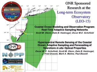
Explore the innovative research projects at the Long-term Ecosystem Observatory (LEO-15) focusing on autonomous systems and regional ocean/atmosphere modeling, demonstrating the potential for recurrent upwelling phenomena and the impact on marine ecosystems.

E N D
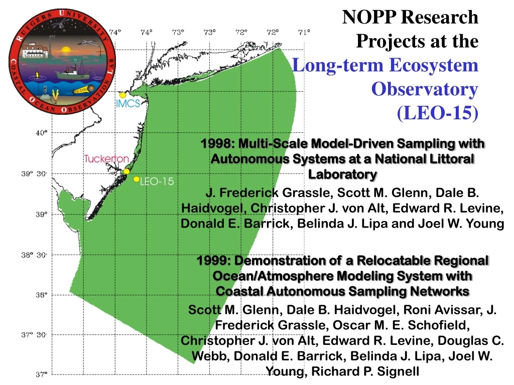
NOPP ResearchProjects at the Long-term Ecosystem Observatory (LEO-15) 1998: Multi-Scale Model-Driven Sampling with Autonomous Systems at a National Littoral Laboratory J. Frederick Grassle, Scott M. Glenn, Dale B. Haidvogel, Christopher J. von Alt, Edward R. Levine, Donald E. Barrick, Belinda J. Lipa and Joel W. Young 1999: Demonstration of a Relocatable Regional Ocean/Atmosphere Modeling System with Coastal Autonomous Sampling Networks Scott M. Glenn, Dale B. Haidvogel, Roni Avissar, J. Frederick Grassle, Oscar M. E. Schofield, Christopher J. von Alt, Edward R. Levine, Douglas C. Webb, Donald E. Barrick, Belinda J. Lipa, Joel W. Young, Richard P. Signell
The Challenge “Shelf waters deeper than 3 meters and shallower than about 30 meters have often been ignored in the past because of the very difficult operating conditions and the complex dynamics, where the water is filled with turbulent boundary layers.” Ken H. Brink 12/12/97 Observational Coastal Oceanography National Science Foundation OCE Workshops http://www.joss.ucar.edu/joss_psg/project/oce_workshop
Spatial Scales 1mm 1cm 1m 10m 100m 1km 10km 100km REMUS Molecular & cellular processes Rutgers research vessels 1 sec Mixing & physiological acclimation satellites 1 min Movement, Physical Transport Temporal Scales 1 hour Impacted fisheries Phytoplankton blooms 1 day LEO-15 Nodes & Moored Systems 1 week Seasonal cycles 1 month WEBB Glider 1 year 10 year
Surface Temp. 21 25 2000 GMT 1800 GMT 25 cm/s 25 cm/s 28 39° 30’ N 39° 30’ N 31 (°C) CZCS Pigments 0.1 0.2 0.7 10 74° 00’ W 39° 15’ N 39° 15’ N 74° 15’ W 74° 00’ W 74° 15’ W (mg/m3) Surface Temp. Chlorophyll a Phenomenological focusPotential for recurrent upwelling, driven by watercolumn-seafloor interactions, to drive bottom water hypoxia-anoxia
Nor’Easter Upwellng 25 0 Temperature Depth (m) 15 15 175 210 Julian Day >6 0 Chlorophyll a (mg L-1) Depth (m) <2 15 175 210 Julian Day Cable in place and functioning about 3 years (1997 first year available). System can be run autonomously or remotely from off-site. Plenty of power to play. 90 vertical profiles during July 1997 Cabled Robotic Profilers
Instrument Package for 2000: ac-9, HiSTAR, FRR, LISST, HS-2, Biolum, VSM 1.0 1 Tidal cycle Upwelling Absorption at 440 nm (m-1) 6 Depth (m) 0 12 30 60 0 Time (hr)
Towed Survey Systems Bio-Optical Profiling Systems
1.5 0.02 0.5 1.0 0.0 a550 39o50 Kd (pred.) July 16, 1999 Absorption-555 Ship Transects 412 nm Depth (m) 39o30 0 0 1.5 Kd (measured) 1.5 Distance (km) 0 10 74o00 74o30 Kd (predicted) 443 nm 490 nm 0 Kd (measured) 0 1.5 Estimated from insitu data Satellite measured 510 nm 5 0 Distance (km) 10 0
AUVs WHOI Survey Remus NUWC Turbulence Remus SLOCUM Glider
REMUS Flight Path 2.5 DEPTH (M) 6.5 500 METERS 300 METERS Bioluminscence Chlorophyll a fluorescnece
Regional Ocean Modeling System (ROMS) Development Initiated by Rutgers/UCLA 1997 Features: • Free-surface, hydrostatic, primitive equation model • State-of-the-art turbulence closure schemes for atmosphere and ocean • Efficient coarse-grained, shared-memory, parallel code • Enables support of high-resolution real-time coastal forecasting applications
Navy Products Rutgers Global Atmospheric Forecasts NOGAPS 1998 I.C. B.C. Local Atmospheric Forecasts NORAPS Atm. Forcing Ocean Models ROMS SBL
Navy Products NOAA & Rutgers Global Atmospheric Forecasts NOGAPS NCEP 1999 I.C. B.C. I.C. B.C. Local Atmospheric Forecasts COAMPS 27 km 6 hours RAMS 4 km 30 min Atm. Forcing Atm. Forcing Ocean Models ROMS PBL SBL BBL WBL MODAS (POM) I.C. B.C. Waves WAM Wave Models
31 16 8 5 3 LEO-15: Where the camaraderie of a sea going M*A*S*H unit prevails. - New York Times, August 1st, 1999 Go Hard or Go Home!!!- NOPP/ONR 1999