Download
1 / 10
100 likes | 122 Views
Explore student projects completed in the LA438 GIS Application to Design Projects course, integrating GIS skills into landscape architecture design. Express appreciation to dataset providers and showcase the use of GIS in design.

E N D
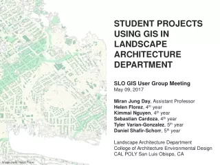
STUDENT PROJECTS USING GIS IN LANDSCAPE ARCHITECTURE DEPARTMENT SLO GIS User Group Meeting May 09, 2017 Miran Jung Day, Assistant Professor Helen Florez, 4th year Kimmai Nguyen, 4th year Sebastian Cardoza, 4th year Tyler Varian-Gonzalez, 5th year Daniel Shafir-Schorr, 5th year Landscape Architecture Department College of Architecture Environmental Design CAL POLY San Luis Obispo, CA Image credit: Helen Florez
INTRODUCTION • Originally from South Korea • MLA degree from the university of Illinois Urbana-Champaign • Registered Landscape Architect, Florida and LEED AP BD+C • 15 years experience in Landscape Architecture design firms • Urban design • Community development • Hospitality planning and design • 5 years teaching Indiana and Cal Poly, California • Large scale planning and design • Design communication Media – Analogue and Digital • Geographic Information System (GIS)
WHAT? Student projects completed in the LA438 GIS Application to Design Projects course WHY? • To express appreciation to those who provide datasets • To tell what we do with the datasets and how we use GIS in design • To showcase landscape architecture projects
LA438 GIS APPLICATION TO DESIGN PROJECTS • An introductory GIS course in the landscape architecture department • Assisting students with design background to integrate and apply basic GIS skills into their design projects • Developing critical thinking and logical design decisions • Average 15 students for 4 hours each class, two classes per week (8hours per week) • Course structure • Lectures, demos, and in-class exercises (6wks) • Project (3 - 4wks)
LA438 TOPICS • Base Map • Feasibility Study • Demographic Study • Use of Digital Elevation Model and Lidar Point Cloud • Spatial Analysis and Hydrology Tools • Soils • Google Earth and ArcScene • Visualization
BASE MAP, SECTION, GIS AND GOOGLE EARTH Image credit: Annelie Heinemann
SOILS Image credit: Maren Hill
WATERSHED AND TERRAIN MODIFICATION Image Credit: Daniel Shafir-Schorr
LIDAR POINT CLOUD AND LAS DATASET Image credit: Brandon Rommos
RISE I REACT I ADAPT Helen Florez, 4th year Kimmai Nguyen, 4th year Sebastian Cardoza, 4th year Lucie Simmons, 4th year Repairing Fresno’s Urban Fabric Tyler Varian-Gonzalez, 5th year Baywood Basins Park Daniel Shafir-Schorr, 5th year