Download

1 / 5
51 likes | 234 Views
MATERIALS NEEDED TO PINPOINT ONE’S LOCATION ON A MAP. Paper weight so map stays in place. Pencil and eraser. Map (in official maps, the North-South axis is the right/left margin). Map has to have a scale. East-West axis. North-South axis.

E N D
MATERIALS NEEDED TO PINPOINT ONE’S LOCATION ON A MAP Paper weight so map stays in place Pencil and eraser Map (in official maps, the North-South axis is the right/left margin) Map has to have a scale East-West axis North-South axis Triangle (with scale; if none, then a ruler will be needed) Circular protractor
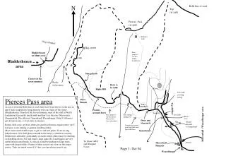
Sample problem: Determine your location on the map given two compass bearings to two landmarks. Compass bearing to Tall Peak is 275o while bearing to Tablet Rock is 80o. STEP 1: Mark the exact middle of the locations and construct cross-hairs for each. Shown here is the cross-hair over Tall Peak and over Tablet Rock. Cross-hair over Tall Peak. Note the use of the exact middle as reference point and the proper positioning of the triangle both of which are crucial to accurate readings.
Sample problem: Determine your location on the map given two compass bearings to two landmarks. Compass bearing to Tall Peak is 275o while bearing to Tablet Rock is 80o. STEP 2: Position the circular protractor (zero mark at North) and mark the given compass bearing. In this case, it is 275o. Then a line is drawn following the given bearing. Cross-hair over Tall Peak. Note the use of the exact middle as reference point. Given bearing (275o) is marked.
Sample problem: Determine your location on the map given two compass bearings to two landmarks. Compass bearing to Tall Peak is 275o while bearing to Tablet Rock is 80o. STEP 3: The protractor is then used to mark the second given bearing over Tablet Rock (80o) and a line is drawn through the Tablet Rock following the given bearing. Cross-hair over Tall Peak. Note the use of the exact middle as reference point. Line is drawn through the given bearing and the Tablet Rock. Given bearing (80o) is marked.
Sample problem: Determine your location on the map given two compass bearings to two landmarks. Compass bearing to Tall Peak is 275o while bearing to Tablet Rock is 80o. STEP 4: The intersection between the two lines drawn indicates your position on the map. Line drawn through Tablet Rock. Line drawn through Tall Peak. Intersection marks your location on the map.