Download
1 / 20
200 likes | 325 Views
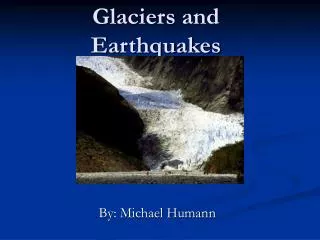
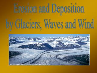
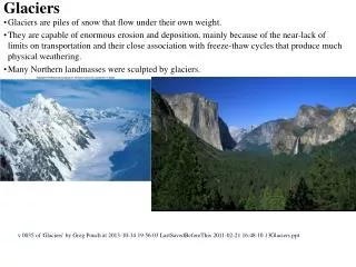
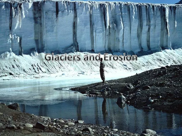
Glaciers and Erosion. Forming Glaciers. When snowfields, large collections of snow and ice, get enough snow, the small grains of ice that make them up, called firn , start to condense into a solid block of ice. A glacier has been formed when the ice starts to move downslope due to gravity.

E N D
Forming Glaciers When snowfields, large collections of snow and ice, get enough snow, the small grains of ice that make them up, called firn, start to condense into a solid block of ice. A glacier has been formed when the ice starts to move downslope due to gravity.
Valley Glaciers Valley Glaciers are long, narrow, wedge shaped glaciers that develop in mountains. Continental Ice Sheets These cover entire landmasses. There are only two left, in Greenland and Antarctica.
Basal Slip The way you expect a glacier to move. Water underneath allows the glacier to move as a solid block down the mountainside. Internal Plastic Flow Solid ice crystals slip over each other, moving the glacier slowly. The centre of the glacier moves faster than the edges, which are more brittle.
Crevasses Large cracks form in the glacier surface as it moves. These crevasses can be more than 30 m deep, and are often hidden.
Deposition Glaciers leave behind erraticsand stratified drift. Erraticsare large boulders, till is unsorted rock material, etc. All this is called glacial drift. Stratified drift is glacial debris that has been sorted into layers by streams of meltwater.
Glacial Lakes Often, glaciers gouge out lakebeds, which fill with meltwater when the glacier retreats. Sometimes, these lakes have not outlet streams, and the water evaporates, making it increasingly salty. These salt lakes are not common, but several exist, like Great Salt Lake in Utah.
Ice Ages During the last ice age, glaciers covered nearly one third of the land on Earth, including almost all of Canada. The most accepted theory for why ice ages happen is the Milankovitch theory, which says that small changes in the Earth’s orbits cause the changes in temperature.
Wind Erosion The most common form of wind erosion is deflation, which blows away the top layer of fine particles. The remaining gravel packs together to form desert pavement, which protects the underlying land from erosion. Deflation hollows can also form, with a depth of 5 to 20 m, and a width of several kilometres. Rocks polished by wind erosion are called ventifacts.
Dunes When a barrier blocks the wind, sand covers it, forming a dune. Loess Deposits of airborne dust; from the German for “loose”.
Wave Erosion Shorelines are being constantly eroded by waves, tides, and chemical weathering. Sea cliffs are produced by wave erosion. Resistant rock areas that project from the shore are called headlands. Rock platforms beneath the water are called terraces, and are either built up by waves depositing sediment, our are made by the erosion of the stone on top of them.
Beaches • A beach is a deposit of any kind of sand or rock fragments along a shoreline. • Most beaches have a raised section called the berm, caused by waves, and sand bars, which are collections of sand, formed underwater.
Longshore Currents • Water moving along the shore are longshore currents, a current parallel to the shoreline. • A long, narrow deposit of sand connected at one end to the shore is called a spit. • A ridge of sand connected an offshore island to the mainland is called a tombolos.
Coastlines • Sea levels are constantly changing, such as during the last ice age, where sea levels were 140 m lower than today, and coastlines were drastically different. • The tectonics of the earth also change coastlines, especially along plate boundaries.
Submergent Coastlines • When the sea level rises, or the land sinks, the previous coastline is submerged. Beaches will begin to form, valleys become bays and inlets, and high points on submerged land become islands. • Estuaries, a river opening where fresh and salt water mix, often form when this occurs.
Emergent Coastline • The opposite also occurs. When the sea level falls, the previously submerged land becomes an emergent coastline.
Barrier Islands Barrier Islands are long, narrow ridges of sand, over 100 km long, parallel to the coastline, somewhere between 3 to 30 km offshore. The area between the shore and the barrier island is called a lagoon.
Coral Reefs Fringing Reef: A coral reef around the coast of an island. Barrier Reef: A reef around the remnants of a volcanic island, much farther away from land. Atoll: A reef surrounded a completely submerged island.