Download
1 / 30
300 likes | 324 Views
Learn about coastal zone definitions, geological time, and factors influencing coastal geology, from sea level changes to cultural influences. Understand the subzones of the coastal zone and the importance of lithology and marine processes.

E N D
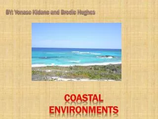
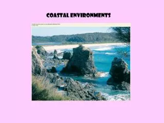
CEM Part IV: Chapter 1 Coastal Terminology and Geologic Environments • Coastal Zone Definitions • Geologic Time • Factors Influencing Coastal Geology • Sea Level Changes • Cultural Influence on Coastal Geology
Features and landforms range in size from centimeters to kilometers and are formed or modified over time scales of minutes to millennia.
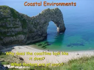
Coastal zone: is defined as the transition zone where the land meets water, the region that is directly influenced by marine or lacustrine hydrodynamic processes. • The coastal zone extends offshore to the continental shelf break and onshore to the first major change in topography above the reach of major storm waves. • The CZ is divided into four subzones: • (1) Coast. • (2) Shore. • (3) Shoreface. • (4) Continental shelf.
Coast:a strip of land of indefinite width that extends from the coastline inland as far as the first major change in topography. • Cliffs, frontal dunes, or a line of permanent vegetation usually mark this inland boundary. • On barrier coasts, the distinctive back-barrier lagoon/marsh/tidal creek complex is considered part of the coast.
The shore: extends from the low-water line to the normal landward limit of storm wave effects. • divided into two zones: backshore (berm) and foreshore (beach face). • Foreshore: low-water line to the limit of wave uprush at high tide. • Berm crest: marks the juncture of the foreshore and backshore.
Shoreface: seaward-dipping zone that extends from the low-water line offshore to the beginning of the continental shelf (slope transition). The shoreface is not found in all coastal zones (low-energy coasts/ consolidated material)
The shoreface can be delineated from shore perpendicular profile surveys or from bathymetric charts (if they contain sufficient soundings in shallow water). The shoreface is the zone of most frequent and vigorous sediment transport.
Continental shelf: the shallow seafloor that borders most continents. • Extends from the toe of the shoreface to the shelf break where the steeply inclined continental slope begins. • It has been common practice to subdivide the shelf into inner-, mid-, and outer zones, although there are no regularly occurring geomorphic features on most shelves that suggest a basis for these subdivisions.
Geologic Time • Geologists have subdivided geologic time into eons, eras,periods, and epochs based on the appearance and disappearance of various fossils. • The epochs of most concern to coastal engineers and geologists are the Pleistocene and Recent (Holocene), extending back a total of 1.8 million years before present. • Quaternary is often used to designate the period comprising the Pleistocene and Recent Epochs.
The Pleistocene Epoch was marked by pronounced climatic fluctuations in the Northern Hemisphere. • The continental glaciers that periodically covered vast areas of the northern continents during this time had profound influence on the surficial geology. • Many geomorphic features in North America were shaped or deposited by the ice sheets.
The Holocene Transgression started approximately 15,000 to 18,000 years ago with the beginning of global sea level rise. • Most of the dynamic, morphological features of the coastal environment are Holocene in age (pre-existing geology is visible). • The drumlins of Boston Harbor and the end moraine islands of southern New England (Long Island, Martha's Vineyard, and Block and Nantucket Islands) are deposits left by the Wisconsin stage glaciers, but barrier spits and beaches found along these shores are more recent (Holocene) features.
Major fluctuations in eustatic sea level accompanied the waxing and waning of the continental glaciers. • Oxygen isotope analysis of deep sea sediments have been used to delineate glacial and interglacial periods. • The most recent NA glacial stage was the Wisconsin during which sea level was more than 100 m below present.
Factors Influencing Coastal Geology • Underlying geology and geomorphology: • Controls the sediment type and availability, and overall gradient. In general the configuration of the coast is (first order) a function of the regional lithology and tectonics. • High-frequency dynamic processes: • Impart energy to the coastal zone on a continuous or, as with storms, repetitive basis. • The sources of energy that cause erosion, move sediment, deposit sediment, and rearrange or shape the preexisting topography/bathymetry.
Lithology:the general character of rock or sediment deposits. • mineral composition and the degree of consolidation. • Marine processes are most effective when acting on uncemented material, which is readily sorted, redistributed, and sculpted into forms that are in a state of dynamic equilibrium with incident energy. • The Atlantic and Gulf of Mexico coasts of the United States are mostly unconsolidated, depositional environments (except select locations like the rocky shores in New England).
Tectonics coasts. • Characterized by structural features such as faults and folds (anticlines and synclines), and large-scale uplift and subsidence of land masses. (US west coast) • Volcanic coasts. • Characterized by large masses of new crustal material or calderas (resulting from the collapse of the cone or explosion).
Waves: • Surface gravity waves are the dominant force driving littoral processes on open coasts. • Wave energy is derive from wind and is ultimately dissipated in the nearshore region and on beaches. • Waves provide an important energy source for forming beaches; sorting bottom sediments on the shoreface; transporting bottom materials onshore, offshore, and alongshore.
Tides: (diurnal, semi-diurnal, mixed) • The periodic change in water level results in different parts of the foreshore being exposed to wave energy throughout the day. In regions with large tidal ranges, the water may rise and fall 10 m, and the shoreline may move laterally several kilometers between high and low water. Different region of the intertidal zone are exposed to erosion and deposition. • tidal currents can erode and transport sediment. residual motions can be highly important and spatially asymmetric patterns of ebb and flood stages may cause mass transport of both water and sediment. • tides cause the draining and filling of tidal bays, an important process related to the cutting and migration of tidal inlets and the formation of flood- and ebb-tidal shoals in barrier coasts.
Energy-Based Classification of Shorelines Hayes (1979) tidal categories for coastlines: Microtidal, < 1 m. Low-mesotidal, 1-2 m. High-mesotidal, 2-3.5 m. Low-macrotidal, 3.5-5 m. Macrotidal, > 5 m.
correlation of morphology based on energy regime Hs2T2 Hs = significant wave height T = significant wave period Hs2T2 0 – 30 = mildly exposed coast Hs2T2 30 – 300 = moderately exposed coast Hs2T2 > 300 = highly exposed coast Classification Based on Wave Energy Walton and Adams, 1978
Hayes (1979) classification was based primarily on shores with low to moderate wave power and was intended to be applied to trailing edge, depositional coasts. Five shoreline categories were identified based on the relative influence of tide range versus mean wave height (Nummedal and Fischer 1978; Hayes 1979; Davis and Hayes 1984): • Tide-dominated (high). • Tide-dominated (low). • Mixed-energy (tide-dominated). • Mixed energy (wave-dominated). • Wave-dominated.
Long Island Classification Amero-Trailing Edge Coast South Shore Significant Wave Conditions: H ~= 1.5 m, T = 8 sec Micro-Tidal Environments Cliff or Bluff Coast Tide Dominated Tide Dominated & Riverine Gravel, sand Gravel 2 m Wave Dominated Sand Mixed Energy Barrier Island
Factors Influencing Coastal Geology • Wind direct influence: saltation, dunes/blowouts • indirect influence: wave generation, ocean circulation • setup - setdown • Seiches: lakes, estuaries, small seas, created by changes in barometric pressure, violent storms and tides. • Storms: tropical, extratropical (Noreasters), storm surges, winds, waves • Biology: reef builders, filter feeders, grasses/wetlands etc.
Sea Level Changes • Sea level changes are easily determined from water level gauges. • Few gauges have data extending back 50/100 years • Eustatic: global sea level changes associated with the addition or removal of water • (15 cm/century – 23 cm/century) • Relative: sea level changes relative to a local datum, incorporates tectonic influences
On the role of the Agulhas system in ocean circulation and climate • Journal name: • Nature • Volume: • 472, • Pages: • 429–436 • Date published: • (28 April 2011) • DOI: • doi:10.1038/nature09983 • Received • 22 June 2010 • Accepted • 01 March 2011 • Published online • 27 April 2011