Download
1 / 18
180 likes | 314 Views
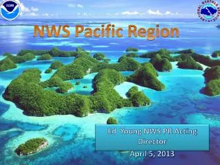
NOAA SATELLITE CONFERENCE. Pacific Region's Satellite Products, Programs and Requirements. Pacific Region Headquarters Honolulu, Hawaii April 2013. Area of Responsibility. Area of Responsibility. Pacific Region covering > 30 million square miles 2 Weather Forecast Offices

E N D
NOAA SATELLITE CONFERENCE Pacific Region's Satellite Products, Programs and Requirements Pacific Region Headquarters Honolulu, Hawaii April 2013
Area of Responsibility • Pacific Region • covering > 30 million square miles • 2 Weather Forecast Offices • 6 Weather Service Offices • 2 Data Collection Offices • Central Pacific Hurricane Center • Pacific Tsunami Warning Center • International Tsunami Information Center
PR Observing Program • NWS PR supports numerous islands, such as Hawaii, American Samoa, Guam, CNMI, and Micronesia • Satellite Ground Stations (including L/X-band antenna) • Surface and upper air in-situ observations • GPS Sensors • These provide: • Invaluable assistance for our Watch, Warning and Advisory programs • Verification • Support for our daily forecast services
PR Observing Program • Challenges • Communications and infrastructure • Limited resources for operations and maintenance • Highly corrosive environments • Time to travel to remote destinations (limited air and boat service) • High costs for equipment, contracts, travel and shipping • Limited personnel
April 5, 2013 00:14 UTC Aqua MODIS
UW-CIMSS Cloud Top Cooling Assesses vertical convective cloud growth using cloud top cooling rates based on boxed average 11 micron band brightness temperatures and GOES Imager data
Hawaii VolcanoesSO2 issues Photograph by M. Poland, November 13, 2008, USGS HVO.
Summary • Pacific Region covers a vast area void of observations • Satellite data is vital to our mission • Ground stations located in Hawaii and Guam • Unique region in the NWS in diversity of comms and variety of offices/services • Complex resources reflect a customized and innovative approach to meeting mission requirements
PR’s Satellite Future • GEO • Himawari 8/9 data reception uncertainties • Temporal and spatial availability • GOES-R (as GOES-West!) • Antenna costs • Data delivery to American Samoa forecasters • GOES-15 coverage of southern Pacific post GOES-R? • LEO • Model and forecast supplements a very data sparse region • Additional valuable data • OSVW, Altimetry, tropical, etc…
Questions Contact: Bill Ward NWS Pacific Region Headquarters Environmental Scientific & Services Division Chief Honolulu, Hawaii Bill.Ward@noaa.gov 808.532.6415