Download
1 / 19
190 likes | 334 Views
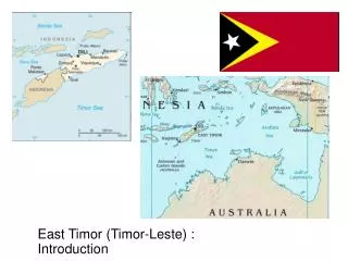
Geospatial Sign Posts And Geopolitical Medium Of The Land Border Between Indonesia And Timor-leste (BSP AS THE GEOSPATIAL AND GEOPOLITICS MEANS OF THE LAND BORDER BETWEEN INDONESIA AND TIMOR-LESTE). Dr. Sri Handoyo Researcher at Balitka-BIG, Cibinong, Indonesia

E N D
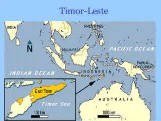
Geospatial Sign Posts And Geopolitical Medium Of The Land Border Between Indonesia And Timor-leste (BSP AS THE GEOSPATIAL AND GEOPOLITICS MEANS OF THE LAND BORDER BETWEEN INDONESIA AND TIMOR-LESTE) Dr. Sri Handoyo Researcher at Balitka-BIG, Cibinong, Indonesia and Lecturer at Pakuan University, Bogor, Indonesia Email: yshandoyo@yahoo.com
LEGAL BASE • Treaty 1904, between The Dutch and The Portuguese • Arbitrary Award 1914 (idem). • Process Verbale 18 December 1914, about demarcation of definitive border. • Document of Oil Poli 9 February 1915, about markers erection in Oecussie . • Document Mota Talas 22 April 1915, about markers erection in East sector . • ANNEXES: • List of border point coordinates (907) • General Map 1:125.000 (1) signed by both Ministers • Joint border maps1:25.000 (17) • Un-resolved segments • 9 Articles of Provisional-Agreement • RI-RDTL 8-4- 2005 signed by both Ministers of Foreign Affairs • +
The joint work phases: Studying the Treaty 1904 and other relevant documents. Joint reconnaissance survey. Joint survey and construction of the common border datum reference frame (CBDRF). Joint delineation surveys. Joint demarcation surveys. Joint mapping. All those activities were based on related joint technical specifications and standard operational procedures.
Results from 2001 to present: • Total Length of border lines: 268.8 kilometers. • “Interim Report on the land Border Delineation between Republic of Indonesia and Democratic Republic of Timor-Leste”, 2004, in three volumes. • “Provisional Agreement between the Government of the Republic of Indonesia and the Government of the Democratic Republic of Timor-Leste on the Land Boundary”, 2005, covering nine Articles and Annexes. • 103 demarcated border markers. • Documents and Records of Discussion (RoD): of JMC meetings (2), of JBC meetings (2), of Special JBC meeting (1), of TSC-BDR meetings (23).
There were no bilateral activities in 2006 and 2007 due to internal problems in Timor-Leste. Therefore, the year of 2006 was initially used unilaterally by the Indonesian Government to survey and establish the Border Sign Posts (BSP) along the border line within the Indonesian territory.
Border Sign Post (BSP): • is a border notice board made from strong brightly red iron pipe and white iron plate, • used to announce that there is a border line close to the post, shown with its distant figure from the post to the border line behind. • is aimed to help people and the border security unit to be aware of their position towards the border line. • In return it is expected that the maintenance of the border line will be well noticed and carried out. • In common it is to increase of public awareness of the local people in the border areas on the Indonesian side, • and one of the objectives is to avoid the reoccurrence of Malibaka (as it happened in 2006) incident and to notify the local people about the existence of boundary line nearby the BSP.
The BORDER SIGN POST • The criteria of location: • Along the border segments that have visual ambiguity of the surrounding border area towards the location of the border point or line. • Along the border segments that have a potencial to be the access of illegal crossing the border. • However, the exact locations will openly be subject to the advice or proposal from the border security team and the local people.
The BORDER SIGN POST • The steps: • Approach the planned location using the agreed point coordinates, • Decide the position around ± 50-100 meter to the border line, • Measure the position using nav-GPS, • Erect the BSP, • Take pictures of the BSP both close up and with its surrounding, • Produce the description sheet including the scketches.
The BORDER SIGN POST The front text, facing Indonesia territory: Perhatian ! Garis Batas Negara RI-RDTL Berada ±25 meter dibelakangtandapenunjukini TandaPenunjuk Batas Nomor 048/2007 (Border Sign Post) Desa Alas Selatan, Kec. Kobalima, Kab. Belu, Prov. NTT Milik Negara Republik Indonesia DilarangMerusak The back text, facing Timor-Leste territory: Perhatian ! (in Indonesian) Andasudahmemasukiwilayah Indonesia ! Atensaun ! (in Tetun) Emi tama onaiha Indonesia nia area ! Mail ! (in Dawan) Hit tamenteupah Indonesia ! Attention ! (in English) You are entering the Indonesian territory !
The Chairman of Bakosurtanal, Mr. R.W. Matindas (right), together with the Vice Governor of NTT Province, Mr. Frans Lebu Raya (left), opening ceremony of the first BSP in Tulakadi Village, Sub District of Tasifeto Timur, in the Belu Regency, 29th November 2006
border point/line at non-river border line border line BSP distance distance distance BSP BSP at river border point/line river bank BSP river bank distance BSP: The Geospatial Functions The position of BSP is its geographic and UTM coordinates. The location is its place in the village where the BSP is built. The position and location of BSP confirm a certain justification on the accuracy of the geospatial information as a complementary element to the land border line.
BSP: The Geospatial Functions (cont…) • While as the completion, the description sheet of BSP contains the following data: • Sequence Number of BSP (yearly based system), • Geographic and UTM coordinates (from field observations), • Height values (approximately derived from the map), • Horizontal distance to border line, • Georeference as WGS 84, and • Places of BSP, i.e., village, sub district, regency, and the province of NTT, as well as the date and the name(s) of surveyor(s) who did the works. • This description sheet is also completed with photographs of the BSP in close up and its surrounding views. The description sheets are printed and bound in a book format as an important formal document of BSP.
BSP: The Geopolitical Roles • As a complementary element to the land border line it is obvious that BSP has a strategic role in securing the states border areas and is very important for the local people as well as the border security officers to prevent from the ocurrence of illegal border crossing and border crimes. Thus, BSP also geopolitically supports the implementation of the boundary lines between Indonesia and Timor-Leste. Its functions are as follows: • To announce not to unintentionally cross the border line, • To avoid crossing the border line illegally, • To avoid border line conflict, • To create a conducive, secure, and peace situations, • To maintain the way of living together as neighbors in peace and friendship.
The BORDER SIGN POST Concluding Remarks: • The BSP is geospatially important to clarify and confirm the people perception of the location of the border lines relative to the BSP position. • The BSP is also geopolitically strategic and meaningfull to support and contribute the peace effort towards the neighborhood along the boundary line between the two countries Indonesia and Timor-Leste. • As Timor-Leste would like to duplicate and implement the BSP system within their territory too, therefore, BSP is proposed to be implemented along the other Indonesian border lines with Malaysia and PNG.
The BORDER SIGN POST Thank You For Your Attentions