Technology and Methods Development to Support Streamgaging
This document provides a comprehensive review of innovative technologies and methods developed to support streamgaging within the ACWI (Advisory Committee on Water Information) networks. It covers flow measurement techniques, including the use of non-contact radar-derived discharge, telemetry, and remote sensing technologies such as AROOS (Airborne Remote Optical Spotlight System). The report highlights current practices in measuring river flow and level, computational modeling for depth retrieval, and examples from notable rivers including the Colorado and Kootenai, emphasizing the importance of accurate data in hydraulic measurements.

Technology and Methods Development to Support Streamgaging
E N D
Presentation Transcript
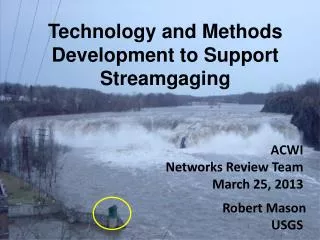
Technology and Methods Development to Support Streamgaging ACWI Networks Review Team March 25, 2013 Robert Mason USGS
The Streamgaging Process FlowMeasurements Streamgage Shift Stage Rating Flow / Stage Flow Time
Current Streamgaging Process Measure Flow Monitor River Level Relate Water Level to Flow Disseminate Information
Index-Velocity Streamgaging Stage-Area Velocity-Velocity Q=V*A
Measurement Method ImprovementsNon-Contact Radar-Derived Discharge Telemetry Velocity Stage Bathymetry
Remote Sensing • 1. Evaluation of remote sensing technologies • Surface velocity from IR Imagery – Areté Associates’ Airborne Remote Optical Spotlight System-Fixed (AROSS-F) • Example from the Colorado River, CO (Kinzel and others, 2012) • 2. Computational modeling (inversion) for depth retrieval from remotely sensed data • Normally, we take bed elevation, discharge, roughness and solve for velocity and water-surface elevation. • Inverse method uses velocity and water-surface elevation to attempt to predict depth (+ Gives refined local information - Requires highly accurate data) • Example from the Kootenai River – (Nelson and others, 2012)
Airborne Remote Optical Spotlight System (AROSS) Source: Steven Anderson, Cindy Piotrowski, John Duganr, Robert DiMarcor and Seth Zuckerma, 2011, “Airborne Passive Remote Sensing of Surface Currents in Rivers and Estuaries”
Cheng, R.T., Gartne, J.W., Mason, R.R., Jr., Costa, J.E., Plant, W.J., Spicer, K.R., Haeni, F.P., Melcher, N.B., Keller, W.C., and Hayes, Ken, 2004. Evaluating a radar-based, non contact streamflow measurement system in the San Joaquin River at Vernalis, California: U.S. Geological Survey Water Resources Open File Report 2004-1015, Costa, J.E., Cheng, R.T., Haeni, F.P., Melcher, N., Spicer, K.R., Hayes, E., Plant, W., Hayes, K., Teague, C., and Barrick, D., 2006, Use of radars to monitor stream discharge by noncontact methods, Water Resources Research, 42, W07422, doi:10.1029/2005WR004430. Kinzel, P.J., Legleiter, C.J., Overstreet, B., Hooper, B., Vierra, K., Nelson, J.M., and Zuckerman, S., 2012, Comparison of acoustic and remotely sensed bathymetry and flow velocity at a river channel confluence, ASCE Hydraulic Methods and Experimental Methods Conference, August 12-15, 2012, Snowbird Utah, 7 p. Nelson, J.M., McDonald, R.R., Kinzel, P.J., and Shimizu, Y., 2012, Using computational modeling of river flow with remotely sensed data to infer channel bathymetry, International Conference on Fluvial Hydraulics -River Flow 2012, September 5-7, San José, Costa Rica. 8p. Steven Anderson, Cindy Piotrowski, John Duganr, Robert DiMarcor and Seth Zuckerma, 2011, “Airborne Passive Remote Sensing of Surface Currents in Rivers and Estuaries” References