Download
1 / 35
350 likes | 365 Views
This seminar explores the relationship between lightning outbreaks and intensity changes in the eyewall of hurricanes. It discusses the radial distribution of lightning, electrification processes, charge distribution, and eyewall cycles. The case study of Hurricane Charley is presented, highlighting the correlation between lightning activity and rapid deepening. Lightning observations have the potential to provide valuable insights into intensity changes in hurricanes.

E N D
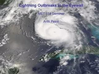
Lightning Outbreaks in the EyewallMET 614 SeminarAntti Pessi
Introduction - Lightning Outbreaks • Updrafts and flash rates in the eyewall usually modest. Core neutral to slantwise convection (Emanuel, 1989) • Lightning outbreaks in the eyewall may indicate rapid intensity change • Often associated with eyewall cycles • Usually hidden on VIS and IR by central dense overcast • Potential of lightning observations in forecasting intensity changes?
Radial Distribution of Lightning in Hurricane • Lyons and Keen (1994), Molinari et al., (1994, 1999), Black and Hallett (1999), Cecil et al., (2002) • Weak maximum near eyewall (<40 km) • Clear minimum 80-160 km • Strong maximum in outer rainbands (210-290 km) 9 Hurricanes composite (Molinari et al., 1999) Andrew ‘92 (Molinari et al., 1994)
Eyewall Electrification • Effective electrification requires ice, graupel and supercooled liquid cloud droplets extending below -20ºC • Steady-state eyewall often lacks supercooled water above -5ºC and updrafts (<5m/s) are too weak to bring up larger supercooled drops and graupel • Instead, new ‘fresh’ eyewall and contracting eyewall have been observed to have updrafts >10m/s and be electrically active Black and Hallett, 1999
Charge Distribution in the Eyewall • Negative strokes usually originate close to max echoes (a few km outward of sfc eyewall, near -10…-15˚C) • Positive strokes originate from stratiform area (outward blown ice crystals) • Coldest cloud tops outward of max echoes Jorgensen (1984) Andrew ‘92 (Molinari et al., 1994)
Eyewall Cycles Storm weakens when: • Outer eyewall forms, act as a barrier to high theta-e inflow • Convection in the outer eyewall leads to secondary circulation: latent heat release, updrafts in the eyewall, descent and adiabatic warming over the inner eyewall Intensifies: • This secondary circulation also causes isobaric height falls in the area it encloses. • Height fall is concentrated at the inner edge of wind maximum causing the gradient wind to increase there and the maximum to contract Jorgensen (1984) Willoughby (1995)
Flight Through Double Eyewall Electric field W CLW (sensor problem! Temperature Wind Black and Hallett, 1999
Hurricane Charley 13 Aug. 2004 • Landfall in Florida, Cat. 4, 130kt, 941mb • 10 direct deaths, damage $14 Billion • Rapid intensification prior to landfall: 964->941mb in 4.5h (5mb/h) • Lightning outbreak in the eyewall coincided with intensification
Data Sources - Hurricane Charley Case • Lightning data from International Long-Range Network (practically from NLDN) • Flash positions overlaid on GOES-12 IR Detection efficiency and sensor locations
Charley 13 Aug. 2004 12-20Z 20Z 12Z
Last 6 hours before landfall: • Eyewall radius shrunk from 20 to 7 km • Storm intensified from 965 to 941 mb
Lightning Rate vs. Intensity 660 eyewall flashes during last 8h
Lightning Rate vs. Intensity Elena, Hugo, Bob (Molinari et al., 1999) Andrew ‘92 (Molinari et al., 1994)
Summary • Convective updrafts and lightning are physically related manifestations of eyewall • Updrafts in a steady hurricane are too weak to electrify the eyewall • Lightning outbreaks in the eyewall are often associated with eyewall cycles or contracting eyewall and storm intensity changes • Eyewall lightning in hurricane Charley coincided with rapid deepening • Lightning observations are continuous, near real-time and have sometimes potential to show changes in intensity