Download

1 / 11
110 likes | 144 Views
Explore how GPS technology tracks Earth's response to melting ice sheets, revealing insights into climate change, earthquake causes, and the impacts on regions like Hudson Bay and the Great Lakes.

E N D
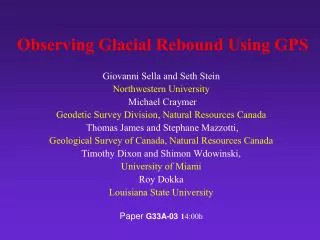
Observing Glacial Rebound Using GPS Giovanni Sella
Glacial Isostatic Adjustment (GIA) GIA is the earth’s response to the removal of the great ice sheets Last glacial maximum 18,000 yrs ago Since then, ice melted back http://jesse.usra.edu/ archive/jesse01-300-01/
Why Motion Today? Small motions resulting from “post-glacial rebound” (GPS can detect motions as small as 1 mm or 1/25 of an inch per year) stem from the fact that the mantle below the earth’s crust flows like a super-viscous fluid -- much, much stickier than road tar or maple syrup. The mantle is still flowing to fill areas underneath the places where the heavy ice sheets pushed out the mantle 18,000 years ago. MANTLE FLOWS OUT MANTLE FLOWS BACK
Constraints on GIA in North America Raised beach Successive beaches left as fossil shorelines, recording uplift history Tide gauge at Churchill Tide gauge shows land rising today Within 1,500 km of Hudson Bay only 1 T. G.
Why Study Glacial Isostatic Adjustment ? - Climate Studies give insight into ice ages & climate, the nature of the earth’s interior, and perhaps earthquakes within North America Extent of ice sheets can be measured Thickness of ice sheets estimated from relative sea level curves and water volume budgets Volume of ice 25-34 M km3 equivalent to 50-70m sea level change Ice thickness history poorly known
Why Study GIA ? - Earthquakes • GIA may be cause of some earthquakes within plate interiors • Most earthquakes happen on boundaries between plates • Unclear what causes the others • GIA has long been suspected as one possible cause Africa Pacific San Andreas Fault
Why study GIA ? - Earthquakes GIA may be cause of some earthquakes within plate interiors: Hard to tell how significant an effect this might be until we know how large GIA motions are Damage from 1929 Grand Banks, Newfoundland M 7.2 earthquake (tsunami caused 27 deaths)
Why Study GIA • Implies an ongoing change in the shape of the earth • Bias a reference frame • No accurate model to predict the amount in either horizontal or vertical
GPS Sites Continuously operating sites in Canada (NRCan) and US (National Geodetic Survey and other agencies) Critical constraints provided by episodically occupied sites in Canada (NRCan Canadian Base Network)
GPS Observed Vertical Velocities Clear pattern of positive velocities in and around Hudson Bay that decreases going southwards to zero (hinge line), beyond which velocities are initially negative and then rise to near zero All sites north of the hinge line and those up to a 100 km south of it are interpreted as being GIA affected
Water level gauges along Great Lakes show same pattern +3 mm/yr 10yrs 3cm 100yrs 30cm -1 mm/yr (Craymer et al. 2005) Post-glacial rebound also affects the water levels of the Great Lakes. As the northern shores rise, water levels are steadily decreasing. Conversely, as the southern shores sink, water levels are rising. This impacts not only industries and homeowners along the shores of the Great Lakes but also the international management of water levels, dams and shipping.