Download
1 / 23
230 likes | 273 Views
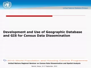
Development and Use of Geographic Database and GIS for Census Data Dissemination. Outline. UN Recommendations/Census Geography Programme Building a Geographic Database Digital Data Dissemination Strategies and Users SALB Project

E N D
Development and Use of Geographic Database and GIS for Census Data Dissemination United Nations Regional Seminar on Census Data Dissemination and Spatial Analysis Nairobi, Kenya, 14-17 September, 2010
Outline • UN Recommendations/Census Geography Programme • Building a Geographic Database • Digital Data Dissemination Strategies and Users • SALB Project • Handbook on Geospatial Infrastructure in Support of Census Activities United Nations Regional Seminar on Census Data Dissemination and Spatial Analysis Nairobi, Kenya, 14-17 September, 2010
Census Geography Programme: a continuous process • The recommendations derived from UN EGM and Workshops on GIS and census mapping emphasized the need for countries to consider the census geography programme as a continuous process, rather than the sequential mapping and dissemination operations. • It was also emphasized that the use of and application of contemporary geospatial technologies and geographical databases is beneficial at all stages of population and housing census process. Geospatial improve the efficiency in the preparatory, enumeration, processing and dissemination phases of the census United Nations Regional Seminar on Census Data Dissemination and Spatial Analysis Nairobi, Kenya, 14-17 September, 2010
Census Cycle United Nations Regional Seminar on Census Data Dissemination and Spatial Analysis Nairobi, Kenya, 14-17 September, 2010
GIS with Census mapping at all stages Pre-census Census Post-Census (Pre-enumeration) (Enumeration) (Post-enumeration) GPS/PDA GIS Digital Mapping GPS Photo/Video GIS Digital Mapping Satellite Imagery GIS Internet (Map-Server) Administrative and Reporting Units EAs Units United Nations Regional Seminar on Census Data Dissemination and Spatial Analysis Nairobi, Kenya, 14-17 September, 2010
Administrative hierarchy • Every country has its own specific administrative hierarchy • Definition: A system by which the country and each lower level set of administrative units (except the lowest) are subdivided to form the next lower level. • Administrative areas for which census data will be reported United Nations Regional Seminar on Census Data Dissemination and Spatial Analysis Nairobi, Kenya, 14-17 September, 2010
Illustration of a nested admin.Hierarchy • Relationships among all types of administrative and reporting unit boundaries are defined. • hierarchical levels may have actual administrative roles • Other units may have statistical roles alone United Nations Regional Seminar on Census Data Dissemination and Spatial Analysis Nairobi, Kenya, 14-17 September, 2010
Coding Scheme • EA: a basic geographic feature • Need for an identifier: linking the geographic feature to the census data (attributes) recorded for them • EAs and administrative units: coding scheme • A unique code assigned to each EA, used in data processing • Coding scheme: scalability, flexibility, intuitiveness, compatibility • Example of a hierarchical coding scheme 1 2 0 3 2 4 4 0 1 2 0 0 5 Enumeration area district locality province United Nations Regional Seminar on Census Data Dissemination and Spatial Analysis Nairobi, Kenya, 14-17 September, 2010
Geocoding Concept • “Geocoding can be broadly defined as the assignment of a code to a geographic location. Usually however, Geocoding refers to a more specific assignment of geographic coordinates (latitude, longitude) to an individual address (UN Report of the EGM on Contemporary Practices in Census Mapping and Use of GIS, 2007) • Geo-coding: not limited to address-matching • Geocoding covers a continuum of spatial scales: from individual housing units to enumeration area level up to higher administrative or national levels. United Nations Regional Seminar on Census Data Dissemination and Spatial Analysis Nairobi, Kenya, 14-17 September, 2010
Complete EA map with all components overlaid on one map display Main components are: Street network, Buildings EA boundaries layer Annotation, Symbols, Labels Building numbers Neatlines Legend United Nations Regional Seminar on Census Data Dissemination and Spatial Analysis Nairobi, Kenya, 14-17 September, 2010
Components of a Hypothetical urban EA map United Nations Regional Seminar on Census Data Dissemination and Spatial Analysis Nairobi, Kenya, 14-17 September, 2010
Implementation of an EA database • All large operational GISs are built on geodatabases; • Arguably the most important part of the GIS • Geodatabases form the basis for all queries, analysis, and decision-making. • A DBMS, or database management system, is where databases are stored. United Nations Regional Seminar on Census Data Dissemination and Spatial Analysis Nairobi, Kenya, 14-17 September, 2010
Entity-Relationship Example: EA entity can be linked to the entity crew leader area. The table for this entity could have attributes such as the name of the crew leader, the regional office responsible, contact information, and the crew leader code (CL code) as primary code, which is also present in the EA entity. R 1-1 1-N United Nations Regional Seminar on Census Data Dissemination and Spatial Analysis Nairobi, Kenya, 14-17 September, 2010
Implementation of an EA database • : Example of an entity table – enumeration area United Nations Regional Seminar on Census Data Dissemination and Spatial Analysis Nairobi, Kenya, 14-17 September, 2010
Components of a digital geographic census database United Nations Regional Seminar on Census Data Dissemination and Spatial Analysis Nairobi, Kenya, 14-17 September, 2010
Different Geographies • A geography for data collection: • EA level or even dwelling level • Another geography for data dissemination: • Aggregated level (confidentiality) United Nations Regional Seminar on Census Data Dissemination and Spatial Analysis Nairobi, Kenya, 14-17 September, 2010
Uses of Graphs: Enriching the Understanding of GIS Data Sets • Exploratory Spatial Data Analysis • Linked Maps, Graphs & Tables • Dynamic Feature Selection • Animation • Visualization over Time United Nations Regional Seminar on Census Data Dissemination and Spatial Analysis Nairobi, Kenya, 14-17 September, 2010
GIS capabilities: Visualization United Nations Regional Seminar on Census Data Dissemination and Spatial Analysis Nairobi, Kenya, 14-17 September, 2010
Digital Data Dissemination Users • The wide range of potential users of disaggregated census data means that the NSO needs to pursue a multi-leveled digital data dissemination strategy. • Broadly, we can distinguish between the following types of users: • Advanced GIS users • Computer literate users • Novice users United Nations Regional Seminar on Census Data Dissemination and Spatial Analysis Nairobi, Kenya, 14-17 September, 2010
The Second Administrative Level Boundaries data set project (SALB) • The Second Administrative Level Boundaries data set project (SALB) has been launched in 2001 in the context of the activities of the UN Geographic Information Working Group (UNGIWG) and has for objective to provide access to a working platform for the collection, management, visualization and sharing of sub national data and information in a seamless way from the national to the global level. • unsalb.org United Nations Regional Seminar on Census Data Dissemination and Spatial Analysis Nairobi, Kenya, 14-17 September, 2010
Handbook on Geospatial Infrastructure in Support of Census Activities (2009) http://unstats.un.org/unsd/demographic/standmeth/handbooks/default.htm United Nations Regional Seminar on Census Data Dissemination and Spatial Analysis Nairobi, Kenya, 14-17 September, 2010
Conclusions • Consider the Census Geography Programme as a continous process • Adapt best practices to suit specific census requirements • Partner with other stakeholders (the public and private sector) in order to • Build the NSDI • Work jointly on coding efforts • Produce value added products – higher demand for census data United Nations Regional Seminar on Census Data Dissemination and Spatial Analysis Nairobi, Kenya, 14-17 September, 2010
THANK YOU! United Nations Regional Seminar on Census Data Dissemination and Spatial Analysis Nairobi, Kenya, 14-17 September, 2010