Download
1 / 21
220 likes | 362 Views
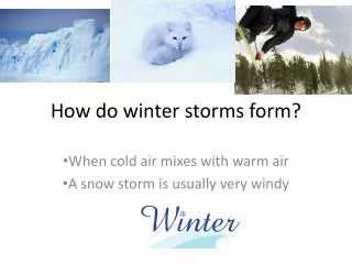
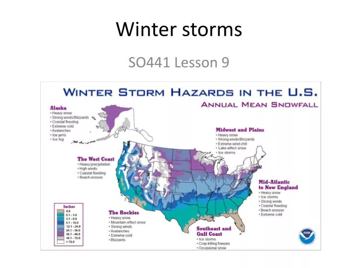
Winter storms. SO441 Lesson 9. What is a winter storm?. Extratropical cyclone, often accompanied by strong: Surface temperature gradients Cyclonic surface wind field Heavy precipitation Usually (but not always) synoptic scale and forced by upper-level height field

E N D
Winter storms SO441 Lesson 9
What is a winter storm? • Extratropical cyclone, often accompanied by strong: • Surface temperature gradients • Cyclonic surface wind field • Heavy precipitation • Usually (but not always) synoptic scale and forced by upper-level height field • Strong upper-level winds • Pronounced upper-level trough • Often neutral or negative tilt to trough axis
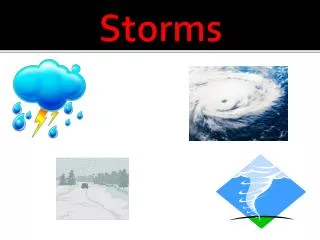
Some climatological considerations • Winter storms bring extreme weather that disrupts transportation and infrastructure • Cold temperatures combined with strong wind and heavy snow and ice often lead to casualties and economic disruption • Important to study winter storms from both observational and theoretical frameworks
Some climatological considerations • Snow is one of the key signatures of a winter storm • Important for several reasons: (1) indicative of sub-freezing air; (2) Latent heat exchange with atmosphere – when water vapor deposits on snow nuclei, much latent heat is released and increasing possible buoyancy. Also, when snow falls into dry surface air, it sublimates and absorbs much latent heat from the air (cooling it) Average first snowfall: 01 Oct-31 Dec Average annual snowfall: 0”-72” (0 cm – 180 cm)
Some climatological considerations • Snow depth (in cm) for February (left) and August (right) • Notice: • Far more terrestrial snow in Northern Hemisphere than in Southern Hemisphere. Why? • Far less coverage of terrestrial snow in Southern Hemisphere • What does this climatology imply for winter storms? Global Monthly EASE-Grid Snow Water Equivalent Climatology http://nsidc.org/data/nsidc-0271.html
Synoptic conditions favorable for winter storms Remember this graphic (from Lesson 4)? Cyclone days per winter. Figure from Ulbrich et al. (2009)
Global mean 850-mb temperaturesJanuary (left) and July (right) Where would you expect the greatest frequency of winter storms? Why?
Once the cyclone (surface low) develops, what precipitation will it bring? • Depends on several factors • Moisture content of near-surface air • Amount of lift • Temperature of air column Heavy snow Sleet / snow Freezing rain Rain Rain / thunderstorms athensgaweather.com
For this winter storm (04 Feb 2011) where would it snow? Strong warm-air advection! Strong cold-air advection! CIMSS
Elevated instability • Warm air aloft (from strong WAA just above the surface) can lead to elevated instability • Enhances snowfall rates, up to 2-3” per hour (5-8 cm/hr) Washington Post Wikipedia
Thermal profiles for winter precip • For snow: • Ideally, have a warm-air advection (veering wind) profile • Provides forcing for upward vertical motion • Temperature must be below freezing the entire column • Except perhaps right at the surface, if the air is sub-saturated • Otherwise, snow flakes will melt as they fall • For freezing rain: • Ideally, have a warm-air advection profile above the surface • Need a deep “warm nose” – a layer several 10s of mb thick of temperatures > 0C. • If precip begins as snow, it will melt completely in the layer and become liquid • Below the warm nose, need an equally deep (or at least cold) layer of air at the surface • Ideally, co-located with a regime of cold-air advection • The layer should be sub-freezing, and cold enough to offset the warming that will occur as liquid water changes phases to ice • For sleet: • Need precipitation to begin as snow • Need a shallow, not-very-warm layer to partially melt snow flakes • Need a sub-freezing layer close to the surface to freeze the ice/water mixture into a round ice pellet NOAA
Thermal profilesWhich is which? Oklahoma Climatological Survey
Hypsometric equation and partial thicknesses 1000 – 850 mb thickness (m) 1000 – 850 mb thickness (m) 850 – 700 mb thickness (m) 850 – 700 mb thickness (m)
Lake-effect snow • Movingsurface air willinevitablyacuiretemperature and moisturecharacteristics of thesurfaceitmovesover • Lake effectprecipitation (snow in winter) isonesuchexample • In winter, verycold (and dry) air movesoverthewarm (and unfrozen) lake • Itwarms up and saturates, creatingbothinstability and giving a moisturesourcewhenitrises In the USA, lake-effect precipitation occurs primarily adjacent to the Great Lakes. But, the Great Salt Lake (Utah) and other bodies of water can lead to lake-effect precipitation
Lake-effect snow • Because the climatological wind direction is from the NW in winter, most lake-effect snow occurs to the southeast of the 5 great lakes. • The process is illustrated below: the air warms and moistens as it moves across the unfrozen lake. • As it reaches the other side, topography often forces it to rise, enhancing snow
Lake-effect snow Some interesting types of lake-effect snow.
Cold-air damming • Anotherfacet of winterprecipitationistheinteraction of synoptic-scaleweathersystemswithtopography • Sometimes, particularlyonthe lee side of mountainranges, cool, stable air becomes “trapped” – known as “cold-air damming”. • Ifthecool, stable air is sub-freezing, thenfreezing rain and sleet can formifforcingispresentforprecipitation • Cold-air damming, and alsofreezing rain, isverycommon in the U.S. east Climatological # of hours of freezing rain per year. Note the maximum to the east of the Appalachian mountains.
Cold-air damming • Ideal set up is for a surface cyclone (low pressure) to approach from the windward side of the mountain, and for a surface anticyclone (high pressure) to be located to the north or northeast of the mountains. • This setup favors: • surface cold-air advection (from the high pressure system • Upper-level warm-air advection (ahead of the surface cyclone) Initial time 24-h later
Other facets of winter precipitation • For a givenamount of liquid-equivalentprecipitation, howmuchsnowwouldaccumulate? • Governedbytemperature of the air, watercontent of thesnow, compaction, and surface (ground) temperatures • NOAA maintainsdetailed rules onhowto “officially” measuresnow • http://www.crh.noaa.gov/jkl/?n=snow_measurement St. Louis Univ