Unveiling Plate Tectonics: Continental Drift & Earth's Dynamics
200 likes | 255 Views
Explore the intriguing history behind plate tectonics, from the theory of continental drift by Wegener to the modern understanding of lithosphere dynamics. Discover how continents have shifted over millions of years and the evidence supporting this remarkable theory.

Unveiling Plate Tectonics: Continental Drift & Earth's Dynamics
E N D
Presentation Transcript
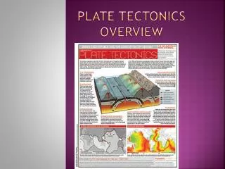
How plate tectonics got figured out -Study of continents (Theory of continental drift; Wegener) -Study of oceans (Theory of continental drift becomes part of larger Theory of plate tectonics)
The continents have moved around the globe over time. CONTINENTAL DRIFT Evidence for continental drift: The shapes of continents match The rocks match The plants match The ice matches Yet, the current positions don’t match They were all together about 250 Million years ago (I’ll call it Pangea, meaning “all the Earth” in Greek) Alfred Lothar Wegener (1880-1930)
What makes a good scientific theory? Scientific Theory - A hypothesis or group of hypotheses that: 1) Explains scientific observations; 2) Is tested with repeated experiments and observations and found always to work; and 3) Is accepted by the scientific community. A good scientific theory: Logical consistency Agrees with the data Verifiable causes that explain and predict Advanced comparisons (simplicity, tradeoff of generality and specificity, distinction between non-fatal difficulties and fatal difficulties)
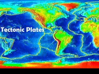
1950s: The bathymetry (topography) of the ocean floor. Bruce Heezen Marie Tharp
Harry Hess Proponent of sea-floor spreading. Used data collected during WW II in Atlantic Ocean.
1963 Fred Vine and Drummand Matthews
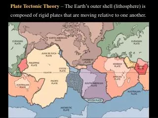
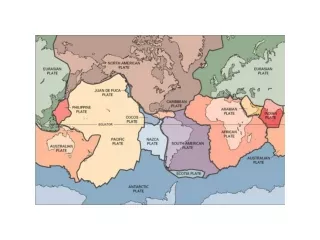
In 1967, W. Jason Morgan proposed that the Earth's surface consists of 12 rigid plates that move relative to each other. Two months later, in 1968, Xavier Le Pichon published a complete model based on 6 major plates with their relative motions.
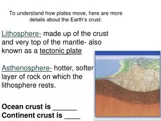
Common Misconception: The convecting mantle is solid (not liquid, despite the boiling water analogy)
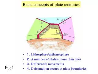
Clarification: The plates can grow or shrink, by the addition of oceanic lithosphere at a mid-ocean ridge or the removal of ocean lithosphere at a subduction zone
Clarification: Although the continental lithosphere does not go away, the pieces of the continents have arranged themselves differently over time