Download
1 / 22
230 likes | 422 Views
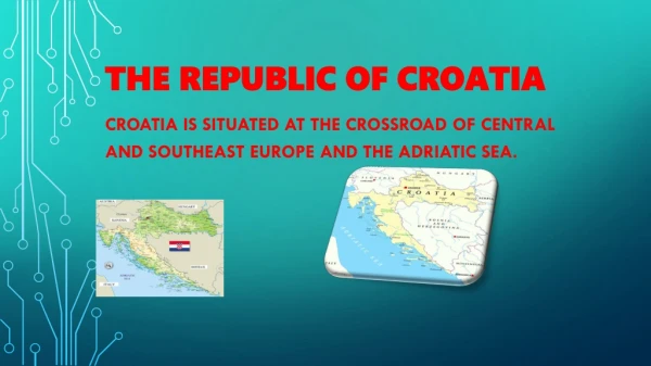
REPUBLIC OF CROATIA DATA BASE ON SEA BATHING WATER QUALITY. Barbara Škevin Ivošević Ministry of Environmental Protection, Physical Planning and Construction Department for Sea Protection www.mzopu.hr Damir Ivanković Institute for Oceanography and Fisheries, Split www.izor.hr. Content:.

E N D
REPUBLIC OF CROATIADATA BASE ON SEA BATHING WATER QUALITY Barbara Škevin Ivošević Ministry of Environmental Protection, Physical Planning and ConstructionDepartment for Sea Protection www.mzopu.hr Damir Ivanković Institute for Oceanography and Fisheries, Split www.izor.hr
Content: • Bathing water monitoring programme • context • responsibilities • important issues • Data base on bathing water monitoring programme • characteristics • features • data flow • data analysis and evaluation • reporting • bathing water profiles • public information
Administrative structure Istria Primorje-Gorski kotar Lika-Senj Zadar Šibenik-Knin Split-Dalmatia Adriatic sea Dubrovnik-Neretva • 20 county and town Zagreb • 7 coastal counties: • Istria • Primorje-Gorski kotar • Lika-Senj • Zadar • Šibenik-Knin • Split-Dalmatia • Dubrovnik-Neretva • Coastline: 5.835 km • Mainland coastline: 1.777 km • Islands coastline: 4.058 km • Number of islands: 1.246 (67 desert islands) • Coastal area: 24,705 km2 • Coastal population: 1.427.008
Bathing water monitoring program-coastal watersLegal framework? • Directive of the European Parliament and of the Council concerning the management of bathing water quality 2006/7/EC – transposed 2008 • Regulation on Sea Bathing Water Quality (OG No.73/08) – bathing water monitoring programme accordingly started 1. January 2009
ADDITIONAL-Marine Environment protectionLegal framework-national level • Sustainable Development Strategy of Republic of Croatia (Official Gazette No.30/09) • National Environmental Strategy (Official Gazette No. 46/02) • National Environmental Action Plan (Official Gazette No. 46/02) • Environmental Protection Act (Official Gazette No.110/07) • Physical Planning and Building Act (OG No. 76/07) • Ordinance on Types of Sea Beaches and Mandatory Requirements (OG No. 50/95) • Contingency Plan for Accidental Marine Pollution in the Republic of Croatia (OG No. 92/08) • WHO/UNEP: Guidelines for Health Related Monitoring of Coastal Water Quality-WHO Regional Office for Europe, Copenhagen, 1979 • Directive of the European Parliament and of the Council establishing a framework for community action in the field of marine environmental policy (Marine Strategy Framework Directive)
Bathing water monitoring programmeHow the responsibilities are divided?
Other important issues? • Sea Bathing water monitoring program was established in 1989. • Monitoring Programme is implemented by Seven Coastal Counties (Public Health Institutes) • Bathing season: 15. May until 30 September • 10 sampling during the season • Program is financed by the regional and local selfgoverment and touristic sector. • Currently we have 913 sampling points • Bathing water profile are completed for all beaches
Web application “Water quality on beaches in Croatia” Data base: • sea bathing water quality data • hidro-meteorological data • assessment • reporting • public information • public participation • bathing water profile http://www.izor.hr/bathing
Data collection Data are collected by eight authorised institutions from seven Croatian counties. Samples were taken every two weeks, 10 times from mid may until end of September on each location. Results are inserted into web application, and instantly presented on the Internet, on public presentation application part. Data can be inserted manually trough HTML form, or by uploading file (bulk insert). All data on the public presentation pages are organised by counties and cities. There is also available search within city or location name or description. Click on the map showing locations are another way to find desired data. Google maps are used for presentation of locations and each location is color coded depending of last measured water quality. At the end of the season, locations are color coded according of final assessment. Also is available reviewing of all past measurement results.
Quality Assurance / Quality Control • Build in range check for some parameters • Statistical analyses for data range check • Full database log about all users activities (insert, update, delete) • Data and locations visualisations (graphical view and maps) • Workshops at Institute (measuring metodology, data processing) • Annual meetings (data providers)
Data flow Web application Internet Application server Public web application Public users Database IOR - Split Data providers • Web and RDBMS based technologies
Bathing water profile Bathing water profile is included into web application. Main objectives of bathing water profile is pollution risk assessment. Defining beach borders and objects on the beaches on the map, and collecting data about beaches fulfull this purpos. Thought web application users can easily define geographical borders by clicking on the map in the web browser. Also it is possible to upload pictures of beaches as the part of the beach profile.
Bathing water profile - pollution risk Pollution risk assessment • Multicriterial algorithm • Manual correction of risk • Interaction with local community
Elements of beach profile on public web • Additional information about objects on the beach • Picture of the beach • Usage of Ajax (Asynchronous JavaScript and XML)
Interaction with users – public opinion • Commentary • For each sampling point • Possibility to grade location • Automatic email notification • Suggestions of new sampling points • Just click on the map showing existing location • Explanation for suggestion • Automatic email notification
Public opinion evaluation • Suggestions and commentary since season 2010 • Automatic email notifications and web access of authorized institutions • In season 2010 Commentary: 22, Suggestions: 18 entries • In season 2011 (since May 26th) Commentary: 5 , Suggestions: 20 Season 2011 • Suggestions of new sampling points (red) • Commentary (yellow)
Final assessment Final assessment of each location is automatically calculated using statistical procedures defined in the local Croatian regulation and also according EU directive 2006/7/EZ (despite lack of minimal 3 previous seasons). The Croatian regulation have more strict rules, so final assessment in case of some locations are different, regarding used procedures (showing better state in EU directive then in Croatian regulation view). Statistical parts of various reports about sea bathing water quality are automatically generated by web application.
Public interest • Season 2009 (10.5.-30.09.) 80281 visits • Season 2010 (10.5.-16.09.) 117782 visits • Until May 26th 2011 Season 2011 71881 visits (Search engines and robots excluded)
Public interest – by location Access by locations - season 2010
Browser problems • IE6 browser does not support AJAX technologies • Automatic redirection to view without AJAX for IE6 visitors • Relatively small number of this type of access • Slow javascript execution in some browsers • New browser releases have increased speed of javascript execution • Usage of standardized technologies (HTML, CSS, javascript), we avoid nonstandard techniques (Flash, Silverlight)
Future development • Development of “light” version of public page (only basic maps and essential information) • Improve quality of beach profile data • Improve search capabilities regards beach profile data (objects) • Improve info for search engines (robots)
Thank you for your attention • Questions? • Remarks? • Comments?