Download
1 / 19
190 likes | 332 Views
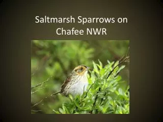
This study focuses on the presence and absence of Saltmarsh Sparrows (SALS) using occupancy surveys conducted at John H. Chafee and Sachuest Point National Wildlife Refuges over two years (2008-2009). Utilizing established grids, the research evaluates nesting success, habitat conditions, and management practices. Key findings indicate varying densities of sparrows across high and low marsh habitats and the impact of shoreline deterioration. Recommendations are made for enhancing management strategies, including potential excavation and dredging to improve habitat quality.

E N D
Occupancy Methods • Presence / absence individuals = each SALS and associated habitat • Established 1 ha grids along UTM lines • John H. Chafee NWR = 123 grids • Sachuest Point NWR = 34 grids • Three replicates per year (June / July / August) • Two years (2008 & 2009) • Minimum 3 observers • Presence / absence nests = nest searches 3x per year also
Occupancy Surveys 2008-09 Kimberly Drive Marsh
SALS Nest Data: • Occupancy Surveys 2008-09 • More extensive refuge-wide nest searching • SHARP Project 2011 – 13 • Focused efforts mainly in demographic plots JH Chafee NWR
Kimberly Drive - JHC • More pristine marsh • Higher proportion of high marsh habitat • Higher nest success rates • How much management should we do in this area? Drain some of the pools & pannes?
Occupancy Surveys 2008-09 West Sprague Bridge/ Sedge Island – JHC
West Sprague Bridge/ Sedge Island – JHC • Both high and low marsh habitat • High marsh is more patchy • Locally dense populations of sparrows • Some land ownership by Audubon Soc. • Can we raise elevation of low marsh in this area without detriment to current nesting habitat? • Should drain pannes and/or cattail marsh?
Occupancy Surveys 2008-09 Starr Drive – JHC
Starr Drive – JHC • May have lower densities of sparrows • Mostly low marsh habitat • Beginning to see rapid deterioration of shorelines (possibly due in part to high nutrient levels?)
Occupancy Surveys 2008-09 South Middle Bridge – JHC
Occupancy Surveys 2008-09 North Middle Bridge – JHC
South Middle bridge/ North Middle bridge – JHC • Isolated patches of high marsh, mainly low marsh • Shoreline deterioration and erosion impacting much of the marsh (SMB) • Potential areas for excavating runnels (particularly NMB) and dredge deposition (SMB) • How and where to place dredge materials?
Vegetation Surveys: • Established 1 ha grids along UTM lines • John H. Chafee NWR = 123 grids • Sachuest Point NWR = 34 grids • Each grid contained 4 - 70m transects (plus center point) • Points were surveyed every 5 meters, each transect contained 14 points • Total of 57 points per grid
Other Salt Marsh Data • Nekton surveys for all of the refuge marshes, (~100 points) • Water level logger data: (3 – JHC, 1 – SPT) • SETs: JHC – 7 measured + 5 new in 2014; SPT – 6 measured • Salinity: limited data collected in 2009 with SMI data and also at nekton samplingsites • Marsh bird surveys: JHC - 9 points, SPT - 1 point