Download
1 / 14
140 likes | 152 Views
This document provides an overview of the fire monitoring characteristics of GOES and MTSAT platforms, including satellite view angles, spectral bands, and fire detectability limits. It also compares the minimum detectable fire size and fire saturation points for different platforms. The document is from a workshop held in Darmstadt, Germany on March 23, 2004.

E N D
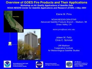
Overview of GOES and MTSAT Platforms: Fire Monitoring Characteristics GOFC/GOLD Global Geostationary Fire Monitoring Applications Workshop EUMETSAT, Darmstadt, Germany 23 March 2004 Elaine M. Prins NOAA/NESDIS/ORA Advanced Satellite Products Team Madison, Wisconsin elaine.prins@ssec.wisc.edu Christropher C. Schmidt Joleen M. Feltz UW-Madison Cooperative Institute for Meteorological Satellite Studies National Oceanic and Atmospheric Administration (NOAA) Advanced Satellite Products Team (ASPT) UW-Madison Cooperative Institute for Meteorological Satellite Studies (CIMSS) National Aeronautics and Space Administration
Overview • Geostationary platform fire monitoring characteristics- GOES-10/-12: fire monitoring in the Western Hemisphere- GOES-9: fire monitoring in the Western Pacific, SE Asia, and Australia- Future MTSAT-1R fire monitoring capabilities- Next Generation GOES ABI spectral bands and fire monitoring • Comparisons of minimum detectable fire size for GOES-9/-10/-12, MSG, and MTSAT-1R • Comparisons of fire saturation points for GOES-9/-10/-12, MSG, and MTSAT-1R
-160 -120 -80 -40 80 GOES-E GOES-W GOES-12 (East) Imager Characteristics Band Wavelength IGFOV Sampled Subpoint NEDT (microns) (km) Resolution (km) 1 0.53-.77 1.0x1.0 0.57x1.0 10-bit data 2 3.76-4.03 4.0x4.0 2.3x4.0 .21 K @ 300 K 3 5.77- 7.33 4.0x4.0 2.3x4.0 .16 K @ 230 K 4 10.23-11.24 4.0x4.0 2.3x4.0 .10 K @ 300 K 5 NA 6 12.96-13.72 8.0x8.0 2.3x8.0 .18 K 60 40 Satellite View Angle 80° 65° 20 0 GOES-10 (West) Imager Characteristics Band Wavelength IGFOV Sampled Subpoint NEDT (microns) (km) Resolution (km) 1 0.53-.72 1.0x1.0 0.57x1.0 10-bit data 2 3.78-4.03 4.0x4.0 2.3x4.0 .23 K @ 300 K 3 6.47-7.03 8.0x8.0 2.3x8.0 .30 K @ 230 K 4 10.2-11.2 4.0x4.0 2.3x4.0 .14 K @ 300 K 5 11.5-12.5 4.0x4.0 2.3x4.0 .26 K @ 300 K -20 -40 -60 -80 Current U.S. Geostationary Coverage and Fire Monitoring Characteristics Fire Monitoring Characteristics • Oversampling in the East/West direction with a sub-sampled res of 2.3x4.0 km • High temporal resolution: every 15 minutes over portions of North America, half-hourly elsewhere, capability for 1-minute imaging in Super Rapid Scan Operational mode. • GOES-12 band 2 has an elevated saturation temperature of ~337 K.Elevated GOES-12 band 2 saturation temperature gives improved fire characterization. GOES-10 saturates at ~322K resulting in non-fire saturation points during peak heating hours. • Fire size detectability limits with an average fire temperature of 750K:Equator: .15 ha 50°N: .32 ha
GOES-East Multi-spectral Fire Detection in Canada Date: 21 June 1995 Time: 2345 UTC
GOES-9 Imager Characteristics Band Wavelength IGFOV Sampled Subpoint NEDT (microns) (km) Resolution (km) 1 0.52-.72 1.0x1.0 0.57x1.0 10-bit data 2 3.78-4.03 4.0x4.0 2.3x4.0 .23 K @ 300 K 3 6.47-7.02 8.0x8.0 2.3x8.0 .30 K @ 230 K 4 10.2-11.2 4.0x4.0 2.3x4.0 .14 K @ 300 K 5 11.5-12.5 4.0x4.0 2.3x4.0 .26 K @ 300 K Satellite View Angle 80° 65° Overview of GOES-9 Fire Monitoring Capabilities for SE Asia Fire Monitoring Characteristics • Oversampling in the East/West direction with a sub-sampled res of 2.3x4.0 km provides a better opportunity to capture an entire fire within a fov. • High temporal resolution: full disk every hour, reduced sectors every half-hour • GOES-9 band 2 has a saturation temperature of ~324 K.This may result in numerous non-fire saturation points during peak heating hours. • Fire size detectability limits with an average fire temperature of 750K:Equator: .15 ha 50°N: .32 ha
MTSAT-1R JAMI Characteristics Band Wavelength IGFOV NEDT (microns) (km) 1 0.55-.90 0.5 12-bit data 2 10.3-11.3 2.0 .08-.16 in all IR bands 3 11.5-12.5 2.0 @ 300 K 4 6.5-7.0 2.0 5 3.5-4.0 2.0 Satellite View Angle 80° 65° Overview of MTSAT-1R Fire Monitoring Capabilities for SE Asia Fire Monitoring Characteristics • IGFOV resolution of 0.5 km in the visible and 2.0 km in all IR bands. Highest resolution to date from an operational meteorological geostationary satellite • High temporal resolution: capable of full disk in < 24 minutes • MTSAT-1R band 5 has a saturation temperature of ~320 K.Along with an increased spatial resolution and spectral width extending towards the shorter wavelengths, will result in numerous saturation points during peak heating hours. • Fire size detectability limits with a fire temperature of 750K:Equator: .03 ha 50°N: .06 ha
- - GOES-9 Fire Monitoring in SE Asia GOES-9 4 micron imagery Date: 19- Mar-2004 Times: 0325-0725 UTC Satellite view angle: 70º GOES-9 visible imagery Date: 19- Mar-2004 Times: 0725 UTC
Estimates of Minimum Detectable Fire Size at Various Fire Temperatures Locations: 50°N and the Equator Comparison of Fire Saturation Points
ABI Current Spectral Coverage 16 bands 5 bands Spatial resolution 0.64 mm Visible 0.5 km Approx. 1 km Other Visible/nearIR 1.0 km n/a Bands (>2 mm) 2 km Approx. 4 km Spatial coverage Full disk 4 per hour Every 3 hours CONUS 12 per hour ~4 per hour Operation during eclipse Yes No The Advanced Baseline Imager
ABI Bands Band 7: Saturation temperature of 400K MSG/AVHRR/Sounder(s) MODIS/MTG/ Aircraft, etc Current GOES Imagers
GOES-R and GOES-I/M Simulations of Viejas Fire Using MODIS Data: January 3, 2001 at 1900 UTC Simulated GOES-R: 3.9 micron Simulated GOES-I/M: 3.9 micron
Summary • GOES-E/-W- GOES-E(-12) allows for half-hourly fire products for the Western Hemisphere; products useful even at high satellite zenith angles (65-80º).- GOES-W(-10) fire monitoring and subpixel characterization capabilities are reduced due to low saturation in the 3.9 m band. • GOES-9- Although fire monitoring/characterization capabilities reduced due to low saturation in the the 3.9 m band, provides first diurnal look at fire hot spots in the Western Pacific, SE Asia, and Australia- Nearly hourly full disk coverage • MTSAT-1R- Future diurnal fire monitoring at 2 km spatial resolution - Full disk coverage in less than 24 minutes- Low saturation in the 3.9 m band with increased spatial resolution will severely hinder sub-pixel fire characterization • Next Generation GOES ABI - Enhanced spatial resolution (2 km in the IR) and high saturation in the 3.9 m band (400K) result in improved fire characterization- Full disk coverage every 15 minutes • Minimum Detectable Fire Size and Saturation Issues
The Basics of GOES Satellite Infrared Fire Detection p 1-p Pixel (Example from South America)