Download
1 / 17
170 likes | 293 Views
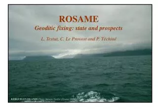
ROSAME Geoditic fixing: state and prospects. L. Testut, C. Le Provost and P. Téchiné. KERGUELEN ISLANDS Photo: Antoine Guillot (Nivmer 2000). R éseau d’ O bservation S ub-Antarctique et A ntarctique du niveau de la Me r. Antarctic and South Indian Ocean Tide Gauges Networks

E N D
ROSAMEGeoditic fixing: state and prospects L. Testut, C. Le Provost and P. Téchiné KERGUELEN ISLANDS Photo: Antoine Guillot (Nivmer 2000)
Réseau d’Observation Sub-Antarctique et Antarctique du niveau de la Mer • Antarctic and South Indian Ocean Tide Gauges Networks • Part of the French contribution to GLOSS • Part of global networks of monitoring southern ocean • 4 costal tides gauges • 2 moorings (Crozet - Amsterdam) • Monitoring Antarctic Circumpolar Current • Altimeter calibration • Monitoring the long term sea level
DUMONT D’URVILLE CROZET SAINT-PAUL KERGUELEN Georeferencing of ROSAME TG - G. Woppelman and C. Le Provost. NIVMER 1994
Kerguelen (70°13 E – 49°20 S) TG: Pressure Gauge Type:WLR7 Aanderaa Inst. date: 1993 Time sampling: 1h Transmission: Argos
GPS equipment Tide Gauge -GPS IGS site (cnes) -DORIS (cnes) -GPS Pillar (1994) -Network of TGBMs GPS DORIS
Prospect -Install a GPS -Initiate a levelling program (IGN) - Monitoring the instrumental reference GPS pillar Tide gauge TGBM Instrumental reference
Calibration of the Pressure Gauge (Kerguelen) • Waves in the stilling well • Pressure transducer drift Drift ~0.2 cm/yr +1.3 ± 2 cm (0.97) new TG old TG Reference TG
Calibration of the Pressure Gauge (Kerguelen) 04/93 02/98 01/2001 -> T(°C)=a+bR+cR2+dR3 [A’, B’, C’, D’] - > Pressure=AT+BTR+CTR2+DTR3 [A, B, C, D] Constructor Calibration
Saint-Paul (77°32 E - 38°42 S) - No power supply - Nobody TG: Pressure Gauge Type:WLR7 Aanderaa Inst. date: 1994 Time sampling: 1h Transmission: Argos
Crozet (51°52 E – 46°25 S) TG: Pressure Gauge Type:MORS Inst. date: 1995 Time sampling:1h System: Argos
Crozet (51°52 E – 46°25 S) • - No power supply • Difficult access • Oceanic vandalism
Dumont d’Urville (140° E - 66°39 S) GPS DORIS TG: Pressure Gauge Type:MORS Inst. date: 1997 Time sampling:30min/1h System: Argos
CONCLUSION Difficult task to maintain a TG network in such hostile conditions • Technical • Logistic • Financial
PERSPECTIVES • CGPS@KERGUELEN • Initiate a levelling program • Rebuilt Crozet TG • CGPS@CROZET