Download
1 / 21
210 likes | 337 Views
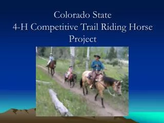
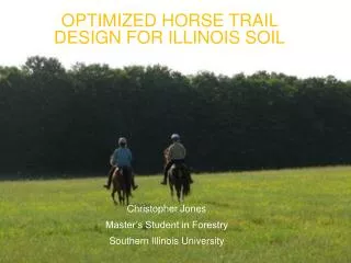
Optimized Horse Trail Design for Illinois Soil. Christopher Jones Master’s Student in Forestry Southern Illinois University. Equestrian Recreation. Projected Growth Top five activity, growing on USFS lands (Cordell , 2012 ) Economic Benefits Contributes positively to local economies

E N D
Optimized Horse Trail Design for Illinois Soil Christopher Jones Master’s Student in Forestry Southern Illinois University
Equestrian Recreation • Projected Growth • Top five activity, growing on USFS lands (Cordell, 2012) • Economic Benefits • Contributes positively to local economies • Up to 6x indirect expenditures
Impact and Erosion • Use ? degradation (e.g., Deluca et al., 1998; Wilson, et al., 1994; Olive et al., 2009) • Even lowest amounts of use (Cole, 2004; Liddle, 1997) • Erosion can influence user behavior (Marion and Leung, 2004) Use-impact relationship from Cole (2004).
Equestrian Erosion • Soil compaction, increased trail width and depth, and reduced surface litter (Whittaker,1978) • Urine and feces • Nitrogen, phosphorous, and heavy metals (Edwards et al.,1999) • Water pollution • Direct/indirect conflicts • Shawnee National Forest
Landscape Features • The problems associated with recreation impact are more likely the result of poor planning and location (Cole, 1987; Leung & Marion, 2000) • Trail position, trail slope alignment angle (TSA), grade, water drainage, and type of use (Summer, 1980; Kuss, 1983; Olive & Marion, 2009) • Slope one of the most influential (Bratton et al., 1979; Wilson & Seney, 1994)
Negating Impact Through Design • Considerations taken during the planning process should be able to prevent most impacts (Marion et al., 2004) • Controlling water flow by utilizing the landscape (Birchard, et al., 2000; Hesselbarth et al., 1996) • Hardening the surface in poorly drained soils (Meyer, 2002) • Experimental research about trail design is limited • Few studies focus on the effectiveness of actions taken to mitigate recreation impact (Leung et al., 2000; Cole, 2004b)
Justification • Empirically test for the effects of trail design, proximal landscape attributes, and routing characteristics on equestrian trail soil transport. • Overcome limitation of observational studies • Design and maintain trails at lower cost, improved safety, and higher ecological resilience
Hypothesis • Erosion rates on equestrian trails will be significantly reduced if five factors are taken into consideration during the trail design: • Trail-slope alignment • Canopy cover • Landform position • Substrate amendment • Benching
Location • New trail system on University Farms • Built near SIUC’s equine facilities
Trail Design • Plot areas based on available 4-foot contour maps • GPS-based ground verification • Produce route that crosses a variety of landscapes • One-mile long • Five-meter segments for analysis
Construction • Initial ground truthing • Thirteen-foot corridor, twelve-foot overhead clearance • Plant and stump removal • Substrate amendment Standard dimensions for an equestrian trail (Hancock et al., 2007, p. 39).
Baseline Data Collection • Trail divided into five meter segments • Design Variable Values • Use of Trimble GPS, Suunto survey equipment • Establish fixed reference points for each trail section • Provides baseline for future data collection
Measurement of cross-sectional area soil erosion. Adapted by Park (2009) from Marion (1994).
Data Collection • Monthly • Rain events: precipitation > 2.54 cm / 24 hours • Unsafe conditions (fallen trees, etc) monitored for and removed
Analysis and Reporting • Statistical regression analyses run via SPSS • MANOVA and post hoc tests
STATUS • Finishing construction phase • Addition of electric conductivity (EC) meter
Applications • Applications extend far beyond Southern Illinois • Reduce costs of trail repair for forest/park managers • Promote equestrian recreation • Reduce conflicts between horse riders and other recreationists • Additional research possibilities • ROV UGV UAV
Acknowledgements • Dr. Logan Park, Dr. Zaczek, Department of Forestry • Dr. Guangxing Wang, Department of Geography • Dr. Sheryl King, Director of Equine Studies • Southern Illinois University • Horsemen’s Council of Illinois