Download
1 / 58
580 likes | 595 Views
Explore the benefits and repairs of new reference frames discussed at the 2015 Geospatial Summit, including necessary fixes for NAVD 88 and NAD 83, improving accuracy, sustainability, and efficiency for better service provision. Understand how these repairs address issues like fragility, bias, and tilt, leading to enhanced geospatial data precision.

E N D
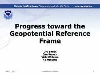
Benefits of the New Reference Frames Dru Smith Joe Evjen 60 minutes 2015 Geospatial Summit
Outline • Needed repairs • Benefits of new frames: • Repairs • Improvements 2015 Geospatial Summit
What is a repair? • A fix to something in the current system that is currently causing NGS to: • Fail to provide heights, or • Provide inaccurate heights, or • Put undue burden on users, or • Waste resources 2015 Geospatial Summit
What is an improvement? • A change to something in the current system that by itself is not causing significant problems, but whose cost/benefit ratio is worthwhile and which helps NGS to provide: • Better service and/or • Better accuracy and/or • Better sustainability and/or • Better efficiency 2015 Geospatial Summit
Needed Repairs 2015 Geospatial Summit
Needed Repairs: NAVD 88 • Inherent weaknesses of passive marks • Fragility, convenience, movement • Cost-prohibitive maintenance • Adjustment issues • Minimally constrained, Helmert approximation, inconsistent surface gravity surveys • Sparseness • Bias and Tilt • WRT GRACE/GOCE geoid models 2015 Geospatial Summit
Needed Repairs: NAD 83 • NAD83 frame ≠ GPS navigation frame • NAD83 frame ≠ WAAS navigation frame • NAD83 frame ≠ satellite orbits frame • NAD83 frame ≠ satellite product frame • NAD83 frame ≠ international geodetic frame • International flights take off & land on different datums • Many geodetic tools assume ITRF as default 2015 Geospatial Summit
6.3 meters 5.0 map how you navigate? 3.8 Your GNSS frame, ITRF 2.5 1.3 Your map datum, NAD 83 * As GNSS un-augmented user range error improves over time …
Needed Repairs: Island datums(PRVD02, ASVD02, NMVD03, GUVD04, VIVD09) • Many of the same issues as NAVD 88 • Fragility, convenience, movement, MCA, sparseness, bias, tilt • Normal orthometric heights 2015 Geospatial Summit
Needed Repairs: Hawaii • No vertical datum exists! 2015 Geospatial Summit
Needed Repairs: IGLD 85 • Many of the same issues as NAVD 88 • They were co-defined from the same leveling and gravity data • Thirty years of GIA have changed the levels of the lakes 2015 Geospatial Summit
Repairs that come with the new reference frames 2015 Geospatial Summit
Repairing NAVD 88 2015 Geospatial Summit
Repairing NAVD 88* Problem: Fragility of bench marks Repair: In the new geopotential reference frame, orthometric heights are available to GNSS receivers without need for any bench marks * and PRVD02, ASVD02, NMVD03, GUVD04, VIVD09 2015 Geospatial Summit
Repairing NAVD 88* Problem: Inconvenient bench mark locations Repair: In the new geopotential reference frame, orthometric heights are equally available to GNSS receivers everywhere in the USA * and PRVD02, ASVD02, NMVD03, GUVD04, VIVD09 2015 Geospatial Summit
Repairing NAVD 88* Problem: Unchecked movement of bench marks Repair: In the new geopotential reference frame, orthometric heights at the epoch of the survey, are available to GNSS receivers because of time-dependent geoid models and time-dependent CORS positions * and PRVD02, ASVD02, NMVD03, GUVD04, VIVD09 2015 Geospatial Summit
Repairing NAVD 88* Problem: Minimally Constrained Adjustment (absolute accuracy of heights is dependent on distance from origin) Repair: In the new geopotential reference frame, the absolute accuracy of orthometric heights will have greater consistency throughout the country. * and PRVD02, ASVD02, NMVD03, GUVD04, VIVD09 2015 Geospatial Summit
Repairing NAVD 88 Problem: Helmert Approximation (heights rely on a first-order approximation which doesn’t propagate into accuracy statistics) Repair: In the new geopotential reference frame, approximations are being quantified and bounded and will be reflected in accuracy statistics. 2015 Geospatial Summit
Repairing NAVD 88 Problem: Inconsistent surface gravity surveys (heights rely 2 million surface gravity measurements which span decades and reflect no time dependency) Repair: In the new geopotential reference frame, the gravity field will be consistent, and epoch dependent, directly influencing the time dependent geoid and time dependent orthometric heights 2015 Geospatial Summit
Repairing NAVD 88* Problem: Sparseness (bench mark spatial distribution tends to cluster around population clusters) Repair: In the new geopotential reference frame, orthometric heights are equally available to GNSS receivers everywhere in the USA * and PRVD02, ASVD02, NMVD03, GUVD04, VIVD09 2015 Geospatial Summit
Benefits of repairs: NAVD 88* Problem: Bias and Tilt (“zero height surface” of datum is not the geoid) Repair: In the new geopotential reference frame, the geoid will be the zero height surface, and will be built upon global satellite models * and PRVD02, ASVD02, NMVD03, GUVD04, VIVD09 2015 Geospatial Summit
Repairing NAD 83 2015 Geospatial Summit
Repairing NAD 83 • Align US frame with ITRF, GPS, WAAS • Remove non-geocentricity • Move beyond cascade of NAD83 realizations • Better agreement across USA – Mexico border • Velocities everywhere, so weuse similar techniques everywhere 2015 Geospatial Summit
Repairing Island datums (PRVD02, ASVD02, NMVD03, GUVD04, VIVD09) 2015 Geospatial Summit
Repairing Island datums(PRVD02, ASVD02, NMVD03, GUVD04, VIVD09) Problem: Normal Orthometric Heights (heights do not rely on actual gravity measurements) Repair: In the new geopotential reference frame, orthometric heights will be available to GNSS receivers, not normal orthometric heights 2015 Geospatial Summit
Repairing Hawaii 2015 Geospatial Summit
Repairing Hawaii Problem: No Vertical Datum (NGS has never officially defined a vertical datum for Hawaii) Repair: In the new geopotential reference frame, orthometric heights will be available to GNSS receivers in Hawaii, consistent with heights across the North American continent 2015 Geospatial Summit
Repairing IGLD 85 2015 Geospatial Summit
Repairing IGLD 85 Problem: GIA changes aren’t reflected in IGLD 85 Repair: In the new geopotential reference frame, dynamic heights at the epoch of the survey, are available to GNSS receivers because of time-dependent geoid models, time-dependent CORS positions and time dependent gravity field models 2015 Geospatial Summit
Improvements that come with the new reference frames 2015 Geospatial Summit
Improving Heights Continental consistency In the new geopotential reference frame, heights will be consistent from pole to equator and Aleutians to Greenland. 2015 Geospatial Summit
Extent of 2022 geoid model used for new geopotential reference frame 2015 Geospatial Summit
Hawaii Many US Pacific Territories (not Guam, CNMI nor American Samoa) 2015 Geospatial Summit
Alaska, including entire Aleutian Island Chain Canada CONUS (USA) 2015 Geospatial Summit
Bermuda Mexico All Caribbean Countries All Central American Countries 2015 Geospatial Summit
Improving Heights Time-dependent heights on passive control In the new geopotential reference frame, heights on passive control will eventually be stored at and distributed by NGS, and changes over time will be reflected as actual changes 2015 Geospatial Summit
Assume “H” was determined four different times: 1990: 2.100 1994: 2.110 2002: 2.190 2009: 2.180 2.350 2.300 2.250 2.200 H 2.150 2.100 2.050 2.000 1975 1985 1980 1990 2015 2025 1995 2005 2020 2030 2000 2010 time
In standard NGS procedure, a height is held fixed until replaced. So plotting the height as seen on a datasheet over time would look like this: 2.350 2.300 2.250 2.200 H Height unknown before first survey 2.150 2.100 2.050 2.000 1975 1985 1980 1990 2015 2025 1995 2005 2020 2030 2000 2010 time
This will change in the future. First, error bars will be shown. Shown here are the same values of “H”, but with error bars representing their standard deviations. 1990: 2.100 +/- 0.0375 (3.75 cm) 1994: 2.110 +/- 0.0250 (2.50 cm) 2002: 2.190 +/- 0.0200 (2.00 cm) 2009: 2.180 +/- 0.0250 (2.50 cm) 2.350 2.300 2.250 2.200 H 2.150 2.100 2.050 2.000 1975 1985 1980 1990 2015 2025 1995 2005 2020 2030 2000 2010 time
Using least squares, we could fit a line, using appropriate weights to fit to the data 2.350 2.300 2.250 2.200 H 2.150 2.100 2.050 2.000 1975 1985 1980 1990 2015 2025 1995 2005 2020 2030 2000 2010 time
Using a simple H = mt+b fitting, we get: m = 0.00505 m/y (+5.05 cm uplift per year) b(1970) = 2.004 m 2.350 2.300 H = (0.00505)(t-1970) + 2.004 2.250 2.200 H 2.150 2.100 2.050 2.000 1975 1985 1980 1990 2015 2025 1995 2005 2020 2030 2000 2010 time
Now, we can find H at various time intervals. 2.350 2.300 2.250 2.200 H 2.150 2.100 2.050 2.000 1975 1985 1980 1990 2015 2025 1995 2005 2020 2030 2000 2010 time
And propagating the actual measurement error forward and backward in time, we see that there is a strong dependence on higher accuracy height estimates occurring near the actual surveys. 2.350 2.300 2.250 2.200 H 2.150 2.100 2.050 2.000 1975 1985 1980 1990 2015 2025 1995 2005 2020 2030 2000 2010 time
Compare this with current NGS procedures… 2.350 2.300 2.250 2.200 H Height unknown before first survey 2.150 2.100 2.050 2.000 1975 1985 1980 1990 2015 2025 1995 2005 2020 2030 2000 2010 time