Download
1 / 63
630 likes | 808 Views
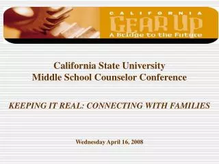
Keeping it Real—Connecting Curriculum to the Community. John P. Bayerl Michael Berry Career Center Dearborn Public Schools. Welcome to the Information Age!. Some experts say that in 2008, the amount of new data created will EQUAL that which is already stored in the Library of Congress!

E N D
Keeping it Real—Connecting Curriculum to the Community John P. Bayerl Michael Berry Career Center Dearborn Public Schools
Welcome to the Information Age! • Some experts say that in 2008, the amount of new data created will EQUAL that which is already stored in the Library of Congress! • Our students live in a world where they have instant, and nearly unlimited access to the sum-total of human thought since the beginning of civilization.
This Requires a Paradigm Shift in Education • No longer can we focus on the creation of new data. It is all there, waiting for students to access on the internet, their cell phone, or iPod. • Instead, we must ask students: “Now that you have all this data, what can you do with it?”
Databases contain tremendous amounts of information. But how do you make sense of it?
Geographic Information Systems A GIS uses graphic displays (maps) to make sense of diverse data and use that knowledge to solve relevant, local problems. GeoSpatial Technologies have been identified by the Department of Labor as one of the three fastest growing careers in the next ten years.
What happens when you assign students projects that use relevant, real world data, and ask them to solve a problem in the community they live in?
The Michael Berry Career Center • Opened in 2005 • Half-day magnet program attracting students from 3 local high schools. • 450 Students all take a 2-hour CTE class, and a 1-hour elective. • 25 students enrolled in Software Specialist (GIS) class.
Information Technology at MBCC • Software Specialist Class (First Year). • Combination of Web Design, Multi-Media, Digital Design and GIS. • Students learn 7 state-of-the-art software packages including Microsoft Office, Macromedia (Fireworks, Dreamweaver, Flash), Photoshop, Satellite Tool Kit (STK), Electronic Field Study (Pictometry), Rhino3D and ArcGIS.
Software Specialist at MBCC • Focuses on technical and workplace skills applicable to 21st century jobs. • GIS serves as the framework around which all projects and lessons are built. • S.T.A.R.S. Curriculum: Turnkey GIS curriculum from Digital Quest, Inc. • www.digitalquest.com or www.spacestars.com • www.hitechinc.us (sales)
Information Technology at MBCC(Second Year Options) • CIW Certification for Web Design Students • STARS Certification for GIS Students
STARS Certification • Students must complete a comprehensive GIS project. • Prepare and submit a written and visual report of results. • Take and pass (80%) the S.T.A.R.S. certification exam (administered by DigitalQuest).
What makes GIS at MBCC Unique? • Uses only actual, real-world data drawn from and about the student’s own community. • Data draws from many sources and is applicable to diverse career fields. • Focus on rigorous computer, technical and workplace skills relevant to most 21st century jobs. • Relationships with the local GIS community have allowed most students to have a meaningful off-site experience relative to their own GIS, I.T. or computer career interests.
It takes more than knowing how to use sophisticated computer software to create projects such as these. • Math skills • Science knowledge • Reading and Writing abilities • Mastery of basic concepts of Government and Civics from Social Studies. • Most importantly, it takes motivated, self-directed students willing to explore new methods of solving problems.
How does GIS support concepts across curricula? • With the NCLB and new graduation requirements, students are pressed to find enough elective hours to obtain the knowledge and skills necessitated by the high-tech demands of 21st century jobs. • Elective classes must therefore support content from academic areas, making students more successful in all their classes. • GIS is ideally suited for this purpose, as it provides hands-on opportunities to apply academic skills and knowledge in relevant, real world applications.
Language Arts Example In the GIS course, students are asked to explore topics they find relevant, and produce a variety of written, visual and oral presentations to both the class, or audiences of interested community members.
Background: • Students completed a practice project similar to that needed for certification. • Followed a project management model to design the project. • Practiced presenting to a “live” audience.
Invited Guests • City of Dearborn: • GIS/MIS • Fire Dept • DPW (water, sewer, roads) • Wade-Trim engineering consultants • Superintendent’s office • GIS Curriculum sales representative. • Teachers and directors from 3 CTE including one in Ohio. • Professor from EMU GIS program.
Social Studies Example • The very nature of GIS implies that students use maps to gain perspective on relevant issues in their community.
Mathematics Example • Geometry, roughly translated is “Earth Measuring”. Students must understand the math involved in changing the spherical globe to a planar map. Further, they must be able to easily convert between units of measure.
Science Example • Ecology is about interactions. The power of GIS allows us to explore relationships between diverse data sets
Science Example • Student Interns began with a simple database showing pest complaints in their city…
Science Example • And a basic map of the city…
Science Example • Onto which they plotted the complaints…
Science Example • Used the software to model the density of the rat population…
Science Example • And looking for an explanation…
Wayne County RESA School Board • Moe presented a brief PowerPoint outlining the local, real-world application of GIS at MBCC.
Pictometery Training • Ryan and Mike had the privilege of attending the roll-out training for a cutting-edge package of aerial imagery and analysis software sponsored by Wayne County Emergency Management. • They were the only two students invited to attend!