Download
1 / 33
330 likes | 480 Views
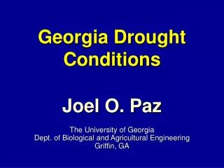
Drought Monitoring, Prediction and Response - A View From Georgia -. David Emory Stooksbury, Ph.D. State Climatologist and Associate Professor Engineering and Atmospheric Sciences College of Agricultural & Environmental Sciences The University of Georgia stooks@engr.uga.edu.

E N D
Drought Monitoring, Prediction and Response- A View From Georgia - David Emory Stooksbury, Ph.D. State Climatologist and Associate Professor Engineering and Atmospheric Sciences College of Agricultural & Environmental Sciences The University of Georgia stooks@engr.uga.edu
Facts About Georgia • In 1960 Atlanta’s population: 1 million • In 1960 Georgia’s population: 4.3 million • In 2008 Atlanta’s population: 4.5 million • In 2008 Georgia’s population: 8.5+ million • Largest state east of the Mississippi River • 8th largest state in population
Facts About Georgia • Northern quarter is southern highlands • Southern half is the coastal plain • Most of the population lives in the piedmont • The fall line bisects the state (Montgomery, Columbus, Macon, Augusta, Columbia, Raleigh, Richmond and Georgetown)
Georgia Water Facts • North of the fall line - primarily surface water • Drainage basin for Lake Lanier 1040 sq. miles. • South of the fall line - primarily ground water • 1.5 million acres under irrigation, primarily in southwest Georgia
Georgia Climate Facts • Rule of Thumb: 50 inches of rain per year • More than 80 inches in the mountains • 45 inches interior southeast • Rain is more or less evenly distributed over the year: March 5 inches and October 3.5 inches • Evapotranspiration is extremely important in drought forecasting
GEORGIA DROUGHT MANAGEMENT PLAN • DROUGHT DECLARATION PROCESS • AGENCIES and ORGANIZATIONS • PRE-DROUGHT STRATEGIES • DROUGHT RESPONSES • DROUGHT INDICATORS and TRIGGERS • CLIMATE DIVISIONS MAP Approved: March 26, 2003
Section 1) DROUGHT DECLARATION PROCESS The following is the process for declaring drought conditions and responses: 1A): The State Climatologist’s office and EPD will routinely monitor and evaluate stream flows, lake levels, precipitation, groundwater levels, and other climatic indicators that are supplied by several cooperating entities …
Precipitation • 30 days • 90 days • 6 months • 12 months • Water Year • 24 months • 36 months
Drought Level Guidance CD Drought Indicators 1 SPI-3, SPI-6, SPI-12 Lake Allatoona Chattooga River at Summerville 2 SPI-3, SPI-6, SPI-12 Lake Lanier, Lake Allatoona Etowah River at Canton Chestatee River near Dahlonega
Georgia Drought Response Levels • Level One: Water on scheduled days - 12 midnight to 10 a.m - and - 4 p.m. to 12 midnight. • Level Two: Water on scheduled days - 12 midnight to 10 a.m. • Level Three: Water on scheduled weekend day - 12 midnight to 10 a.m. • Level Four: Complete outdoor water use ban
Determining Drought Level Response • Look at climatological data • Look at triggers guidance • Discussion
Comments about Discussion • Drought impacts are cumulative - data may not capture the essence of the drought • Drought varies over time and space - part of the state may be in short-term drought while other parts are in long-term - the importance various indicators will vary from drought to drought and within a drought. • Seasonal components are important as well antecedent conditions such as soil moisture, stream flows, reservoir levels
Determining when to relax restrictions • Look at climatological data • Look at trigger guidance • Look at climate outlooks • Discussion
Drought Outlooks • CPC Seasonal Outlooks • IRI 3-month Outlooks • NOAA’s and IRI’s ENSO Outlooks • Southeast Climate Consortium’s Outlooks - State Climatologists of AL, FL, GA and NC - La Nina Watch issued in September 2007
Additional Information • State Drought Page: www.georgiadrought.org • UGA Automated Weather Stations: www.georgiaweather.net • Southeast Climate Consortium: www.agroclimate.org