Download
1 / 6
140 likes | 858 Views
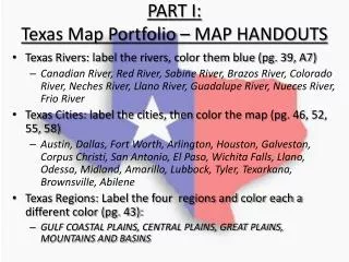
PART I: Texas Map Portfolio – MAP HANDOUTS. Texas Rivers: label the rivers, color them blue (pg. 39, A7) Canadian River, Red River, Sabine River, Brazos River, Colorado River, Neches River, Llano River, Guadalupe River, Nueces River, Frio River

E N D
PART I: Texas Map Portfolio – MAP HANDOUTS • Texas Rivers: label the rivers, color them blue (pg. 39, A7) • Canadian River, Red River, Sabine River, Brazos River, Colorado River, Neches River, Llano River, Guadalupe River, Nueces River, Frio River • Texas Cities: label the cities, then color the map (pg. 46, 52, 55, 58) • Austin, Dallas, Fort Worth, Arlington, Houston, Galveston, Corpus Christi, San Antonio, El Paso, Wichita Falls, Llano, Odessa, Midland, Amarillo, Lubbock, Tyler, Texarkana, Brownsville, Abilene • Texas Regions: Label the four regions and color each a different color (pg. 43): • GULF COASTAL PLAINS, CENTRAL PLAINS, GREAT PLAINS, MOUNTAINS AND BASINS
Part I Examples • Each River should be labeled and colored BLUE. • Include the following rivers: • Canadian River, Red River, Sabine River, Brazos River, Colorado River, Neches River, Llano River, Guadalupe River, Nueces River, Frio River
Part I Examples • Each city should be labeled and colored. Some dots do not line up perfectly – make corrections as appropriate. • Include the following cities: • Austin, Dallas, Fort Worth, Arlington, Houston, Galveston, Corpus Christi, San Antonio, El Paso, Wichita Falls, Llano, Odessa, Midland, Amarillo, Lubbock, Tyler, Texarkana, Brownsville, Abilene
Part I Examples • Each region should be labeled and colored. • The 4 Regions of Texas are: • Gulf Coastal Plains • Central Plains • Great Plains • Mountains and Basins
Part II:Texas Map (Spiral #3) In your Spiral Notebook (Item 3), you will draw and label the rivers, cities and 4 regions of Texas. Use your Map handouts as a reference. See directions below Rivers: Label, then Draw in BLUE • Canadian River, Red River, Sabine River, Brazos River, Colorado River, Neches River, Llano River, Guadalupe River, Nueces River, Frio River CITIES: Mark a dot for each city, then label correctly • Austin, Dallas, Fort Worth, Arlington, Houston, Galveston, Corpus Christi, San Antonio, El Paso, Wichita Falls, Llano, Odessa, Midland, Amarillo, Lubbock, Tyler, Texarkana, Brownsville, Abilene 4 Regions • Accurately Draw the 4 natural regions of Texas (Gulf Coastal Plains, Central Plains, Great Plains, Mountains and Basins), Label, and color each a different color
Part II Example • Rivers: Label, then Draw in BLUE • Canadian River, Red River, Sabine River, Brazos River, Colorado River, Neches River, Llano River, Guadalupe River, Nueces River, Frio River • CITIES: Mark a dot for each city, then label correctly • Austin, Dallas, Fort Worth, Arlington, Houston, Galveston, Corpus Christi, San Antonio, El Paso, Wichita Falls, Llano, Odessa, Midland, Amarillo, Lubbock, Tyler, Texarkana, Brownsville, Abilene • 4 Regions • Accurately Draw the 4 natural regions of Texas (Gulf Coastal Plains, Central Plains, Great Plains, Mountains and Basins), Label, and color each a different color