Download
1 / 83
830 likes | 1.1k Views
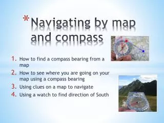
May 2008. Map and Compass CASARA Ottawa . Outline ? Session 1. Session 1Maps and map projectionsMap readingCompass WorkRouting and Planning. May 2008. Map and Compass CASARA Ottawa . Outline ? Session 2. Practical ExercisesPacing distancesTaking bearings and headingsWalking in a straight

E N D
1. May 2011 Map and Compass CASARA Ottawa MAP and COMPASS
COURSE
for
CASARA
Langley Muir
MAY 2011
2. May 2008 Map and Compass CASARA Ottawa Outline � Session 1 Session 1
Maps and map projections
Map reading
Compass Work
Routing and Planning
This theory takes about 1-1/2 hours to get through. You need to do a lot of table exercises in map reading and visualization in order to learn map conventions and to be able to plot efficiently and effectively. The practical work, involving about 5 hours of finding things in the bush is vital if you are actually going to be able to use this stuff. This theory takes about 1-1/2 hours to get through. You need to do a lot of table exercises in map reading and visualization in order to learn map conventions and to be able to plot efficiently and effectively. The practical work, involving about 5 hours of finding things in the bush is vital if you are actually going to be able to use this stuff.
3. May 2008 Map and Compass CASARA Ottawa Outline � Session 2 Practical Exercises
Pacing distances
Taking bearings and headings
Walking in a straight line
Avoiding Obstacles
Orienteering Course The first practical takes about 5 hours to do and you need to practice it continually if you are to be confident and accurate.The first practical takes about 5 hours to do and you need to practice it continually if you are to be confident and accurate.
4. May 2008 Map and Compass CASARA Ottawa Outline � Session 3 Night Navigation Exercise.
5. May 2008 Map and Compass CASARA Ottawa Overview Lots of theory here
You will not retain it
Practice, Practice, Practice
6. May 2008 Map and Compass CASARA Ottawa
7. May 2008 Map and Compass CASARA Ottawa SESSION 1 Map and Compass Theory
8. May 2008 Map and Compass CASARA Ottawa MAPS AND PROJECTIONS
9. May 2008 Map and Compass CASARA Ottawa Maps vs Charts A Map is a graphical representation of a portion of the earth�s surface.
A Chart is a map containing information useful to navigation � either marine or aeronautical.
A topographical map contains information about land elevation.
A planimetric map contains no physical info,
eg roadmaps.
10. May 2008 Map and Compass CASARA Ottawa Maps and Charts for CASARA WAC � aeronautical planning chart, 1:1,000,000
VNC � VFR navigation chart, 1:500,00
JOG � Joint Operations Graphic, 1:250,000
Road Maps: 1:250,000
National Topographic Series
1:250,000 for flying
1:50,000 for hiking
Land Use Maps, 1:20,000
Orienteering, 1:10,000 These are the most common maps and charts that CASARA deals with. You need to get a copy of each one and examine it carefully.These are the most common maps and charts that CASARA deals with. You need to get a copy of each one and examine it carefully.
11. May 2008 Map and Compass CASARA Ottawa Map projections Difficulty is to display the surface of a 3-dimensional object on a plane surface.
Hundreds of different projections.
Mostly mathematically derived
Specific uses, each preserves some particular property.
12. May 2008 Map and Compass CASARA Ottawa Lambert Conformal Projection Most of the aviation charts you will use are Lambert ConformalMost of the aviation charts you will use are Lambert Conformal
13. May 2008 Map and Compass CASARA Ottawa Stereographic Projections Most used for polar or arctic chartsMost used for polar or arctic charts
14. May 2008 Map and Compass CASARA Ottawa Mercator Projection The most common type that you see hung up on walls everywhereThe most common type that you see hung up on walls everywhere
15. May 2008 Map and Compass CASARA Ottawa UTM Projection 1 Most of the Topographic maps use this projectionMost of the Topographic maps use this projection
16. May 2008 Map and Compass CASARA Ottawa UTM Zone Shape If you understand this then you will understand the difference between grid north and true northIf you understand this then you will understand the difference between grid north and true north
17. May 2008 Map and Compass CASARA Ottawa
18. May 2008 Map and Compass CASARA Ottawa UNDERSTANDING MAPS
19. May 2008 Map and Compass CASARA Ottawa Legends From left to right on 1:50,000 topos in English
Dates and revisions, magnetic declination
Sources
Symbols
Map name, location, Scales (in both languages)
Conversion factors for elevation, contour interval, projection, datum, and datum conversion
Sources and dates and revisions in French
Around edges, co-ordinates (lat-long and UTM)
Get a couple of maps, a topo and a VNC, and find out where all this stuff is. This is the system for Topos.Get a couple of maps, a topo and a VNC, and find out where all this stuff is. This is the system for Topos.
20. May 2008 Map and Compass CASARA Ottawa Map Scales Expressed as
1 unit on map = nnnn units on the ground.
1:50,000 means that
1 cm on map = 50,000 cm on ground
= 500 m on ground
= 0.5 km on ground
21. May 2008 Map and Compass CASARA Ottawa Units Aircraft and ships use nautical miles
Everyone on the ground uses kilometers
Aircraft and Ships use Long � latitude
Ground uses MGRS (UTM)
Conversion is always necessary
Conversion is a MAJOR source of ERROR
22. May 2008 Map and Compass CASARA Ottawa Scale Conversion Factors 1 nm x 1.852 = km
x 1.1516 = statute mile
x 6082 = feet
1 mile x 0.8683 = nautical miles
x 1.61 = kilometers
x 1760 = yards
x 5280 = feet
x 63,360 = inches
1 km x 0.540 = nautical mile
x 0.621 = statute mile
You should have these factors tattooed on the back of your eyeballs, or at least close at hand.You should have these factors tattooed on the back of your eyeballs, or at least close at hand.
23. May 2008 Map and Compass CASARA Ottawa
24. May 2008 Map and Compass CASARA Ottawa DATUMS
25. May 2008 Map and Compass CASARA Ottawa Global and Local Datums
26. May 2008 Map and Compass CASARA Ottawa Earth Surfaces
27. May 2008 Map and Compass CASARA Ottawa Useful Datums WGS 84
International standard
Default for most GPS
In practice is the same as NAD83
NAD27
North American datum of 1927
On lots of older maps � look at the legend!!!
About 300m difference around here.
The difference is not much when you are talking about moving about in an aircraft, but it can be a lot if you are humping about in deep bush.
Most VNCs are converting to WGS84 and almost all Topos did so long ago. You can still find lots of stuff on NAD27, so always make sure which one you are supposed to be on.The difference is not much when you are talking about moving about in an aircraft, but it can be a lot if you are humping about in deep bush.
Most VNCs are converting to WGS84 and almost all Topos did so long ago. You can still find lots of stuff on NAD27, so always make sure which one you are supposed to be on.
28. May 2008 Map and Compass CASARA Ottawa
29. May 2008 Map and Compass CASARA Ottawa GRIDS
30. May 2008 Map and Compass CASARA Ottawa Common Grids GEOREF � exclusive to aeronautical
Lat-Long - aeronautical and marine
UTM/MGRS - ground navigation
MTM � local grid
similar to UTM
Used by municipalities and NCC
Look around edges of map for co-ords.
31. May 2008 Map and Compass CASARA Ottawa Map Grid Overprints Latitude and Longitude
Aeronautical and marine charts
1 minute of latitude = 1 nautical mile
1 minute of longitude = cos(lat)* 1 nm
UTM
National Topographic Series
1km or 10 km grids
32. May 2008 Map and Compass CASARA Ottawa World UTM Zones
33. May 2008 Map and Compass CASARA Ottawa Canadian UTM Zones
34. May 2008 Map and Compass CASARA Ottawa UTM Co-ordinates
35. May 2008 Map and Compass CASARA Ottawa Example Position Rockcliffe Airport is at:
N 45 27.617 W 075 38.767
18T 0449486 5034287
18T is the zone descriptor
When abbreviating, do not round up.
We generally know where we are within 100 km. so we can abbreviate the position
36. May 2008 Map and Compass CASARA Ottawa Military Grid Reference System 1 The Military Grid Reference System (MGRS) is an extension of the UTM system. UTM zone number and zone character are used to identify an area 6 degrees in east-west extent and 8 degrees in north-south extent.
UTM zone number and designator are followed by 100 km square easting and northing identifiers.
The system uses a set of alphabetic characters for the 100 km grid squares.
Starting at the 180 degree meridian the characters A to Z (omitting I and O) are used for 18 degrees before starting over. This is very complex and simply a different method of labelling the 100km grid squares, but it is the one used by the military.This is very complex and simply a different method of labelling the 100km grid squares, but it is the one used by the military.
37. May 2008 Map and Compass CASARA Ottawa Military Grid Reference System 2 From the equator north the characters A to V (omitting I and O) are used for 100 km squares, repeating every 2,000 km.
Northing designators normally begin with 'A' at the equator for odd numbered UTM easting zones.
For even numbered easting zones the northing designators are offset by five characters, starting at the equator with 'F'.
South of the equator, the characters continue the pattern set north of the equator.
38. May 2008 Map and Compass CASARA Ottawa Military Grid Reference System 3 Complicating the system, ellipsoid junctions (spheroid junctions in the terminology of MGRS) require a shift of 10 characters in the northing 100 km grid square designators. Different geodetic datums using different reference ellipsoids use different starting row offset numbers to accomplish this.
39. May 2008 Map and Compass CASARA Ottawa MGRS Co-ordinates Example (CYRO, at 18T 0449486 5034287)
18T (Locating a point within the Grid Zone Designation)
18T VR (within a 100 kilometer square)
18T VR 4 3 (within a 10 kilometer square)
18T VR 49 34 (within a 1 kilometer square)
18T VR 494 342 (within a 100-meter square)
18T VR 4948 3428 (within a 10-meter square) **
18T VR 49486 34287 (within a 1-meter square)
In practice, as long as you don�t go too far away, you won�t get into any problems if you simply ignore the differences between UTM and MTM. However, when dealing with another agency, always make sure what sort of abbreviated code they are using.In practice, as long as you don�t go too far away, you won�t get into any problems if you simply ignore the differences between UTM and MTM. However, when dealing with another agency, always make sure what sort of abbreviated code they are using.
40. May 2008 Map and Compass CASARA Ottawa UTM vs MGRS vs Geographic MGRS: 18T VR 49486 34287
UTM: 18T 0449486 5034287
Read by SG1 as 4948 3428
Geographic: N 45 27 37.0 W075 38 46.0
Read in a NOCL to the nearest minute as
452 707 538
Always find out who is using what convention!!
Different agencies have different ways of reading out the positions, make sure you know what is being used.Different agencies have different ways of reading out the positions, make sure you know what is being used.
41. May 2008 Map and Compass CASARA Ottawa Navigational Triangle � UTM course = tan-1((e2 � e1)/(n2-n1))
dist = sqrt( (e2 � e1)2 + (n2 � n1)2)
= (n2 � n1)/ cos(course)
= (e2 � e1)/sin(course)
How to figure out how far away and on what course the next point is, as long as you have a scientific calculator.How to figure out how far away and on what course the next point is, as long as you have a scientific calculator.
42. May 2008 Map and Compass CASARA Ottawa Navigational Triangle - GEOG Geographical
dep = ?long cos(mid-lat)
course = tan-1 *(dep / ?lat)
dist = 60*?lat* cos(course)
dist = sqrt( (60*?lat)2 + (60*dep)2 )
43. May 2008 Map and Compass CASARA Ottawa Roamers or Plotters These are useful devices, since they allow you to do accurate plotting on your map or chart.These are useful devices, since they allow you to do accurate plotting on your map or chart.
44. May 2008 Map and Compass CASARA Ottawa Mapping Accuracy 1:250K map positions are accurate to 250m, 90% of the time.
1:50L map positions are accurate to within 50m, 90% of the time.
You may not get better accuracy than this even if you do have GPS. These are the international Standards. Most North American or European maps are much more accurate than this.These are the international Standards. Most North American or European maps are much more accurate than this.
45. May 2008 Map and Compass CASARA Ottawa
46. May 2008 Map and Compass CASARA Ottawa MAP READING
47. May 2008 Map and Compass CASARA Ottawa Map Symbols International Standards
Legend is on the back of some NTS
Maps legends, or at least a brief summary of them, are on al maps and charts. However, you need to get hold of a comprehensive booklet (from most map stores) and study it carefully. You need to have most of the symbols memorized.Maps legends, or at least a brief summary of them, are on al maps and charts. However, you need to get hold of a comprehensive booklet (from most map stores) and study it carefully. You need to have most of the symbols memorized.
48. May 2008 Map and Compass CASARA Ottawa Map Symbols 1
49. May 2008 Map and Compass CASARA Ottawa Map Symbols 2
50. May 2008 Map and Compass CASARA Ottawa Sample Map This is an extract from the NTS, 1:250K, 31G, Ottawa map.This is an extract from the NTS, 1:250K, 31G, Ottawa map.
51. May 2008 Map and Compass CASARA Ottawa Plotting Positions - 1 What is at:
4585 50365
460 5032
46005 503324
How About:
45 28 075 32.8
45 31.5 075 38
Quarry, Powerline, water tower, Convent, running track (school)
Quarry, Powerline, water tower, Convent, running track (school)
52. May 2008 Map and Compass CASARA Ottawa Plotting Positions - 2 What are the co-ordinates of:
Runway at CYRO (UTM and Lat, Long)
How long is a minute of Latitude? (nm, km)
How long is a minute of Longitude? (nm, km)
What is about 4 nm at 120o from CYRO?
What is about 5.5km E along Innes Rd from the Detention Centre?
(18T 0449486 5034287), (45 27.5 075 39.7), 1nm (2km), 0.7nm (1.4 km), DND track, lumber yard(18T 0449486 5034287), (45 27.5 075 39.7), 1nm (2km), 0.7nm (1.4 km), DND track, lumber yard
53. May 2008 Map and Compass CASARA Ottawa Simple Contours
54. May 2008 Map and Compass CASARA Ottawa Topographic Contours
55. May 2008 Map and Compass CASARA Ottawa Map Reading Exercise Which way does the creek at 460 5031 run?
What is the elevation of the contour line at 45 33.5 075 25
Is the water tower base S of Orleans, higher or lower? How high is the tower?
How many 400m running tracks are on the map?
West, 70m, 90m, 36m, West, 70m, 90m, 36m,
56. May 2008 Map and Compass CASARA Ottawa
57. May 2008 Map and Compass CASARA Ottawa The MAGNETIC COMPASS
58. May 2008 Map and Compass CASARA Ottawa History Invented in China (1044), imported quickly to Europe (1190)
Basically a magnetised needle on a low friction bearing.
Points to magnetic north, not true north.
Can use a sewing needle floating in water.
59. May 2008 Map and Compass CASARA Ottawa Compass Types Three major types:
Military lensmatic.
Aircraft or boat
Orienteering.
For general usage the only useful type of compass to have is the orienteering one. The simplest ones work just as well as the most expensive ones. You pay a lot for being able to pre-set declination and have a not very good signal mirror.For general usage the only useful type of compass to have is the orienteering one. The simplest ones work just as well as the most expensive ones. You pay a lot for being able to pre-set declination and have a not very good signal mirror.
60. May 2008 Map and Compass CASARA Ottawa Orienteering Compass
61. May 2008 Map and Compass CASARA Ottawa Getting A Bearing
62. May 2008 Map and Compass CASARA Ottawa Taking a Bearing � 1 Two basic methods.
Arm�s Length sighting
Hip sighting.
63. May 2008 Map and Compass CASARA Ottawa Magnetic Variation Magnetic variation in Ottawa is 14 degrees west. Note that if we go to Thunder Bay, it is essentially 0.Magnetic variation in Ottawa is 14 degrees west. Note that if we go to Thunder Bay, it is essentially 0.
64. May 2008 Map and Compass CASARA Ottawa Magnetic and True North CADET - Compass to True, Add East
East is least and West is Best.
Use declination adjustment and always work in true.
Aircraft always work in magnetic.
Around here variation is about 14oW If you mess up the correction around here, you will be out by a total of 30 degrees; which is almost always important. You should be able to do this in your sleep, without thinking about it
If you mess up the correction around here, you will be out by a total of 30 degrees; which is almost always important. You should be able to do this in your sleep, without thinking about it
65. May 2008 Map and Compass CASARA Ottawa Plotting Bearings Once the bearings are taken, correct for variation.
Use compass to plot 2 or more bearings.
Back bearings for your own position.
Cocked Hat for object location.
66. May 2008 Map and Compass CASARA Ottawa Bearing Exercises OSC to CYRO is 080T (094M). Dist = 10.5 km. We are at the intersection of Innes and Bearbrook, in Blackburn Hamlet. OSC to CYRO is 080T (094M). Dist = 10.5 km. We are at the intersection of Innes and Bearbrook, in Blackburn Hamlet.
67. May 2008 Map and Compass CASARA Ottawa
68. May 2008 Map and Compass CASARA Ottawa SPEED and DISTANCE
69. May 2008 Map and Compass CASARA Ottawa Route Finding Determine start and end points
Draw line between them, calculate distance
Determine route, missing obvious problems.
Calculate distance and approx time. Distance = speed x time; speed = distance / time; time = distance / speed. Pay attention to the units.
These tips and tricks are important for the ground teams; aircrew may, however, find themselves on the ground occasionallyDistance = speed x time; speed = distance / time; time = distance / speed. Pay attention to the units.
These tips and tricks are important for the ground teams; aircrew may, however, find themselves on the ground occasionally
70. May 2008 Map and Compass CASARA Ottawa Tips and Tricks 1 You can�t walk on water
Swamps have a lot of water in them
Low, flat areas may be swamps
Going up and down hills is hard work
Valleys with streams in them are generally full of undergrowth.
Avoid going over cliffs.
71. May 2008 Map and Compass CASARA Ottawa Tips and Tricks 2 Distinguish between
Finding a route from A-B
Walking a straight line from A-B
In populated areas there are lots of paths
It is easier to hike on a path than bush-crash.
There are lots of tapings, cairns, and paths that are irrelevant.
72. May 2008 Map and Compass CASARA Ottawa Tips and Tricks - 3 Make use of multiple lines of evidence.
Direction hiked
Time and distance hiked
Topography and surrounding landmarks.
NEVER - EVER lose track of where you are on the map.
73. May 2008 Map and Compass CASARA Ottawa Avoiding Obstacles Accurate note-keeping will keep you out of trouble.
Use box method or 45o methods.
Use deliberate aiming off.
Make use of Handrails
Ridges, creeks, roads, trails, lakes, etc.
74. May 2008 Map and Compass CASARA Ottawa Avoiding Obstacles - 2
75. May 2008 Map and Compass CASARA Ottawa Hiking Speeds A fit individual can hike at:
5 km/hr on a good road
3 km/ hr on a good trail
1 � 2 km/hr on a poor path or open bush
Down to 1 km per day in really bad conditions.
When planning add time for route finding, and breaks.
76. May 2008 Map and Compass CASARA Ottawa Pacing Counting paces is a way of estimating distance.
Need to calibrate yourself.
Use pace beads for counts
Don�t get distracted! If you don�t have pace beads, a handfull of pebbles work well.If you don�t have pace beads, a handfull of pebbles work well.
77. May 2008 Map and Compass CASARA Ottawa Don�t Get Misplaced Always keep meticulous notes on both the map and your notebook.
Time
Fixes to co-ordinate with the map.
General description.
NEVER-EVER lose your place on the map.
78. May 2008 Map and Compass CASARA Ottawa
79. May 2008 Map and Compass CASARA Ottawa SESSION 2 Outdoor Practicum
80. May 2008 Map and Compass CASARA Ottawa Afternoon Exercise Afternoon Exercise will be at:
North end of Tauvette in Blackburn Hamlet.
04549 50314 or 18T VR 549 314
N045 26.1 W075 34.6
Time 13:00L
81. May 2008 Map and Compass CASARA Ottawa
82. May 2008 Map and Compass CASARA Ottawa SESSION 3 Night Navigation Practicum
83. May 2008 Map and Compass CASARA Ottawa Night Navigation Night Session will be at:
Intersection of Ramseyville Rd and Walkley Road, just E of #417, N side of sharp bend to S. - part of Mer Bleu
04542 50277 or 18T VR 542 277
N45 24 W075 35
Time: 20:00L � will be dark by 20:30.