Download
1 / 21
210 likes | 534 Views
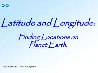
Latitude and Longitude:. Finding Locations on Planet Earth. With thanks and credit to Step.com. GEOGRAPHY – LONGITUDE/LATITUDE BELLRINGER 10/3. What is longitude? How does it work?. What is latitude? How does it work?.

E N D
Latitude and Longitude: Finding Locations on Planet Earth. With thanks and credit to Step.com
GEOGRAPHY – LONGITUDE/LATITUDEBELLRINGER 10/3 • What is longitude? • How does it work? • What is latitude? • How does it work?
Draw a Circle on your paper. Create the equator and the prime meridian.
On the map horizontal lines are lines of latitude and.... vertical lines are lines of longitude. The X axis is the equator and the Y axis which runs through Greenwich, England is the Prime Meridian. Equator Prime Meridian
Any location north of the equator is in the NORTHERN HEMISPHERE, written as ___°N (Hemi = half; sphere = globe)
Any location south of the equator is in the SOUTHERN HEMISPHERE, written as ___°S (Hemi = half; sphere = globe)
Any location west of the prime meridian is in the WESTERN HEMISPHERE, written as ____°W (Hemi = half; sphere = globe)
Any location east of the prime meridian is in the EASTERN HEMISPHERE,written as ____°E (Hemi = half; sphere = globe)
We can divide the Earth into quadrants: NE where all latitudes are NORTH and all longitudes are EAST. (quadrants quad = four)
We can divide the Earth into quadrants: SE where all latitudes are SOUTH and all longitudes are EAST. (quadrants quad = four)
We can divide the Earth into quadrants: SW where all latitudes are SOUTH and all longitudes are WEST. (quadrants quad = four)
We can divide the Earth into quadrants: NW where all latitudes are NORTH and all longitudes are WEST. EVERY point in the United States will have a NORTH latitude and a WEST longitude since we are in the NW quadrant.
With the person next to you answer the following questions: • What continent is in the NE quadrant? • What continent is in the SE quadrant? • What continent is in the NW quadrant? • What continent is in the SW quadrant? • (Can you add any countries you know)?
What is latitude? (HORIZONTAL LINES) 90°N Y-axis Latitude measures the distance North and South from the equator. Label the North Pole 90° N Label the South Pole 90° S And remember that the equator is 0° latitude. 90°S 0° What is the maximum possible latitude on Earth? 90° is maximum. You could be at 90°N or 90°S but there is no greater latitude on Earth (or anywhere else)
What is longitude? VERTICAL LINES Longitude measures the distance East and West from the prime meridian The prime meridian is 0° And if you go half way around the world you will reach the 180° longitude line. 180° 0° 180° Understand that there aren’t two 180° lines. On this FLAT map it just looks that way. It’s the SAME line. What is the maximum possible longitude on Earth? 180° longitude
60°N, 30°W 75°S, 75°E 15°S, 105°W Each box on this map is 15°. With that in mind how can we identify specific locations (red dots)? Remember, write latitude first! What are the coordinates of location......A What are the coordinates of location......B What are the coordinates of location......C But what about location D ? It’s in the middle of a box. What do we do now?
Here are some things to remember: • Latitude is written first and mustalways include N (north) or S (south) of the equator. • Longitude is written next and must always include E (east) or W (west) of the prime meridian. As with anything else you learn you will get better with practice......... SO PRACTICE, PRACTICE, PRACTICE!
WORLD TIME ZONES Fig. 1-9: The world’s 24 standard time zones each represent about 15° of longitude. GMT is Universal Time. International Date Line (turn clock forward 24 hrs going WEST; turn back 24hrs going EAST)
US Land Ordinance, 1785 • US divided country into townships and ranges so that land could be divided up and sold to white settlers moving West A township is 6 square miles Principal Meridians – some of the north-south lines Base lines – some of the east-west lines
Townships are split into 36 square mile sections (1-36)Tiers are N/S of baselinesRanges are E/W of meridiansSections are divided into 4 quarter-sections (NW/NE/SW/SE)Survey maps have a scale of 1:24,000 (1 in = 24,000 in or 2,000 ft)
How to Read Township and Range: • N ½ of NW ¼ of sec. 19, T44N, R8E R7E R8E T44N T44N