Download
1 / 9
90 likes | 215 Views
1-Day of 2-D. How Are The Results Of Hydraulic Models Used To Manage Floodplain Development Under The NFIP? Eric Simmons, FEMA Region IX. Idealized Schematic of Floodplain Mapping. Topographic Data & Ground Elevations. Floodplain Boundaries. . . =. . . . . +. .

E N D
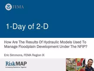
1-Day of 2-D How Are The Results Of Hydraulic Models Used To Manage Floodplain Development Under The NFIP? Eric Simmons, FEMA Region IX
Idealized Schematic of Floodplain Mapping Topographic Data & Ground Elevations Floodplain Boundaries = + Water Surface Elevations Floodway Stations Streamflow & Meterological Data Hydrologic Analysis Flood Flows Hydraulic Modeling Flood Data / Database Digital Base Mapping Final Flood Maps - - Initial Data Initial Outputs Input Analyses Final Products Field Data & Surveys
Considerations For The NFIP • Model Results Are Used For Floodplain Management: • Flood hazard areas • Flood elevations • Regulatory floodways • Differences between 1-D and 2-D Computer Programs?
Considerations For The NFIP • Model Results Are Used For Floodplain Management: • Flood hazard areas • Flood elevations • Regulatory floodways • Differences between 1-D and 2-D Computer Programs? • Momentum, velocity averaging, vertical variations, etc. • Riverine, coastal and alluvial floodplains • Cross sections (with prescribed flow direction) vs. nodes • Steady vs. unsteady (peak discharge vs. hydrograph) • Ability to perform automated encroachment analysis • Model setup time, costs, equipment, run times, industry expertise, stakeholder acceptance, etc. • Cross section spacing and mesh resolution
Considerations For The NFIP • Model Results Are Used For Floodplain Management: • Flood hazard areas • Flood elevations • Regulatory floodways • Differences between 1-D and 2-D Computer Programs? • Momentum, velocity averaging, vertical variations, etc. • Riverine, coastal and alluvial floodplains • Cross sections (with prescribed flow direction) vs. nodes • Steady vs. unsteady (peak discharge vs. hydrograph) • Ability to perform automated encroachment analysis • Model setup time, costs, equipment, run times, industry expertise, stakeholder acceptance, etc. • Cross section spacing and mesh resolution
Advantages of 2-D Computer Programs • Flow Splits • Very Wide Floodplain • Braided Channels • Scour Analysis • Sediment and Pollutant Transport • Estuary Dynamics • Other?
1-D Model Links: Profile, Baseline & SFHA • ●Baseline► Model ► Flood Profile ► Floodplain. • 1% Annual Chance Water-Surface Elevations (for development/new building and flood insurance purposes) determined from Flood Profile along profile baseline (or table in the FIS) Flood Insurance Study (FIS) (digital & hard-copy) Hydraulic Model Mapped Floodplain (SFHA) on FIRM Panels (digital & hard-copy) Hydraulic Baseline in Floodplain
Floodplain Management • Floodplain Management is a Decision Making Process That Aims to Achieve Wise Use or Nonuse of the Floodplain • With the National Flood Insurance Program over 21,000 communities nationwide have adopted a floodplain management process based on, at least, a Flood Insurance Rate Map • Flood Insurance Rate Maps: • High Hazard Areas (flood zone boundary) • Base Flood Elevations (flood profile & profile baseline) or Depths • Regulatory Floodways (in riverine areas)
My QuestionsFor Today • What issues does FEMA face in using 2-D and unsteady models? • What underlying assumptions of each model are valid/invalid? • When do the benefits outweigh costs for another analysis type? • Should we let a 2-D hydraulic model delineate the mapped floodplain boundaries (or a separate GIS application as typically done with 1-D analyses)? • How can/should 1% annual chance flood elevations be recorded for individual structures (to the nearest tenth of a foot) using 2-D models? • Can 2-D programs efficiently model floodways? If not, should NFIP floodplain management and mapping criteria be changed? • For which analyses should 1-D and 2-D modeling be linked?