Download
1 / 18
180 likes | 343 Views
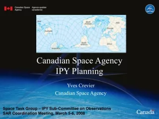
Canadian Space Agency IPY Planning. Yves Crevier Canadian Space Agency. Space Task Group – IPY Sub-Committee on Observations SAR Coordination Meeting, March 5-6, 2008. Funding for Canadian IPY activities. Government of Canada $150M. NSERC $6M. Government of Canada Program for IPY.

E N D
Canadian Space Agency IPY Planning Yves Crevier Canadian Space Agency Space Task Group – IPY Sub-Committee on Observations SAR Coordination Meeting, March 5-6, 2008
Funding for Canadian IPY activities Government of Canada $150M NSERC $6M
Government of Canada Program for IPY $150M in funding over six years starting FY 2006-07 for Canadian participation in: • Science and research focused on science for climate change impacts and adaptation and health and well-being of northern communities • Training & capacity-building • Communications & outreach • Logistics, infrastructure, emergency preparedness, data management • Support for licensing, coordination and administration
Role of CSA in IPY • Ensure the use of Space Technologies in IPY Science initiatives • Guarantee fluid and continued availability and access to EO data from CSA supported mission • Dedicate programs and resources to support science, application demonstration, and operational use of EO data for IPY • Encourage strong collaborations (National and International)
RADARSAT 1 as an Operational System • In operation since 1996 – confirmed continued operations until 2009 • Demonstrated potential for routine polar observation (world-wide ice services, Arctic and Antarctic missions) • Archive collected over both polar regions (>250,000 images over the Arctic)
Iqaluit, Nunavut, CanadaRADARSAT-2 Fine Quad-PolJanuary 7, 2008 GreenlandRADARSAT-2 Standard Quad-PolDecember 18, 2007 RADARSAT 2 as an Ensured Continuity • RADARSAT-1 Heritage modes • Enhanced modes & capabilities • Multi-polarization, Polarimetry • Ultra-fine resolution • Left and right looking • Canadian Government data allocation available for • International Science Projects
RADARSAT Constellation Mission • 3 satellites – C-Band, dual-pol operations, quad-pol exp.,multiple swaths and resolution available • Increased imaging frequency for polar regions – up to 4 time/day • Increasing operational use • Improving system reliability
CSA IPY Activities • Arctic Science Archive Processing project • RADARSAT Polar Science Database • Coordination through Space Task Group
1. ASAP • Objectives: • Initiate the processing of RSAT 1 archive collected over both poles. • Ensure accessibility for scientific activities • Direct contribution to IPY national and International science programs • 12 years of relevant datasets based on operational and background missions activities
ASAP Legacy • Blanket coverage in Fine 1 of the Canadian polar region and the Arctic Archipelago (collected during the CIM, 2000-2001) • Max and Min ice extent Arctic snapshots from 2003 to … • Thematically relevant dataset acquired over specific areas of interest (supersites) identified by the research communities • Canadian Ice Service dataset acquired since 1996 • Canadian Arctic land mass mosaics – summer and winter 1998-99 • Canadian Interferometric Mission dataset
Frozen Baseline – F1 Phase 1 - Baseline Fine Mode. Northern Canadian complete coverage (20 000 scenes)
Min and Max Sea Ice Extent Phase 2 - - Arctic Basin ScanSAR Sea-Ice Snapshots (364 scenes)
Canadian Supersites Phase 3 - Arctic Super-sites (4038 scenes)
2. RADARSAT Polar Science Database Objectives • to create and disseminate a circumpolar Arctic data treasury of satellite-based radar data and derived information products in support of science and local needs of northern peoples and communities. Highlights • Making use of Radarsat archives and missions – RSAT-1,-2,-C • Done through collaboration with recognized Arctic portals (CCIN, ASF DAAC, PolarVIEW?, and others) • Serve urgent Canadian & international goals • In support of science and northern communities • A lasting legacy
3.Coordination Through STG • Support the objective of STG • Ensure CSA collaboration for: • Acquisition and planning coordination • Data management (archiving, standard, inter-operability, etc.) • Open data policy for science activities
Wish List of the CSA EOAU • Make RADARSAT 1 archive available • Ensure RADARSAT 1 operations continuity • Extend the Canadian RADARSAT-2 data GoC allocation framework to the International IPY science community • Contribute to and Witness the implementation of a virtual SAR constellation in support to operational and science activities…
Summary: Outputs & Outcomes • RADARSAT data & products are put into use • New partnerships with science and clients / users. • World-contributing new northern EO presence and strengthened Antarctic EO presence • Contributing to Canadian goals for northern sustainability, resources management, sovereignty, and science • Canadian satellite EO coordinated with global goals and data demand and supply.