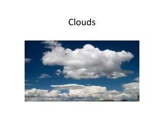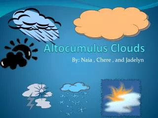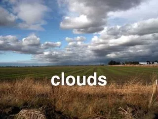
Altocumulus Clouds
Altocumulus Clouds. Picture by Curtis Hughes. Adolfo Merlin . November 9 th , 2013 . Picture by Curtis Hughes. . 5km – 8 km high (6,500ft. and 20,000 ft.) Parallel bands or round masses

Altocumulus Clouds
E N D
Presentation Transcript
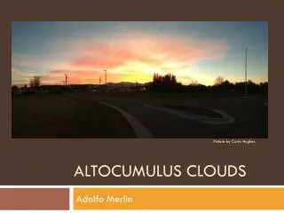
Altocumulus Clouds Picture by Curtis Hughes Adolfo Merlin
November 9th , 2013 Picture by Curtis Hughes
. • 5km – 8 km high (6,500ft. and 20,000 ft.) • Parallel bands or round masses • Presence of altocumulus clouds on a warm and humid day may be an indication by thunderstorms later in the day or following weeks. www.crh.noaa.gov
Cold Front • Cold air lifts warm/moist air • As the warm air raises, water vapor condenses. • This produces altocumulus clouds. Patrick L. Abbott. Natural Disasters. Fifth Edition Pg. 276-279
Severe Weather Storms! . • If the cold front is strong and traveling fast, it can create frontal thunderstorms that would produce rain for several hours in a large area. Results can lead to floods and sever wind. www.crh.noaa.gov
Floods Results • The results from the even can create secondary to tertiary effects of heavy rain that can create inconveniences or destruction of property.
Reflection I could use this information, by knowing some information of weather and disasters. Next time I hear the news taking about cold fronts or anything about weather. I can try to predict, hey it may be sever wind and rainstorm. So I can avoid going out and the events won’t effect me if I prepare at home.
References Slide 1 & 2 Slide 3 Slide 4 Slide 5 Slide 6 Other Sources: • Pictures were taken by Curtis Hughes and provided by Kat Santos • http://www.crh.noaa.gov/lmk/?n=cloud_classification • http://ww2010.atmos.uiuc.edu/%28Gh%29/wwhlpr/cold_front_precip.rxml?hret=/guides/mtr/cld/cldtyp/mdl/altcu.rxml • http://www.crh.noaa.gov/lmk/?n=cool_season_severe_weather • http://www.weather.com/encyclopedia/thunder/frontal.html • http://smartmap.us/forum/?page_id=14 CH. 7-8 Slide, pictures were from the slide that Mr. Allard and Elizabeth Payan took. • Patrick L. Abbott. Natural Disasters. Fifth Edition