Download
1 / 30
300 likes | 400 Views
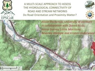
Alison Pechenick, University of Vermont in collaboration with Donna Rizzo, Kerrie Garvey, Leslie Morrissey, Beverley Wemple and Kristen Underwood. A MULTI-SCALE APPROACH TO ASSESS THE HYDROLOGICAL CONNECTIVITY OF ROAD AND STREAM NETWORKS Do Road Orientation and Proximity Matter?.

E N D
Alison Pechenick, University of Vermont in collaboration with Donna Rizzo, Kerrie Garvey, Leslie Morrissey, Beverley Wemple and Kristen Underwood A MULTI-SCALE APPROACH TO ASSESS THE HYDROLOGICAL CONNECTIVITY OF ROAD AND STREAM NETWORKS Do Road Orientation and Proximity Matter?
Winooski River Valley: A river seeks “dynamic equilibrium” Energy dissipates in a slow and predictable manner... unless otherwise constrained
Roads threaten... • watershed health • water quality and quantity • riparian and aquatic habitats • flood management • stream geomorphic stability Roads stress watersheds by... • dramatically impacting the movement of water and sediment across the landscape • altering drainage paths • concentrating overland flow in roadside ditches. ~~~ Motivation ~~~ Road proximity has a negative impact on stream geomorphic health. This is especially true with respect to roads located within the riparian corridor. Road orientation plays a role in determining stream geomorphic health. Parallel and perpendicular roads present multiple opportunities for redirecting runoff into streams. ~~~ Hypotheses ~~~
Drainage Density Increases with Hydrologically-Connected Roads Roads (including compacted, unpaved) and other impervious surfaces act like streams. Flow rate and volume increase with Drainage Density Jones JA, Swanson FJ, Wemple BC, Snyder KU. 2000. Effects of roads on hydrology, geomorphology, and disturbance patches in stream networks. Conservation Biology 14:76-85
Jones et al., 2000 Hydrologic Connectivity on the Hillslopes • Road prism intercepts overland and sub-surface flows (gw flow rates << overland flow rates) • Roads channel overland flow • and sediment to streams
Hydrologic Connectivity via Ditches & Culverts
Vermont Agency of Natural Resources River Management Program • Channel and watershed management • Restore dynamic equilibrium • Predict channel instability • Statewide data collection • Phase 1 data Combine local knowledge with remotely-sensed and other map information to characterize watershed and channel corridor features(land use, soils, channel slope, sinuosity, etc.) • Phase 2 data Expert field evaluation using blend of well-established protocols to characterize stream geomorphic condition according to a variety of assessment parameters (e.g., incision and entrenchment ratios, access to flood plain, grain size distribution, etc.) Winooski River Vermont Watersheds
Vermont Agency of Natural Resources River Management Program • Channel and watershed management • Restore dynamic equilibrium • Predict channel instability • Statewide data collection • Phase 1 data Combine local knowledge with remotely-sensed and other map information to characterize watershed and channel corridor features(land use, soils, channel slope, sinuosity, etc.) • Phase 2 data Expert field evaluation using blend of well-established protocols to characterize stream geomorphic condition according to a variety of assessment parameters (e.g., incision and entrenchment ratios, access to flood plain, grain size distribution, etc.) https://anrnode.anr.state.vt.us/SGA/default.aspx Winooski River Vermont Watersheds
Subwatershed Middlebury, Vermont Wikipedia Commons
Channel & watershed management • Restore dynamic equilibrium • Predict channel instability VT ANR River Management Program RapidGeomorphic Assessment RGA score
Mining the Phase 2 Stream Reach Data: Sole anthropogenic influence = Road Development • ~2300 assessed reaches, 112 different VTANR RMP projects • Selection criteria: • drainage area < 50 mi2 • forest cover ≥ 75% • remove of reaches with development > 10%, railroad lines, impoundments (e.g., dams), straightening not due to roads • If multiple reaches in same river network, select reach furthest downstream Result: N=102 statistically independent reaches believed to be free of anthropogenic influences with the exception of roads.
Reach-scale subwatersheds (“Direct Drainage”)
Road metrics were evaluated over four geographic regions, characterized by channel proximity and drainage scope. RGA scores are always the reach score assigned in the field. Streams (blue segments), reach breaks (circles), and subwatersheds (polygons) for the VTANR-RMP assessment of the Middlebury River watershed. Reach Direct Drainage = LocalCatchment = Total Upstream Network
Road Metric #1: Road-Stream Crossings • Raw Count (old) • Number per Unit Area (old) • Number per Unit Length of Stream (new, also now in USGS pub rel 2013) • Recognition of Direct and Dramatic Impacts of Crossings on Stream Condition Road-Stream Crossings Roads Streams Corridor Reach Direct Drainage Catchment
Sum of distances, stream to nearest roads (m/m) *similar to a USGS metric found in 2013 publication. Road Metric #2 Our new approach for characterizing PROXIMITY Roads Streams Reach Direct Drainage Catchment Distance measured
Road Metrics #3, Our new approach for characterizing ORIENTATION Parallel Roads Perpendicular Roads Streams Reach Direct Drainage Catchment For Each of Parallel and Perpendicular: Sum of distances, roads to nearest streams (m/m) Mean of distances, roads to nearest streams (m) Percent of roads in orientation category o50 m pt layers 91° 67° 25° 125°
ArcGIS ToolsGraphics and Shapes > Calculate Geometry (for azimuth calculations - extension downloaded from ArcScripts website)Near (distance between roads and streams - proximity metric)Construct Points (create points at 50m intervals)Split (split lines at 50m intervals)Spatial Join (used like the "Near" function but for the orientation metric as it also joins the fields from the two joined features - i.e. a road and stream segment with azimuth calculated will result in the stream segment with both azimuths listed in the attribute table)Calculations for the proximity results of parallel and perpendicular done in attribute table - use the two azimuths after performing spatial join (if statement assigns "parallel" and "perpendicular").
New road metrics sensitive at multiple scales Table entries are p-values from inspecting individual metrics using Logistic Regression Analysis p=0.05 considered significant • normalized by • stream length
USGS GIS guidelines released 2013 Mean of the distances @ 30m “Anthropogenic Factors” National Water-Quality Assessment Program: Methods to Characterize Environmental Settings of Stream and Groundwater Sampling Sites for National Water-Quality Assessment USGS, 2012. Released 2013. • normalized by • stream length
Classification tool using continuous predictor variables to categorize a dependent variable into pre-defined classes (e.g., Fair, Good, ...) Discriminant Analysis DA contingency table showing counts for RGA classification using combined Inherent and Proximity metrics as inputs at the Reach Direct Drainage scale: Predictions 55% exact, 88% within one class.
Discriminant Analysis on individual metric categories... Inherent metrics dominate at 2 Reach scales; Orientation metrics comparable for Reach DD; Proximity metricsstrong for Catchment Corridor * Metrics not available Inherent Metrics: Bedform, Bed material, Confinement, Slope
Discriminant Analysis on individual metric categories... Inherent metrics dominate at 2 Reach scales; Orientation comparable for Reach DD Proximity metrics strong for Catchment Corridor Proximity and Orientation valuablefor Catchment;improvement overtraditional road density * Metrics not available Inherent Metrics: Bedform, Bed material, Confinement, Slope “NA”: Can we characterize inherent metrics at the catchment (channel network) scale?
Discriminant Analysis on combinations of two metric categories... Reach Scales: Proximity and Orientation best predictors of stream condition, both enhanced by Inherents At catchment scales, “Inherent” is slope (%) of main channel for the total upstream river network
Discriminant Analysis on combinations of two metric categories... Reach Scales: Proximity and Orientation best predictors of stream condition, both enhanced by Inherents Corridor Scales:Proximity best predictor, enhanced both by Density and Inherent * Field and GIS GIS only * At catchment scales, “Inherent” is slope (%) of main channel for the total upstream river network
Discriminant Analysis on combinations of three metric categories... • Strongest reach- scale predictions involve Proximity, Orientation, and Inherent metrics • Strongest catchment-scale predictions always include theProximity metrics At catchment scales, “Inherent” is slope (%) of main channel for the total upstream river network
In conclusion... • First study to examine relationships between road • network geometry and river channel morphology: • Extensive dataset of stream reaches (VTANR RMP data unique) • Nearly exclusive of other anthropogenic influences • Field-based, stream geomorphic assessment protocols • Road metrics included traditional (density) and • newly-derived (orientation, proximity) • After accounting for inherent channel characteristics*, measures of road network geometry provided important explanatory power: • Discriminate channel condition, especially at the largest (catchment) scale. • Metrics were derived by geospatial analyses of remotely-sensed data: • Identify other reachesat risk without requiring intensive “Phase 2” field assessments. • *bedform, slope, confinement, dominant bed material Winooski River Vermont Watersheds