Download
1 / 6
0 likes | 56 Views
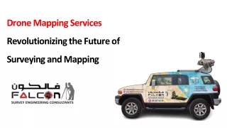
If you want drone mapping services, rely on Agri Drone Specialists! We also offer drone seeding services to help farmers or landowners with precision agricultural solutions. Contact us at 027 323 8155 or visit https://www.agridronespecialists.co.nz/

E N D
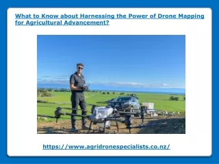
What to Know about Harnessing the Power of Drone Mapping for Agricultural Advancement? https://www.agridronespecialists.co.nz/
Do you know about the advancements in the agriculture landscape? Have you heard about drone mapping services? It is a cutting-edge technology for farmers to optimise their yields and minimize resource usage.
Modern sensors and cameras aboard drones allow them to provide an aerial perspective of farms. It enables farmers to gather invaluable data for informed decision-making. Data Collection: Multispectral and LiDAR data, as well as detailed photos, can be obtained by drones. These data provide insights into crop health, soil conditions, drainage patterns, and pest infestations. It enables farmers to recognise possible problems at an early stage. Field Monitoring: Through regular drone mapping- you and other farmers can monitor the vast fields with unprecedented frequency and accuracy. A drone’s collected imagery is used to identify diseased or stressed crop patches. It helps you assess plant density and track growth rates throughout the season. Real-time monitoring helps in timely intervention and ensures optimal crop health.
Yield Mapping: Drone mapping helps generate yield maps. It offers insightful information on the geographic diversity found in fields. By analysing these maps, you can identify high-yielding areas and factors contributing to yield variations, such as soil fertility or water availability. You can use this information for future crop planning and resource allocation strategies to experience improved productivity and profitability. Regulatory Compliance and Safety: Using drones in agriculture requires you to follow the governing rules and regulations. Safety procedures are essential to avoid mishaps and guarantee responsible drone operation. It requires getting professional services for drone mapping to prevent legal issues and mitigate risks.
Conclusion: Drone mapping holds immense potential for revolutionising agriculture by providing actionable insights for optimised crop management. By embracing this transformative technology and harnessing its capabilities, you and other farmers can unlock new levels of efficiency and productivity. Drone mapping in agriculture is an innovation that empowers farmers to navigate challenges and seize opportunities for a prosperous future. If you want drone mapping services, rely on Agri Drone Specialists! We also offer drone seeding services to help farmers or landowners with precision agricultural solutions. Contact us at 027 323 8155 or alex@agridronespecialists.co.nz to discuss your drone mapping requirements!
Agri Drone Specialists 74 Montreal RoadNelson, New ZealandPhone: 027 323 8155Email: alex@agridronespecialists.co.nz https://www.agridronespecialists.co.nz/