Drone Agricultural Surveying_ A Comprehensive Guide
0 likes | 12 Views
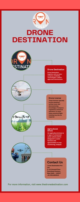
Damage Mapping for Insurance is a cutting-edge solution that provides accurate and efficient damage assessment for insurance companies. Our advanced technology allows insurers to quickly and accurately map out the extent of damage caused by natural disasters or accidents, saving valuable time and resources. With our solution, insurance adjusters can seamlessly assess the damage remotely without the need for on-site visits, ensuring faster claim processing and quicker resolution for policyholders. Trust Damage Mapping for Insurance to streamline your claims process and deliver accurate assessme
Download Presentation 
Drone Agricultural Surveying_ A Comprehensive Guide
An Image/Link below is provided (as is) to download presentation
Download Policy: Content on the Website is provided to you AS IS for your information and personal use and may not be sold / licensed / shared on other websites without getting consent from its author.
Content is provided to you AS IS for your information and personal use only.
Download presentation by click this link.
While downloading, if for some reason you are not able to download a presentation, the publisher may have deleted the file from their server.
During download, if you can't get a presentation, the file might be deleted by the publisher.
E N D
Presentation Transcript


![READ [PDF] Bar Exam Success: A Comprehensive Guide: A Comprehensive Guide (](https://cdn7.slideserve.com/12503608/bar-exam-success-a-comprehensive-guide-dt.jpg)

More Related