Download
1 / 32
320 likes | 523 Views
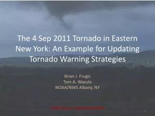
The 4 Sep 2011 Tornado in Eastern New York: An Example for Updating Tornado Warning Strategies. Brian J. Frugis Tom A. Wasula NOAA/NWS Albany, NY. CSTAR Grant #: NA01NWS4680002. CSTAR IV & Motivation for Study.

E N D
The 4 Sep 2011 Tornado in Eastern New York: An Example for Updating Tornado Warning Strategies Brian J. Frugis Tom A. Wasula NOAA/NWS Albany, NY CSTAR Grant #: NA01NWS4680002
CSTAR IV & Motivation for Study • New Tornado Climatology was developed over the summer of 2010 and 2011 for the Northeastern US with CSTAR work by undergrad UAlbany students • A goal of CSTAR IV is to develop/update tornado warning strategies using the new 8 bit high resolution radar data • V-R shear relationship has been an effective method for predicting tornadic development, however, this is based off of 4-bit radar data
Updated Tornado Climatology by CWANumber of Tornadoes for 1980 – 2011
Previous Work • LaPenta (2000) led a COMET study on V-R shear relationship for Northeastern United States tornadoes • Collaborate project between UAlbany and NWS Albany • This study created nomograms for operational use based on a linear relationship between gate-to-gate shear and the strength of the rotational velocity of the mesocyclone
V-R Shear Relationship • Maximum observed gate-to-gate shear below 3 km was found to be useful in identifying tornadic storms (LaPentaet al. 2000) S=Vr/(D*1800) Shear (S) is measured in units of s-1, rotational velocity (Vr) in knots and D is the diameter of which S is calculated in n mi.
Accounting for Varying Shear Values With 4-bit data, adjacent pixels are 0.5 n mi apart within 30 n mi from the radar. This distance becomes 1.0 n mi at 60 n mi away from the radar due to beam spreading Because of this, D is variable depending on range from radar and must be normalized In the LaPenta study, D was set to 0.5 n mi for areas within 30 n mi of radar and adjusted for areas further away (LaPenta et al, 2000)
Maximum Velocity Differential of Mesocyclone (Vm) • Determine strength of large-scale mesocyclone • Based off “Mesocyclone Recognition Guidelines” (Andra et al. 1994) • Uses a 3.5 nm mesocyclone width Image from 1998 Mechanicville, NY F3 Tornado, courtesy of LaPenta, et al. 2000
Legacy 4-bit V/SRM Products • Resolution: 1 km (0.54 nm) by 1 degree • Range: 124 nm • 16 data levels: -64 kts to +64 kts An example of 4-bit reflectivity (Z) image from KENX from 2123z 4 Sept 2011
8 Bit V/SRM Products • Introduced in late 2002/early 2003 with AWIPS build 5.2.1 • Resolution: 0.25 km (0.13 nm) by 1 degree • Range: 124 nm (no change) • 256 data levels (28): -123 kts to +123 (using standard setup) An example of 8-bit reflectivity (Z) image from KENX from 2123z 4 Sept 2011
Super Resolution 8 bit V/SRM Products • Introduced in Spring-Summer 2008 with RPA/RDA Build 10.0 • Resolution: 0.25 km (0.13 nm) by ½ degree • Range: 162 nm • 256 data levels (28): -123 kts to +123 (using standard setup) An example of 8-bit super resolution reflectivity (Z) image from KENX from 2123z 4 Sept 2011
Advantages of New High Res Data • With the 8-bit high res data, we no longer have to adjust D for range when using the V-R shear technique • This is because going from the mid point to mid point of adjacent pixels is 0.5 n mi or less for up to 60 n mi from the radar • The higher resolution data allows more subtle features to be resolved • Higher velocity values can be calculated (up to 128 kts in normal setup for 8 bit as compared to 64 kts for 4 bit)
4 Sept 2011 Tornado • Rated EF1 with top winds of 110 mph by NWS Albany Survey Team • Formed at 2120z near Florida, NY • Up to a half-mile wide through Cranesville, NY • Dissipated at 2135z near Glenville, NY • On the ground for 7 miles KENX 0.5° Z Loop from 4 Sept 2011 between 2109z and 2146z
4 Sept 2011 Tornado Imagery of some of the damage along the EF1 Cranesville Tornado path from September 2011 (Image courtesy of Google Inc.). Map of EF1 Cranesville Tornado after it crossed the Mohawk River from 4 Sept 2011 (Image Courtesy of Google, Inc.).
Using Spectrum Width as an Indicator of Tornadic Development KENX 0.5° Reflectivity Loop w/TVS KENX 0.5° Spectrum Width Loop
Calculating Legacy V-R Shear • 4 bit KENX SRM 4 Sept 2011 – 2123z • Since distance from RDA=20 nm, shear can be measured with 0.5 n mi diameter • Vr =43.0 kts • S=0.0450 s-1
Maximum Velocity Differential of Mesocyclone (Vm) SRM Cross-Section from KENX Radar 2123z 4 Sept 2011 – About 20 n mi from RDA Mesocyclone Circulation Tornadic Circulation Image is from Vertical Slice Pane from AWIPS FSI Maximum Velocity of Mesocyclone (Vm) = 55 kts
4 Sept 2011 Tornado S=.0450 s-1 Vm=55 kts (LaPenta et al., 2000)
4 Sep 2011 2123Z KENX SRM Legacy 4-bit: (1 km x 1 degree) Super Resolution 8 bit: (0.25 km x 0.5 degree) Vr=43.0 kts, D=0.5 n mi, S=0.0450 s-1 Vr=53.9 kts, D=0.5 n mi, S=0.0626 s-1
Methodology of New Study 8 bit radar data from 33 tornadoes from 2003-2011 were examined on the Weather Event Simulator (WES) using the Four-Dimensional Storm Investigator (FSI). Shear was calculated for each tornado using a diameter of 0.5 nm for all tornadoes within 60 nm of radar. The maximum velocity differential of the mesocyclone (Vm)was calculated for each storm Results of S and Vm were compared to the nomogram graphic created by the LaPentastudy
First Draft at Updated Nomogram Preliminary updated nomogram using high resolution 8 bit data based off 33 tornadoes from 2003-2011. This graphic also contains 9 “null” cases of mesocyclones that were warned, but did not produce a confirmed tornado.
Using Normalized Rotation (NROT) from GR2Analyst Software • 78 tornadic cases from 2003-2011 have been examined in GR2Analyst so far • Average NROT value at the time of tornado touchdown is 0.88 and the median value is 0.81 • At 3 scans prior to tornado formation (about 10-15 minutes before touchdown), NROT shows an average value of 0.80 and a median value of 0.81 NROT display from GR2Analyst from 2119Z. NROT values reached a maximum of +1.40 just prior to tornado touchdown.
Conclusions • Differences in the Vr and S values between the 4-bit and 8-bit data show the need of new nomograms for operational use. The example case of 4 Sept 2011 displayed a Vr difference of 10.9 kft and S difference of .0176 s-1, which give significant differences based off the original LaPenta study nomogram. • Improvements in radar resolution have removed the need to normalize for range further away from the radar. This will allow for quicker identification of tornadic storms and hopefully an improvement in lead time, as the forecaster will not need to figure out what length to set D when calculating S. • NROT has shown to be a useful tool in evaluating a storm’s tornadic potential. NROT shows a signal up to several scans before the tornado formation.
Future Work • Calculate S/Vm for remainder of useable cases across the Northeast between 2003-2011 and examine more null cases as well. • Complete nomograms for operational use based off 8 bit data (similar to work completed by LaPenta) and incorporate more null cases into graphics. • Examine null cases for NROT values using GR2Analyst and create box and whisker plots for NROT data.
Limitations/Potential Issues • Knowing what was really a tornado can be somewhat subjective • Weak tornadoes common to this area don’t always show much different damage than thunderstorm winds/microbursts • On the contrary, some tornadoes may have occurred in rural or mountainous areas and may incorrectly be classified as “null cases” • Radar doesn’t always show rotation • Not all classified tornadoes show classic rotation couplet on radar • Radar data can be limited or affected by terrain • Beam may overshoot low-level features farther away from RDA • Many parts of the Northeast are affected by beam blockage • Determining values for Vm can be difficult at times
Questions? Any questions or comments? Brian.Frugis@noaa.gov Tom.Wasula@noaa.gov