Download
1 / 29
290 likes | 465 Views
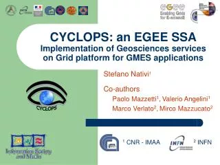
CYCLOPS: an EGEE SSA Implementation of Geosciences services on Grid platform for GMES applications . Stefano Nativi 1 Co-authors Paolo Mazzetti 1 , Valerio Angelini 1 Marco Verlato 2 , Mirco Mazzucato 2. 1 CNR - IMAA. 2 INFN. Outline. CYCLOPS Overview Rationale Objectives

E N D
CYCLOPS: an EGEE SSAImplementation of Geosciences services on Grid platform for GMES applications Stefano Nativi1 Co-authors Paolo Mazzetti1,Valerio Angelini1 Marco Verlato2,Mirco Mazzucato2 1 CNR - IMAA 2 INFN
Outline • CYCLOPS Overview • Rationale • Objectives • Main Activities • Architectural Framework • Spatial Data Infrastructure Services implementation
CYber-Infrastructure for CiviL protection Operative ProcedureS (CYCLOPS) • Specific Support Action of EGEE • Duration: 24 months (01/06/2006 – 31/05/2008) • Web site: www.cyclops-project.eu • Contact persons: • roberto.sorani@protezionecivile.it (Project Manager) • nativi@imaa.cnr.it (Technical Manager) • Keywords: GMES, GRID, Geospatial information, Civil Protection • Collaborations with: • PREVIEW, Risk EOS, RISK-AWARE, BOSS4GMES, EGEE, DEGREE
Participants Civil Protection Agencies • CP-CH (Civil Protection of Chania Prefecture) • DDSC (Direction de la Défense et de la Sécurité Civiles) • DPC (Dipartimento della Protezione Civile) • SNBPC (Serviço Nacional de Bombeiros e Protecção Civil) Scientific/Technological partners • EMA (Ecole des Mines d' Ales ) • IMAA-CNR (Istituto di Metodologie per l’Analisi Ambientale del Consiglio Nazionale delle Ricerche) • INFN (Istituto Nazionale di Fisica Nucleare) • TEI-CR (Technological Educational Institute of Crete)
Rationale • Civil Protection and GMES applications/systems have specific requirements: • to access infrastructure, run models and search information in a real-time (RT) or near-real-time (NRT) way • privileging time of response instead of accuracy • to control sensors networks and acquisition systems and modify their acquisition strategy and processing chain • to share geospatial information that has complex characteristics: • Huge amounts of remotely-sensed observations, which are multidimensional and frequently updated • To formalise the knowledge required to analyse data and provide decision-makers with effective information • To implement the strict data policy and the security requirements typical of dual systems (civil/military);
Why to use Grid Platform for GMES applications? • Provide physical resources to support application workloads • Provide the computational power for working out simulation tasks or tasks for critical missions (see job management) • Provide near real time access to data resources (see data management) • Virtual Organization management • Grid information system • Resource cataloguing and sharing • Provide a security infrastructure • Provide a quality of service agreement & monitoring infrastructure • Provide an infrastructure to distribute VO policy management on its nodes
Objective & Research Strategies • Conceive a complete Grid-based platform supporting Civil Protection/GMES applications • The CYCLOPS platform • Many open issues must be addressed • Integration & Interoperability (with EGEE platform) • Implement Spatial Data Infrastructures (SDI) services in the EGEE platform • Integrate sensor networks and acquisition systems in the EGEE platform • Define specific services for GMES/CP applications • Define advanced services (knowledge-based services, Quality-of-Service management, etc.) • Define Data Policy and Security services • Define generic Business Logic, Presentation and Fruition services
CYCLOPS Main Activities • Definition of research and innovation strategies • Analysis of CP systems • EGEE Request for Enhancements • Research strategies for enabling CP applications on Grid infrastructure • Guidelines for CP innovation towards the adoption of Grid technologies • Cross-dissemination between GRID (EGEE) community and GMES (Civil Protection) community. • Seminars, workshops, tutorials directed to CP personnel • Reports to EGEE Working Groups
Standardization Communities • GRID community • test and validate, the middleware re-engineered by EGEE and EGEE-2 in compliance with the current open standards (GGF, OMII Europe) • Geospatial Information community • INSPIRE (The INfrastructure for SPatial InfoRmation in Europe ) • GEOSS (Global Earth Observation System of Systems) • OGC/ISO (Open Geospatial Consortium) • Risk and Crisis Management • Sensor Web Enablement • Earth Observation • OWS: WCS, WFS, CS/W, CTS, WPS, … • Civil Protection community • GMES (Global Monitoring for Environment and Security)
Selected use case:Flood Forecast • Involves heavily meteorology and hydrological modelling • Involves many sensors (floods gauges, rain radars, meteo sats) • Linked to GMES flash flood anticipation service
Selected use case : Large forest fire propagation • Propagation models used on the field are simplistic due to computational limitations • More sophisticated models require heavy computations, large number of field and meteo parameters • French research project PAREFEU, link with GMES service PREVIEW After Sero-Guillaume et al.
Geospatial Community Communities Interoperability Semantic Level Strategic Applications GMES & CP Communities SOA Geospatial Information services Resources Provision GRID Community
CS-W Presentation services Discovery services based on ISO 19115 profiles Access and Download services Thematic Portals WFS Processing Services View services WCS Processing Services View services WMS WMS Spatial Data Infrastructure tiers Resources
CYCLOPS Platform Presentation and Fruition Services Business logic Services CYCLOPS Infrastructure Spatial Data Infrastructure Services Interoperability Platform Security Infrastructure Geospatial Resources Services Advanced Grid Services Environmental Monitoring Resource Infrastructure Sensor Element Services CYCLOPS Architectural Framework Appl. Platform Real Time and Near Real Time Applications for Civil Protection (Data integration, high-performance computing and distributed environment for simulations) GRID Platform (EGEE) Processing Systems Infrastructure Data Systems
Implementing OWS on the top ofa Grid Platform Web over Grid • Grid-enabling OWS • Build OWS implementations which make use of Grid capabilities Grid over Web • Gridifying OWS • Expose OWS as Grid computational elements (CE) which run native calls to external WS
OWS requests to JDL Crosswalks SEs for GMES Dataset specifric CEs for OWS impl.s netCDF HDF GRIB . . . Others... Grid-enabling OWS Portal/ submission tool on Grid User Interface CE SE From OWS request to JDL SRM interface OWS implementation Software (published via GRIS) Resource Broker/ WM proxy DLS (Data Location Service) based on LFC
netCDF HDF GRIB Grid-enabling OWS • Data Aggregation levels (semantic levels) Logical Aggregation Level Host name LFN for a file block
netCDF HDF GRIB Grid-enabling OWS:OWS function Vs. Grid job • OWS server URL • OWS.function request • OWS.function response document • OWS server URL LFN for file block • OWS.function request Grid job for • CEs publishing the required software tag; • CEs close to the SEs containing a LFN replica • OWS.function response document URL to get job status &job output document Service Register Service Consumer (OWS Server) Service Provider
GRID-enabling OWS CE near file-based Dataset DAG Job • • • OWS Request
Grid-enabling WCS • A prototype of Grid-enabled WCS on top of EGEE Platform • Implementation of basic WCS functionalities like subsetting, resampling and interpolation using GRID capabilities • Expected advantages: • Grid support of file replicas • Use of mobile code instead of mobile data • High performances working on large datasets • Scalability
Subsetting Resampling DataEncoding Request Response Traditional WCS Data WCS interface
R R R DataEncoding Result R R D R Request Async. response GRID WCS SE SE Data Subsetting Resampling CE CE CE D S EGEE Grid Interface EGEE Grid Interface EGEE Grid Interface WCS interface Workload Manager EGEE Grid Interface S WCS Interface Result URL
Computing Layer (Java) R R R EGEE GRID Result R Application Layer (Java) R D R Request Async. response GRID WCS : Technologies SE SE CE CE CE D S EGEE Grid Interface EGEE Grid Interface EGEE Grid Interface Java Serialization Workload Manager JDL EGEE Grid Interface S HTTP/SOAP WCS Interface WEB
netCDF HDF GRIB Gridifying OWS • Run application software which calls OWS external services • Implement a Grid application which makes use of OWS service chaining • Possible use of all Grid job types: collection, DAGs, Parametrics, MPI, etc. • Minimal case: Run an existing OWS function as a Grid job + + Grid Job
netCDF HDF GRIB Others... Gridifying OWS CE Resource Broker/ WM proxy SE Native call WSDL OWS OWS OWS
CYCLOPS Infrastructure Spatial Data Infrastructure Services Geospatial Resources Services Advanced Grid Services Environmental Monitoring Resource Infrastructure Sensor Element Services Virtualize Sensors • Two approaches: • A new Grid sensor element • Instrument Element (like GridCC?) • Make use of OGC Sensor Web Enablement services GRID Platform (EGEE) Processing Systems Infrastructure Data Systems