Download
1 / 16
160 likes | 310 Views
Five Themes of Geography. Unit 1. PLACE: Finding Map Location. Chapter 1. What is Geography?. Geo means Earth Graph means visual picture Comes for Ancient Greek Geography is the study of patterns on the Earth’s surface Eg . Climate, Continents, Countries, People, Industries, and Products.

E N D
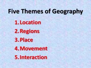
Five Themes of Geography Unit 1
PLACE: Finding Map Location Chapter 1
What is Geography? • Geo means Earth • Graph means visual picture • Comes for Ancient Greek • Geography is the study of patterns on the Earth’s surface • Eg. Climate, Continents, Countries, People, Industries, and Products
Five Geographic Themes Geographers use five themes to organize their studies • Place and Location • Identify places using characteristics and the location • Movement • Looks at flow of people, product, and animals between places • Interaction • Focus on connections between people or plalaces and their surroundings
Five Geographic Themes (cont.) • Environment • Explores the balance of living systems on Earth • Region • Identifies the unique physical and human characteristics of whole areas of the world
Place • The most basic theme – every study in geography includes a sense of place • Focus on unique characteristics that identify a place • Physical characteristics of a place include the shape of the land, weather conditions, natural vegetation, and the animals that live in it. • Eg. Niagra Falls – because of the falls
Location • Location describes where a place is on the Earth’s surface • Location can be given in two ways • Relative location – describes a place in relation to another • Next to the library • Absolute location – describes the location of a place independent of any other location • 43 degrees North by 82 degrees West
Absolute Location • Earth is divided in sections called hemispheres • There are 4 hemispheres – Northern, Southern, Eastern, and Western
Latitude and Longitude • Latitude – horizontal line • Longitude – vertical line • Latitude and longitude are imaginary lines that cross each hemisphere • They allow geographers to pinpoint the exact (absolute) location on the map
Latitude and Longitude (cont.) • Equator is a line of latitude half way between the North Pole and the South Pole • Latitude lines run parallel to the Equator and have a numerical value • Equator has a value of 0 • Latitude is used to pinpoint how far north or south is from the Equator
Latitude and Longitude (cont.) • Longitude lines originate at the North Pole and run North to South • Prime Meridian – line of longitude that passes thorough Greenwich, England, has a value of 0 • International Data Line – on the opposite side and has a value of 180 • Longitude is used to pinpoint how far east or west a place is from the Prime Meridian
Atlas and Street Maps • Map is an overhead representation of the Earth’s surface • Alphanumeric grid has letters along one side and numbers along the other • Used for street and road maps • Example on pg. 17
Relative Location • Not very accurate • Used to give general directions • People use landmarks – left at the corner of Shoppers • Geographers describe relative location more precisely using compass directions and kilometric distance
Compass Direction • Compass rose shows four Cardinal directions • North • South • East • West • And four ordinal directions • Northeast • Southeast • Northwest • Southwest
Finding Distance • Map scale compares distances on the map to the actual distance on the Earth’s surface • Given in three different ways • Ratio scale – indicates the actual distance on the Earth’s surface is X times greater than the distance shown on the map • Bar scale – measures the distance on the map against a bar that represents the distance on the Earth’s surface in kilometres • Statement scale – uses words to express the scale of the map Example of pg. 20
Road Distance • Roads don’t always run straight • Road distance between two places is often greater than straight-line distance