Download
1 / 47
601 likes | 1.75k Views
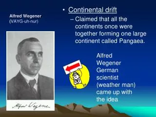
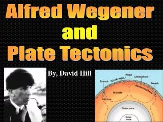
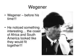
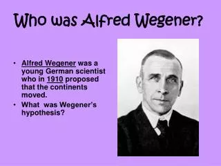
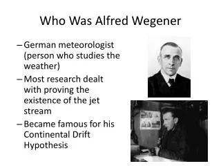
Who Was Alfred Wegener. German meteorologist (person who studies the weather) Most research dealt with proving the existence of the jet stream Became famous for his Continental Drift Hypothesis. What is the Continental Drift Hypothesis. All continents were together in one landmass

E N D
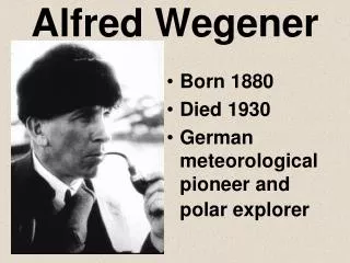
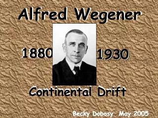
Who Was Alfred Wegener • German meteorologist (person who studies the weather) • Most research dealt with proving the existence of the jet stream • Became famous for his Continental Drift Hypothesis
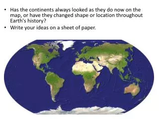
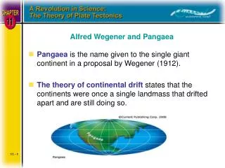
What is the Continental Drift Hypothesis • All continents were together in one landmass • Landmass was known as Pangaea • Some natural event happened and caused the continents to split • Continents drifted apart to their current day position
Pangaea Animation • http://www.youtube.com/watch?v=hSdlQ8x7cuk
What type of evidence did he use to support his hypothesis? • The continents seems to fit together like a puzzle • One large land mass known as Pangaea • Lauratania – North America, Europe, Asia • Gondwana – South America, Australia, Africa, Antarctica, India
What type of evidence did he use to support his hypothesis? • Geologic Evidence: • Similar rock formations found on different continents • These formations were the same age • Different mountain ranges line up and have similarities
What type of evidence did he use to support his hypothesis? • Fossil Evidence: • Four index fossils were found throughout the five southern continents • Prime example: Glossopteris – type of tropical fern • Most animals were fresh water or land dwellers and couldn’t swim long distances
What type of evidence did he use to support his hypothesis? • Climatic Evidence • Coal Beds: indicate tropical climates and were found in Antarctica • Fossils indicate animals lived in tropical ecosystems • Glacial deposits (moraines) on different continents are similar by positioning and material • Glacial striations or scratch marks follow same trends on different continents
Why wasn’t Wegner’s Hypothesis accepted? • Wegner had an abundance of evidence to support his hypothesis • Didn’t have the mechanism to explain how the continents divided
Bill Nye Video • http://www.youtube.com/watch?v=GyMLlLxbfa4
History of Science • Until the mid-1900’s scientists thought the bottom of the ocean was flat • World War II – the development of technology • New sonar technology surveyed the ocean floor • Harry Hess – Geologist and Navy Officer who had to study these sonar scans • The ocean floor in not flat • Mountain range at the bottom of the ocean
What is a Mid Ocean Ridge? • sonar scans showed that there was a 12,000 mile mountain range at the bottom of the ocean • Most famous part = Mid Atlantic Ridge • Volcanic activity is happening in this area under the water • Ridges can stand over a mile tall underneath the water
What is the big deal about mid-ocean ridges? • Hess built upon the continental drifty hypothesis • Hess proposed that the continents separated due to sea floor spreading • Sea floor spreading occurred at the MOR’s
Sea Floor Spreading • Magma moves upward and out of cracks in the seafloor. • As it hardens on the surface, new seafloor forms. • Older seafloor is pushed away from the edge.
First Line of Evidence from Hess • Hess tested core samples (sediment/rock) ages • The farther from the mid ocean ridge (MOR), the older the rocks were • Pattern remained consistent on both sides of the MOR
Core Samples and Radiometric Dating Isochronal Map
What was Hess’ other line of evidence • Paleomagnetism: magnetic direction acquired by the minerals in a rock at the timetherockwasdeposited or hardened • Affected by the location of Earth’s North Pole • Normal positioning and reversed positioning
How does paleomagnetism work in sea floor spreading • Magma/lava has a high iron content • Iron is affected by Earth’s magnetism • As the magma plumes from the opening in the ridge, it hardens to lava • The iron in ocean rocks point to the magnetic North Pole • Magnetic North Pole moves and/or reverses randomly over time
Paleomagnetism Simulation • http://oit.williams.edu/itech/learning-objects/
How does paleomagnetism work in sea floor spreading? • Direction of iron follows the same trends on both sides of the MOR • Age correlation with iron trends • Rock ages and magnetic field direction changes sea floor spreading along the MOR’s
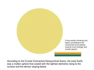
Earth’s Crust Oceanic Continental Makes up the land/continents on Earth Composed of mostly Granites Thick – 20-70 km thick Density – 2.7 g/mL • Makes up the ocean floor • Composed of pillow basalts (rock type) • Thin – 5 km thick • Density – 3.0 g/mL
How are continental and oceanic crust similar? • They both have similar chemical compositions
How are continental and oceanic crust similar? • They both have similar chemical compositions • Make up an area known as the Lithosphere
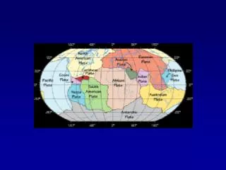
How are continental and oceanic crust similar? • They both have similar chemical compositions • Make up an area known as the Lithosphere • Are broken up into pieces known as tectonic plates
Important Layers for Plate Tectonics • Two sub-layers that drive plate tectonics: • Lithosphere • Asthenosphere • Lithosphere: Crust and rigid upper most part of the mantle = tectonic plate • Asthenosphere: plastic layer within the upper mantle that contains the mechanisms to cause plate movement
Making of the Theory of Plate Tectonics • http://www.youtube.com/watch?v=6CsTTmvX6mc
How did the Theory of Plate Tectonics come about? • Merger of all evidence: • Wegener’s continental drift hypothesis evidence • Hess’ sonar scans, core sample ages, paleomagentism to form sea floor spreading • Geographic evidence: mountain ranges, volcanoes, island arcs, trenches, MOR’s • Earthquake data
Divergent Boundary • Plates move apart AKA sea floor spreading • Occurs along mid ocean ridges in oceans • Can happen on land; lead to the break up of Pangaea • Rift Valley – a linear shaped lowland caused by the movement of the land away from one another
Convergent Boundaries • Subduction occurs • Denser plate goes under the less dense plate • Intense pressure and heat melts subducting plate • Hess’ crustal recycling process
Convergent Boundaries • Three types: • Continental vs. Continental • Oceanic vs. Oceanic • Continental vs. Oceanic
Oceanic – Oceanic Subduction • Subduction of two oceanic plates • Denser older oceanic plate subducts under younger less dense • Lots of volcanism and earthquakes • Island Arc and deepest trenches are formed Examples: Aleutian Islands and Japan
Continental – Oceanic Subduction • Subduction of denser oceanic plate under the continental • Continental plate has a lower density • Uplifts the land around the coast • Volcanoes and strong earthquakes occur at these regions • Example: Ring of Fire (Around the Pacific Ocean)
Continental – Continental Collision • When two continental plates/crust collide • Both plates have similar densities • Land buckles and pushes up • Push up motion of land = uplift • Lots of heat and pressure change the rocks • Forms mountain ranges and many Earthquakes • Example: Himalayas
Transform Boundary • When two plates slide past each • Transform Fault and Strike Slip Fault • Occurs on land and in the ocean along the MOR’s • Many earthquakes • Prime Example: San Andreas Fault
How do the tectonic plates move apart? • Convection currents move the tectonic plates • Occurs in the asthenosphere • Pertains to how magma responds to heating, pressure, cooling, and density fluctuations
How do Convection Currents operate in the Asthenosphere? • Heat from the Core heats the magma in asthenosphere • Magma rises to boundary with Crust • Pressure breaks Crust and magma forms new oceanic crust • Most magma is trapped and moves underneath the Crust away from heat
How do Convection Currents operate in the Asthenosphere? • As the magma moves under the Crust, it moves the tectonic plate as it cools • Cooling process cause magma’s density to increase • Cooled dense magma starts to sink • Sinking occurs when plates subduct – slab pull