Download
1 / 10
100 likes | 423 Views
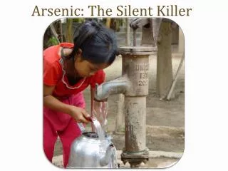
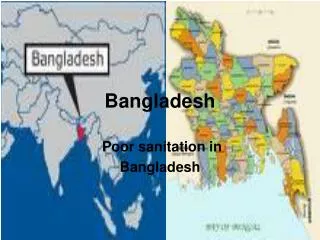
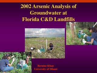
Spatial Analysis of Arsenic Groundwater Contamination: Bangladesh. Danielle Eastman 12-4-06. Background. Most severe arsenic problem in the world. Shallow wells installed Area:147,570 km2 Population: ~128 million people. Natural source of Arsenic WHO drinking standard: 10 ug/L

E N D
Spatial Analysis of Arsenic Groundwater Contamination: Bangladesh Danielle Eastman 12-4-06
Background • Most severe arsenic problem in the world. • Shallow wells installed • Area:147,570 km2 • Population: ~128 million people
Natural source of Arsenic • WHO drinking standard: 10 ug/L • Bangladesh standard: 50 ug/L • 97% drinking water is contaminated • 80% of population at risk to poisoning
Objectives • Identify spatial variations in arsenic, iron, and sediment types. • Is there a relationship between sediment type and arsenic levels? • What is the relationship between iron and arsenic? • What is the influence of the major river systems that run through Bangladesh? • Can these relationships support the hypothesis of arsenic mobilization and transport suggested by the BGS, as well as others?
Approach • Create Basemap • Create shapefiles of borehole data. • Join borehole data with basemap • Create maps of chemistry and geology based on borehole data • Used query information and spatial patterns to do analysis
Implications • Arsenic and iron concentrations do not reflect hypothesis about iron being a sink for arsenic. • The geology map gives a general idea of the influence of geology, but smaller scale analysis must be done to show the relationship between geology and arsenic.
References • Al-Muyeed, Abdullah, and Afrin, Rumana. Investigation of the efficiency of existing iron • and arsenic removal plants in Bangladesh. (2006). Journal of Water Supply: Research and Technology, 55 (4). 293-299. • British Geologic Survey (BGS): Natural Environmental Research Council. (2006) Water • Quality Data Retrieved November 15, 2006, from the groundwater arsenic problem in Bangladesh (phase 2) Website: http://www.bgs.ac.uk/arsenic/bangladesh/datadownload.htm • ESRI. (2006). Map of Bangladesh. Retrieved November 15, 2006, from GIS and • Mapping Software Website: http://arcdata.esri.com/data_downloader/DataDownloader?part=10200 • Hassan, M. Manzurul, Atkins, Peter J., and Dunn, Christine E. Social implications of • arsenic poisoning in Bangladesh. (2005). Social Science and Medicine, 61. 2201-2211. • Hossain, M. F. Arsenic Contamination in Bangladesh-An Overview. (2006). Agriculture, • Ecosystems, and Environment, 113, 1-16. • Hossain, Faisal and Sivakumar, Bellie. Spatial pattern of arsenic contamination in • shallow wells of Bangladesh: regional geology and nonlinear dynamics. (2005) Stochastic Environmental Research and Risk Assessment, 20. 66-76. • Mukhopadhyay, Basap, Mukherjee, P. K., Bhattacharya, Debkumar, and Sengupta, S. • Delineation of arsenic-contamination zones in Bengal Delta, India: a geographic information system and fractal approach. (2006). Environmental Geology, 49. 1009-1020.