Download
1 / 14

E N D
State Standard • 7.3.spi.9. identify the location of Earth's major landforms and bodies of water (i.e., Rockies, Andes, Himalayas, Alps, Urals, Sahara desert, Nile River Valley, Great Plains, Mississippi River, Amazon River, Thames River, Seine River, Rhine River, Danube River, Tigris River, Eurphrates River, Ganges River, Volga River, Yellow River)
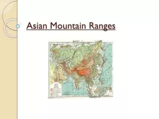
The Himalayan Mountain Range • Location: Immediately North of the Indian Subcontinent • Made of the Hindu Kush, Karakorum and the Himalaya • Size: 1,500 miles long 250 miles wide • Climate: Ranges from jungles to green vegetative landscapes • Youngest mountain range in the world
History of the Himalayas • The Himalayas were formed by a collision between the Indo-Australian Plate and the Eurasian Plate • The Indus-Valley civilization is the earliest known urban civilization in the area (3300-1300BCE)
Religious Significance of the Himalayas • The Himalayas are considered to be the land of Shiva • There are numerous isolated Buddhist monasteries high in the Himalayan Mountains • Many Muslims, Buddhist and Hindus live in the Himalayan region Rongbuk Monastery
Economic Significance of the Himalayas • Agricultural land is concentrated in the Taraiplain • characterized by a very low economic growth rate • The Himalayas has major hydroelectric potential • Some of the world's major river systems arise in the Himalayas • Provides for 3 billion people • Tourism is a major industry
Mount Everest • Highest point on earth • 29,029 feet above sea level • Grows about .15 inches per year • First summited in 1953
The Ural Mountains • Location: Runs north to south in western Russia • Size: 1,500 miles long 155 miles wide • Climate: Ranges from Artic to Sub-Artic • Some of the oldest mountains in the world
History of the Ural Mountains • Formed when the European plate collided with the Asian plate • Created natural Europe and Asia border • First settlements appeared on the Ural at the beginning of the Middle Stone Age
Cultural Significance of the Ural Mountains • http://www.euronews.com/2011/05/07/the-urals-russia-s-backbone/
Economic Significance of the Ural Mountains • They contain extensive amounts of iron ore, coal, and oil • Since the 1930's the Urals have become a principal industrial region in Russia
Mount Narodnaya • Highest point in the Ural Mountains • 6,217 feet