Download
1 / 13
130 likes | 309 Views
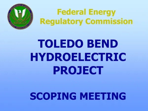
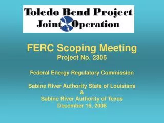
FERC Scoping Meeting Project No. 2305. Federal Energy Regulatory Commission Sabine River Authority State of Louisiana & Sabine River Authority of Texas December 16, 2008. Sabine River Basin Facts. Length – 560 miles Drainage Area – 9,952 sq. mi. 25% -Louisiana 75% in Texas

E N D
FERC Scoping MeetingProject No. 2305 Federal Energy Regulatory Commission Sabine River Authority State of Louisiana & Sabine River Authority of Texas December 16, 2008
Sabine River Basin Facts • Length – 560 miles • Drainage Area – 9,952 sq. mi. • 25% -Louisiana • 75% in Texas • Boundary reach covered by Sabine River Compact. • Available water is split equally between States. • Toledo Bend Dam is located 147 miles from top of Sabine Lake.
Toledo Bend Project • Owned jointly by • Sabine River Authority State of Louisiana • Sabine River Authority of Texas • Operated by the Toledo Bend Joint Operation
Toledo Bend Joint Operation 6 Member Executive Committee • 2 Board members appoint from the SRA-TX Board of Directors • 2 Board members appoint from the SRA-LA Board of Directors • The General Managers of SRA-TX and SRA-LA
Toledo Bend Joint Operation Responsible for setting policy for the operations and maintenance and power sales of the jointly held assets which include the spillway, dam and power house and other related facilities.
Toledo Bend Project • 65 mile long reservoir • 185,000 surface acres • 1263 miles of shoreline • 4,477,000 acre-feet controlled storage • Water Supply and Hydro-Electric
Toledo Bend Dam • 11,250 feet long. • Max height 112 feet. • Top width 25 feet. • Rolled earth fill with soil-cement on upstream slope for erosion control.
Toledo Bend Dam Spillway • Length – 838 Feet • 11 40X28 Foot tainter gates. • Low flow sluiceway • Design discharge capacity 290,000 cfs
Toledo Bend Hydroelectric Operations • Two Vertical Units utilizing Kaplan turbines • Authorized installed capacity of 81MW
Toledo Bend Dam HydroelectricProposed Mini-Hydro Unit • Designed to capture energy associated with routine spillway flow releases. • Horizontal Kaplan machine • Electric Capacity of 0.875 MW • Annually 5.4 to 7.0 million kW-hrs produced
Transformer and Control System Turbine
FERC License • Current license issued in October, 1963 • Project became operational in 1968. • License expires September 30, 2013. • Filed NOI/PAD September 22, 2008 • Prepare relicensing application 2008-2011 • File license application September, 2011
Additional Information Public Web site http://www.tbpjo.org Melvin Swoboda 409-746-2192 or mswoboda@sratx.org