Download
1 / 46
460 likes | 465 Views
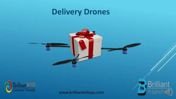
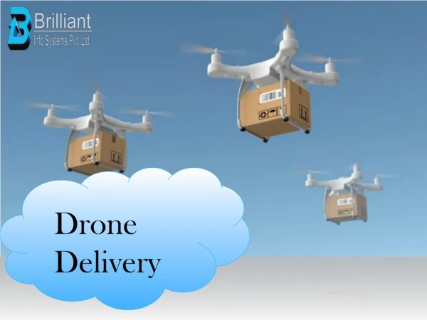
Unmanned Aerial Vehicle offers less stressful<br>environment, it is used for better decision<br>making, it presents safer environment, and<br>they can fly longer hours as long as the<br>vehicle allows for it (no human fatigue in the<br>plane).<br>There is no need for the qualified pilot to fly<br>it, in the long run,<br>Unmanned Air Vehicle can stay in the air for<br>up to 30 hours, doing the repetitive tasks,<br>performing the precise, repetitive raster scan<br>of the region, day-after-day, night-after-night<br>in the complete darkness or in the fog and<br>under computer control.<br>Unmanned Air Vehicle performs the<br>geological survey, it performs the visual or<br>thermal imaging of the region, it can measure<br>the cell phone, radio or TV coverage over any<br>terrain, the drone pilots or operators can<br>easily hand off controls of the drone without<br>any operational downtime.<br>The drones can have more pinpoint accuracy<br>from greater distances. DRONE (Dynamic Remotely Operated Navigation<br>Equipment), also known as UAV, is a device which can fly<br>either with the help of autopilot and GPS coordinates on the<br>pre-set course or can be operated manually with radio signals<br>using the remote control or smartphone app. Drones are<br>nowadays emerging as a component of precision agriculture<br>along with contributing to sustainable agriculture. Various<br>sensors are used in the drones based upon the purpose.<br>Mostly the sensors sensitive to the following bands of<br>electromagnetic waves are used in agriculture:<br>1. Red, Green, and Blue (RGB) bands: These bands are<br>used for counting the number of plants, for modeling<br>elevation, and visual inspection of the crop field.<br>2. Near Infra-Red (NIR) band: This band is used for water<br>management, erosion analysis, plant counting, soil<br>moisture analysis, and assessment of crop health.

E N D
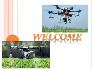
Use of Drone Technology in Agriculture Course No: AGM- 691 (1+0) Presented by A. M. Khobragade Regn No. PhD/019/064 Research Guide & Seminar Incharge Dr. J. D. Jadhav (Head) Department of Agricultural Meteorology, College of Agriculture, Pune 2020-21 DOCTORAL SEMINAR ON
Content: • Introduction . • What is drone /UAV. • Working Principle of UAV • Uses of Drone technology in agro-meteorology. • Relation of UAV’s with climate change and agrometeorology. • How drones helps to study our climate & forecast weather. • How weather parameters effects on drone operations. • Uses of Drone technology in agriculture. • Future plans of drone technology. • References.
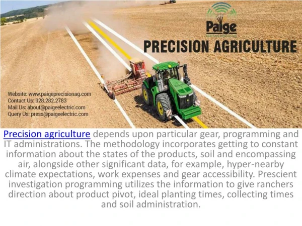
Introduction : Climate change is having a major impact on food security. More than 815 million people are chronically hungry and 64 percent of the chronically hungry are in Asia. The world needs to increase food production by almost 50 percent by 2050 to feed a population of nine billion, yet resources such as land and water are becoming more and scarcer. Farming communities and others involved in agriculture have to adapt agriculture to climate change and other challenges. ICT-driven tools and technologies to enhance decision making through accurate, reliable and timely information have an important role to play. Agriculture has to look towards emerging technologies for solutions to overcome some of the challenges facing it. FAO and ITU, have been working together in addressing same of the challenges faced in agriculture through the use of sustainable ICTs.
“In the current milieu, use of sustainable information and communication technology in agriculture in not an option. It is a necessity.” Gerard Sylvester, Food and Agriculture Organization. One of the latest developments is the increase in the use of small, unmanned aerial vehicles (UAVs), commonly known as drones, for agriculture. Drones are remote controlled aircraft with no human pilot on-board. These have a huge potential in agriculture in supporting evidence-based planning and in spatial data collection. http://www.fao.org/3/i8494en/i8494en.pdf
Intervention of Drone Technology in Agriculture Hon Vice Chancellor of VNMKV Parbhani promoting drone intervention in Agriculture
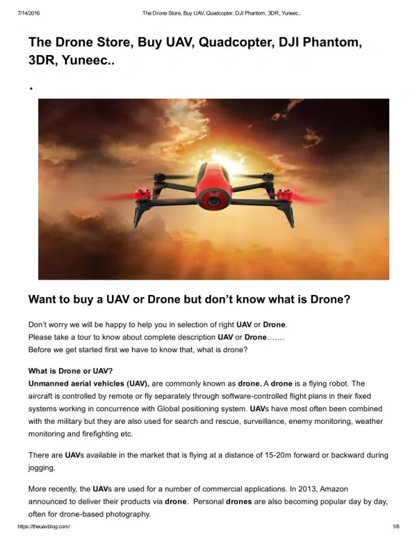
What is drone / UAV : (Dynamic Remotely Operated Navigation Equipment) A drone, in technological terms, is an unmanned aircraft. Drones are more formally known as unmanned aerial vehicles (UAVs) or unmanned aircraft systems (UASes). Essentially, a drone is a flying robot that can be remotely controlled or fly autonomously through software-controlled flight plans in their embedded systems, working in conjunction with onboard sensors and GPS. https://internetofthingsagenda.techtarget.com/definition/drone
Propellers and Working Principle of Drone (Quadcopter) • Working Principle of Quadcopter • A quadcopter has four propellers at four corners of the frame • For each propeller, speed and direction of rotation is independently controlled for balance and movement of the drone • In a traditional quadrotor, all the four rotors are placed at equal distance each othe • To maintain the balance of system, one pair of rotors rotates in clockwise direction and other pair rotate in anti-clockwise direction • To move up (hover), all rotors should run at high speed. By changing the speed of rotors, the drone can be move forward, backward, and side-to-side • Propellers Number of propellors are provided to drones. The more propellors improve the stability of drones and load carrying capacity but such drones need more battery power to drive more motor to get high power. A quadcopter is more popular drone. • Bicopter (2 propeller) • Triplecopter (3 propeller) • Quadcopter (4 propeller) • Hexacopter (6 propeller) • Ocptacopter (8 propeller)
Block Diagram Layout of Quadcopter
Information about Parts Frame: • It should have sufficient strength hold the propeller momentum and additional weight for motors and cameras • Sturdy and less aerodynamic resistance Propellers: • The speed and load lifting ability of drone depends on shape, size and number of propellers • The long propellers create huge thrust to carry heavy loads at a low speed (RPM) and less sensitive to change the speed of rotation • Short propellers carry less loads. They change rotation speeds quickly and requires a high speed for more thrust. Motor: • Both motors brus less and brushed type can be used for drones • Brushed motor is less expensive and useful for small-sized drones • Brushless type motors are powerful and energy very efficient. But they need Electronic Speed Controller (ESC) to control their speed. These brushless motors are widely used for racing freestyle drones, traffic survey and aerial photography drone.
ESC (Electronic Speed Controller): • ESC is used to connect the battery to the electric motor for power supply • It converts the signal from the flight controller to revolution per minted (RPM) of motor • ESC is provided to each motor of the drone Flight Controller (FC): • It is the computer processor which manages balance and telecommunication controls using different transmitter • Sensors are located in this unit for accelerometer, barometer, magnetometer, gyrometer and GPS. Radio Transmitter: Sends the radio signal to ESC to pilot to control motor speed. Radio Receiver: Received the signal from the pilot. This device is attached to the quadcopter. Battery: High-power capacity, Lithium Polymer (LiPo) are used for most drones. The battery can have 3S (3 cells) or 4S (4 cells).
Uses of drone technology in agrometeorology : Specialized UAV that have the capacity of gathering weather data and information. Not only will the weather drone help in providing real-time weather data but it can help scientists make weather predictions. In 1991, the first unmanned aircraft was developed by NASA. It was designed to fly 60,000 feet thus collecting data on ozone depletion and weather patterns. Since 2013, meteorological researchers from Oklahoma University have been developing miniature inexpensive drones which can be used to gather and relay real-time data to scientists on the ground.
At the 2008 Summer Olympics held in Beijing, a UC-San Diego professor together with his team deployed unmanned aircraft vehicles into the pollution clouds around the city. This was part of the extreme anti-smog program. The professor envisioned that a team of meteorological scientists can send networked drones into the atmosphere to gather useful data which is found between the satellites location and ground weather stations. • Use for storm drones is where the UAV are loaded with individual sensors where the drones are flown into the sky and the sensors are dropped to gather data. • Meteorologists must gather a lot of data in order to predict the occurrence of tornadoes. By using storm proof UAVs, weather forecasters will be able to track more variables thus having access to valuable information. Data gathered can be fed into machine learning systems thus creating models that help to predict accurate tornado warnings.
weather drones are better at predicting storms than traditional weather collecting systems for example weather balloons. In 2016, NASA flew a drone to track Hurricane Matthew. This happened off the coast of Florida. The drone was used to drop sensors into the storm allowing meteorologists to gather data for example temperature, humidity, wind speed, pressure, and direction. • Drone was developed for monitoring disaster. It was fitted with special radar which had the ability to analyze and examining storm formation and intensification. • Most sUAS use GPS to determine the position and speed of the aircraft, provide altitude and location information for Earth observations, and in some autonomous systems, steer the aircraft GPS radio signals travel from a satellite through the ionosphere to the receiver on the GPS module of a sUAS. https://www.prophotouav.com/meteorologists-storm-weather-drones/
Relation of UAV’s with climate change & Agrometeorology : https://images.app.goo.gl/ohcg6W5aV7K7F5e68
How drones help us study our climate, forecast weather : • Each aircraft (UAV) carried more than a dozen instruments, including radiometers to measure solar radiation and optical probes to measure the size and distribution of aerosol particles, including the microscopic components of soot known as black carbon. • To track heavy metals emitted by industry and desert dusts rich in iron, silicon, and calcium that accumulate pollution that blow through industrial areas require extremely sensitive mass spectrometers, however, which are currently too heavy for light, inexpensive drones. • Scientists measured air temperature profiles within about 120 meters of the ground with unprecedented precision.
“We get a resolution of data that’s about 10,000 times as dense as anything done before,” Raman says. Using Raman spectroscopy, the team records air temperature once every second, with a resolution of roughly 10 cm and 0.01 °C. • Drones can provide one-of-a-kind information that helps determine whether methane circulating in our atmosphere comes from, for instance, fossil-fuel extraction, biomass burning, or microbial decomposition of plant matter in flooded areas. A more complete picture of methane sources could improve climate models—and could help regulators develop policies to stem the methane surge into our atmosphere. • https://cen.acs.org/articles/94/i9/drones-help-us-study-climate.html
weather prediction and forcasting of Tornados using Drone (Quadcopter)
How weather parameters effect on Drones operations : Weather parameters always gives good and bad effects during the flight of Drones/ UAVs. • Rainfall • Temperature extremes • Humidity • Solar storms • Wind ,turbulence • Cloud cover • Fog • Haze • Snow • Ice • Glare .
1. Rainfall : • Flying during the rainfall can cause equipment to be destroyed because most drone are not waterproof. • Rainwater , even in light rainfall conditions, can comes in contact with hot batteries & motors and cause breakdown in electric system. • It may cause greater difficulty for operations of drones that use cameras for stability & navigation , as rain can reduce the contrast required for the camera to discern movement. • During the operation of PRAs under rainfall condition is the difficulty of viewing the drone either by a remote observer / pilot- something critical in VLOs operations – by another aircraft. • Excess moisture can cause temporary equipment failure. • One way to avoid risk check available weather information. • https://www.anac.gov.br/en/safety/aeronautical-meteorology/drones-and-meteorology
2. Temperature : Typical operating temperatures for unmanned aircraft lie between 253 K to 323 K; however, minimum operating temperatures can range from 223 K to 273 K and maximum operating temperatures can range from 308 K to 343 K . Extreme temperatures have negative implications for the physical components of an aircraft as well its aerodynamic performance.
3. Humidity : Humidity presents a problem if the moisture in the air condenses on the electronics used in an sUAS. Water can cause electronics to short, which results in erroneous behavior, loss of functionality, or high amounts of heat output that could lead to a fire. Maximum relative humidity specifications on sUASrange typically from 50% to 100%. Humidity is a greater problem in the morning, when there are relatively lower temperatures and higher humidity levels.
4. Solar streams : Solar storms, such as flares and coronal mass ejections (CMEs), disrupt GPS transmissions. GPS systems use a model to compensate for the ionosphere’s effect on the accuracy of position, but when solar flares occur, these models no longer approximate the average ionosphere correctly.
5. Wind gusts & wind shear: If the wind speed exceeds 15 Kt ( 32km /h) , the remote pilot may experience difficulties in controlling the navigation of the equipment, which could lead to a risk of collision with people, aircraft , or obstacles. Above this speed , resistance level of the equipment to the effects of wind will vary according to the size of the propellers, motor spin and equipment weight. A drone like Phantom 3 should not fly with winds above 36km /h. Have a higher drone as a 6SGEO of mikrocopter can fly in windy condition upto 49km/h. https://www.anac.gov.br/en/safety/aeronautical-meteorology/drones-and-meteorology
6. Fog , clouds, & haze : BVLOS operations require some form of first person view (FPV), often in the form of an onboard camera. Dense fog, clouds, or haze reduce the distance a camera can see. Consequently, flying in these situations is dangerous as sUAS may fly into buildings, manned aircraft, power lines, vehicles, and any other number of hazardous objects. To avoid unexpected entry into instrument flight conditions( IFR) , the remote pilot must be aware of the visibility minima and not perform the operation under fog condition. If fog is formed by extremely small water droplets that float in the air reducing the horizontal visibility to less than 1 thousand meters. In the flight planning phase it is possible to obtain information on the probability of occurrence of fog at the place where the flight will be carried out, by consulting meteorological bulletins.
7. Icing : An aircraft can encounter icing conditions during flight in two ways: precipitation and in-cloud icing. Precipitation combined with freezing temperatures results in either wet snow, dry snow, or freezing rain, the latter of which is the most hazardous to aircraft due to its inclination to freeze immediately upon impact. In-cloud icing in general is a greater threat to manned aircraft and larger unmanned aircraft than to sUAS due to the high altitude of most clouds and the tendency of these clouds to contain large super cooled water droplets. Unlike freezing rain, these larger water droplets do not freeze immediately, but rather run back along the wing and produce a sheet of clear ice that is difficult to remove and can change the shape of the airfoil and thus flight performance
8. Glare : Glare is a weather phenomenon that occurs in clear skies, and yet affects visibility in a couple of ways. The first is by hindering direct observation of the aircraft. In addition to the difficulty of spotting a small aircraft on a bright day, looking too close to the sun can result in watery eyes and spotted vision. To mitigate this problem, the operator should shield the display from glare, either by operating from a shaded location or using a display hood.
weather impact on uav’s operations : Table : Classification of weather hazards for sUAS in terms of severity.
Drones: Various sensors are used in agriculture • Mostly the sensors sensitive to the following bands of electromagnetic waves are used in agriculture: 1. Red, Green, and Blue (RGB) bands: These bands are used for counting the number of plants, for modeling elevation, and visual inspection of the crop field. 2. Near Infra-Red (NIR) band: This band is used for water management, erosion analysis, plant counting, soil moisture analysis, and assessment of crop health. 3. Red Edge band (RE): It is used for plant counting, water management, and crop health assessment. 4. Thermal Infra-Red band: This band has applicability in irrigation scheduling, analyzing plant physiology, and yield forecasting.
Uses of drone technology in agriculture: 1.Soil and field analysis 2. Planting crops and tree 3. Crop spraying/dusting 4. Crop monitoring 5. Irrigation management 6. Health assessment 7. Weed identification 8. Geofensing or protecting the field from animal damage 9. Crop insurance 10. Livestock management
Agriculture drone : Agriculture drone spaying on field. https://meticulousblog.org/top-10-companies-in-agriculture-drone-market/
India Deploys drones to battle outbreak of Locust in UP and Rajasthan
Benefits of drone technology in agriculture: • 1. Increase Yield Improve production, efficiency, & get higher yields by identifying problems before they happened with increased crop health awareness & frequency. • 2.Save time Drones can be set up & deployed quickly. This ease of use allows farmers to gain information routinely or whenever they need it. • 3. Plan for the future Generate precision orthomosaic maps for better crop planning & land management https://www.slideshare.net/Dronefly/agriculture-drones-drones-in-the-field
The future use of drone technology in agriculture : 1. Drone swarms 2. Plant Pollination 3. Beyond Visual Line Of Sight (BVLOS) flying https://www.adama.com/en/products-and-services/innovation-in-farming/how-drones-are-being-used-in-agriculture
coclusion: • Unmanned Aerial Vehicles and Systems offer a new tool set to growers and farmers to reduce costs and increase yields by minimizing the use of fertilizer, insecticides, fungicides and other chemicals, while improving overall plant health and crop yield. • The significant benefits drones offer will make UAV’s ubiquitous in the farming community over the next several years. • The rapidly advancing technology will work to improve the effectiveness and ease of use for drones in the years to come. However process of flight • planning, imaging, post-processing and maintaining the drones will remain a significant undertaking. • Drone Imaging is seeking strategic partners to gather images of crops in all phases of growth, with a variety of pathogens in various levels of vigor.
References : • Ahirwar, S., Swarnkar, R., Bhukya S. and Namwade, G.2019. Application of Drone in Agriculture. Int. J. Curr.Microbiol. App. Sci. 8(01): 2500-2505. • Pasquale Daponte, Luca De Vito, Luigi Glielmo, Luigi Iannelli,Davide Liuzza, Francesco Picariello and Giuseppe Silano, 2019. A review on the use of drones for precision agriculture. IOP Conf. Series: Earth and Environmental Science . pp 275 • Sylvester, G. (2018). E-agriculture in action: Drones foragriculture. Published by Food and Agriculture Organizationof the United Nations and International TelecommunicationUnion, Bangkok. • http://www.fao.org/3/i8494en/i8494en.pdf • https://internetofthingsagenda.techtarget.com/definition/drone • https://meticulousblog.org/top-10-companies-in-agriculture-drone-market/ • https://www.prophotouav.com/meteorologists-storm-weather-drones/ • https://images.app.goo.gl/ohcg6W5aV7K7F5e68 • https://cen.acs.org/articles/94/i9/drones-help-us-study-climate.html • https://www.anac.gov.br/en/safety/aeronautical-meteorology/drones-and-meteorology
https://www.anac.gov.br/en/safety/aeronautical-meteorology/drones-and-meteorologyhttps://www.anac.gov.br/en/safety/aeronautical-meteorology/drones-and-meteorology • https://www.slideshare.net/Dronefly/agriculture-drones-drones-in-the-field • https://www.adama.com/en/products-and-services/innovation-in-farming/how-drones-are-being-used-in-agriculture