Download
1 / 33
330 likes | 512 Views
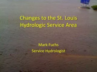
Changes to the St. Louis Hydrologic Service Area. Mark Fuchs Service Hydrologist. Four new forecast points. Two RFC-supported forecast gages PMZM7: Middle Fork Salt River near Holliday, MO DRCM7: Dardenne Creek at St. Peters, MO Two Locally-supported forecast gages

E N D
Changes to the St. LouisHydrologic Service Area Mark Fuchs Service Hydrologist
Four new forecast points • Two RFC-supported forecast gages • PMZM7: Middle Fork Salt River near Holliday, MO • DRCM7: Dardenne Creek at St. Peters, MO • Two Locally-supported forecast gages • LSLM7: Peruque Creek above Lake St. Louis, MO • TGRM7: Hinkson Creek at Columbia, MO
DRCM7 – Dardenne Creek at St. Peters, MO • Basis: Widespread flood impacts both up and downstream of the gage. Parks, athletic fields, roads, and agricultural concerns. Local officials for the city of St. Peters show considerable interest. • Status: Currently being calibrated by NCRFC.
PMZM7 – Middle Fork Salt River near Holliday, MO • Basis: City of Paris City Superintendent is showing considerable interest. Major flooding generates widespread road closures and threatens residential structures and businesses in Paris. • Status: Calibration completed by NCRFC. Flood-only forecasts are now available via the MSPRVFTMO products.
Meramec River at Fenton, MO • Basis: Significant flood impacts in downtown area and in downstream residential areas. City officials would like a gage on the new Gravois Road bridge (old Gravois Road, new bridge) ONLY if we provide forecast services. • Status: NCRFC has agreed to develop and USGS has agreed to install if city can provide adequate funding.
LSLM7 – Peruque Creek above Lake St. Louis, MO • Basis: Considerable flooding of significant roadways (Hoff Road, Koch Road, Summit Estates Drive, and Highway P), along with some businesses. Mayor of St. Paul, MO is very supportive. • Status: Site Specific parameters and NWSRFS calibration are nearing completion.
TGRM7 – Hinkson Creek at Columbia, MO • Basis: Boone County EM has shown considerable interest with impacts to numerous athletic fields near the gage and a power substation at the gage. Level of impact to upstream apartments and two golf courses currently unknown. • Status: MBRFC just beginning calibration and SSHP parameter development. Target date is 31 January 2010. Will pursue as a full RFC-supported forecast point, but may defer to Site Specific if events dictate better model performance.
Local Forecast Points • MultisensorPrecipiation Estimator (MPE) • Site Specific Hydrologic Predictor (SSHP)