Download

1 / 4
0 likes | 7 Views
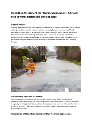
As climate change intensifies, the frequency and severity of flooding events are becoming increasingly<br>concerning.

E N D
Understanding Flood Risk Assessment: An Essential Tool for Urban Planning As climate change intensifies, the frequency and severity of flooding events are becoming increasingly concerning. Flood risk assessment has emerged as a vital process in urban planning and infrastructure development. This article explores the concept of flood risk assessment, its importance, methodologies, and best practices, providing insights into how it plays a crucial role in safeguarding communities and environments. What is Flood Risk Assessment? Flood risk assessment is a systematic process that evaluates the likelihood and potential impact of flooding in a specific area. It involves analyzing various factors such as topography, hydrology, climate patterns, and land use to understand how these elements interact to create flood risks. This assessment is essential for informing decision-makers, guiding development plans, and implementing effective flood management strategies. The Importance of Flood Risk Assessment Flood risk assessment is critical for several reasons: 1. Informed Decision-Making Assessing flood risks provides valuable data that helps policymakers and planners make informed decisions about land use and infrastructure development. This information can guide zoning regulations and building codes, ensuring that new developments are resilient to flooding. 1/4
2. Protection of Lives and Property By identifying high-risk areas, flood risk assessments help protect communities from the devastating impacts of flooding. This proactive approach can save lives, minimize property damage, and reduce the economic burden associated with flood recovery. 3. Environmental Conservation Flood risk assessments also consider the ecological implications of flooding. By understanding flood dynamics, planners can design projects that protect natural habitats and promote sustainable land use practices. 4. Compliance with Regulations Many regions have regulations that require flood risk assessments as part of the development approval process. Compliance with these regulations not only ensures legal adherence but also contributes to safer communities. Key Components of Flood Risk Assessment A comprehensive flood risk assessment typically includes several key components: 1. Hazard Identification This step involves identifying potential flood hazards within the study area. It includes analyzing historical flood data, meteorological information, and geographic features that may contribute to flooding. 2. Vulnerability Assessment Vulnerability assessment evaluates the susceptibility of people, property, and infrastructure to flood impacts. This includes assessing the value of assets at risk and understanding the characteristics of the population in flood-prone areas. 3. Risk Analysis Risk analysis combines hazard and vulnerability assessments to determine the overall flood risk. This involves quantifying the likelihood of flooding and estimating potential consequences, such as economic losses and environmental damage. 4. Mitigation Strategies Based on the findings of the assessment, mitigation strategies are developed to reduce flood risk. These can include structural measures, such as levees and floodwalls, as well as non-structural approaches, such as land use planning and community education. Methodologies for Conducting Flood Risk Assessment Several methodologies can be employed in flood risk assessments, each suited to different contexts and objectives: 1. Historical Analysis This approach involves studying past flood events to identify patterns and trends. Historical data can provide insights into the frequency, intensity, and impacts of flooding, helping to inform future risk assessments. 2/4
2. Hydrological Modeling Hydrological models simulate how water moves through a watershed, allowing for predictions of flood events under various conditions. These models consider factors such as rainfall, land use, and soil type to estimate flood risk accurately. 3. Geographic Information Systems (GIS) GIS technology enables the visualization and analysis of spatial data related to flood risks. By integrating various datasets, planners can create detailed flood risk maps that highlight vulnerable areas and potential impacts. 4. Community Engagement Involving local communities in the flood risk assessment process can provide valuable insights and foster collaboration. Community input can help identify unique risks and promote awareness of flooding issues. Challenges in Flood Risk Assessment While flood risk assessments are essential, they are not without challenges: 1. Data Limitations Accurate flood risk assessments rely on high-quality data. In some regions, historical flood data may be sparse, leading to uncertainties in risk predictions. 2. Changing Climate Patterns Climate change is altering weather patterns, making historical data less reliable for predicting future flood risks. Assessors must account for these changes when evaluating potential hazards. 3. Complex Interactions Flooding is influenced by numerous factors, including land use, hydrology, and climate. Understanding these complex interactions can be challenging and requires interdisciplinary collaboration. 4. Resource Constraints Conducting comprehensive flood risk assessments can be resource-intensive, requiring time, expertise, and funding. Limited resources may hinder the ability to conduct thorough assessments in some regions. Best Practices for Effective Flood Risk Assessment To enhance the effectiveness of flood risk assessments, several best practices should be followed: 1. Adopt a Holistic Approach A comprehensive assessment should consider all aspects of flood risk, including environmental, social, and economic factors. This holistic approach ensures that all relevant risks are addressed. 2. Utilize Advanced Technologies Employing advanced technologies, such as remote sensing and GIS, can improve the accuracy 3/4
and efficiency of flood risk assessments. These tools offer valuable insights into flood dynamics and vulnerability. 3. Engage Stakeholders Involving stakeholders, including community members, local governments, and environmental organizations, can enhance the assessment process. Collaboration fosters a shared understanding of risks and promotes collective action. 4. Regularly Update Assessments Flood risk assessments should be reviewed and updated regularly to reflect changing conditions, such as land use changes and climate impacts. This ensures that the assessments remain relevant and effective. 5. Integrate with Land Use Planning Flood risk assessments should inform land use planning processes to promote sustainable development. By integrating flood risk data into zoning codes and development guidelines, planners can minimize flood risks in vulnerable areas. Conclusion Flood risk assessment is a critical tool in urban planning and infrastructure development, providing valuable insights that help protect communities and the environment. By evaluating flood hazards and vulnerabilities, this assessment process enables informed decision-making and the implementation of effective flood management strategies. For expert guidance on flood risk assessment and related services, visit Onn Point Civil Engineering. 4/4