Flood-Risk-Assessment
Infrastructure Investment: Guiding investments in flood mitigation infrastructure, such as flood barriers, stormwater drainage systems, and green infrastructure solutions. Strategic allocation of resources based on risk assessment results maximizes the cost-effectiveness and sustainability of infrastructure investments, reducing future flood damages and adaptation costs.<br><br>

Flood-Risk-Assessment
E N D
Presentation Transcript
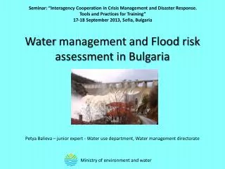
Flood Risk Assessment: Safeguarding Communities Against Nature's Fury Introduction Floods are among the most devastating natural disasters, causing widespread damage to property, infrastructure, and ecosystems. As climate change intensifies the frequency and severity of extreme weather events, the need for comprehensiveFlood Risk Assessmentbecomes increasingly urgent. This article explores the importance of flood risk assessments, their methodologies, and the crucial role they play in enhancing resilience and disaster preparedness. Understanding Flood Risk Assessment A flood risk assessment is a systematic evaluation of the likelihood and potential consequences of flooding in a particular area. It encompasses various factors, including hydrological characteristics, topography, land use patterns, and the presence of flood defenses. By quantifying flood hazards and vulnerabilities, these assessments provide valuable insights for decision-makers, planners, and communities to mitigate risks and enhance resilience. Objectives of Flood Risk Assessment The primary objectives of a flood risk assessment include: 1. Identification of Flood Hazards: Assessing the likelihood of flooding from various sources, including rivers, coastal surges, flash floods, and pluvial events. This involves analyzing historical flood data, hydrological modeling, and forecasting techniques to delineate flood hazard zones. 2. Evaluation of Vulnerable Assets: Identifying vulnerable assets such as residential properties, critical infrastructure, industrial facilities, and environmentally sensitive areas within flood-prone areas. Understanding the exposure and susceptibility of these assets to flood impacts is essential for prioritizing risk reduction measures. 3. Assessment of Potential Impacts: Quantifying the potential consequences of flooding in terms of economic losses, social disruption, environmental degradation, and public safety risks. This includes assessing direct damages to buildings and infrastructure, as well as indirect impacts such as business interruptions and displacement of populations. 4. Development of Mitigation Strategies: Based on the findings of the assessment, developing tailored mitigation strategies to reduce flood risks and enhance resilience. This may involve a combination of structural measures (e.g., flood barriers, levees) and non-structural measures (e.g., land use planning, early warning systems, community education) to minimize vulnerability and increase adaptive capacity. Methodologies Employed
Flood risk assessments utilize a range of methodologies and tools to analyze flood hazards, vulnerabilities, and impacts. Key methodologies include: 1. Hydrological Modeling: Utilizing hydrological models to simulate rainfall-runoff processes, river flow dynamics, and floodplain inundation. These models help predict flood behavior under different scenarios, incorporating factors such as rainfall intensity, land cover changes, and hydraulic infrastructure. 2. Geospatial Analysis: Leveraging geographic information systems (GIS) to integrate spatial data layers, including topography, land use, floodplain mapping, and infrastructure networks. GIS-based analysis allows for the visualization, mapping, and spatial analysis of flood risks, facilitating informed decision-making and communication with stakeholders. 3. Risk Assessment Techniques: Employing quantitative risk assessment techniques to estimate the likelihood and consequences of flooding, including probabilistic modeling, damage functions, and cost-benefit analysis. These techniques help prioritize investments in flood risk management and evaluate the effectiveness of mitigation measures. 4. Stakeholder Engagement: Engaging with stakeholders, including government agencies, local communities, businesses, and environmental organizations, throughout the assessment process. Collaborative approaches ensure that diverse perspectives, knowledge, and priorities are integrated into decision-making, enhancing the legitimacy and effectiveness of flood risk management strategies. Implications for Disaster Preparedness and Resilience The insights gleaned from flood risk assessments have profound implications for disaster preparedness, emergency response, and long-term resilience: 1. Emergency Planning and Response: Informing the development of emergency response plans, evacuation procedures, and crisis management strategies to minimize casualties and protect property during flood events. Timely and accurate risk assessments enable authorities to mobilize resources, coordinate multi-agency responses, and communicate with at-risk populations effectively. 2. Infrastructure Investment: Guiding investments in flood mitigation infrastructure, such as flood barriers, stormwater drainage systems, and green infrastructure solutions. Strategic allocation of resources based on risk assessment results maximizes the cost-effectiveness and sustainability of infrastructure investments, reducing future flood damages and adaptation costs. 3. Land Use Planning and Development Control: Integrating flood risk considerations into land use planning, zoning regulations, and development control policies to steer growth away from high-risk areas and promote resilient urban design. By avoiding inappropriate development in flood-prone areas and encouraging sustainable land management practices, communities can reduce exposure to flood hazards and enhance their adaptive capacity. 4. Community Engagement and Capacity Building: Empowering communities to actively participate in flood risk management efforts through education, awarenessraising campaigns, and capacity-building initiatives. Building community resilience
involves fostering social cohesion, enhancing local knowledge and skills, and promoting collective action to reduce vulnerability and strengthen adaptive capacity. Conclusion In conclusion, flood risk assessment is a fundamental tool for understanding, managing, and mitigating the impacts of flooding on communities, economies, and ecosystems. By systematically evaluating flood hazards, vulnerabilities, and impacts, these assessments provide the foundation for informed decision-making, risk reduction strategies, and resilience-building efforts. Embracing a holistic approach that integrates technical expertise, stakeholder engagement, and adaptive governance is essential for enhancing flood resilience and safeguarding the well-being of present and future generations in the face of climate uncertainty and environmental change. Top of Form