Download
1 / 3
0 likes | 5 Views
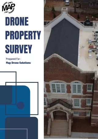
Get Accurate Drone Property Surveys in Georgia<br>Need fast and reliable land mapping? We offer drone property surveys in Georgia with high-quality aerial images and accurate data. Whether you own land, plan to build, or want to check property lines, our drone surveys save time and money. No more guessworku2014just clear, detailed maps from trusted experts. We serve all of Georgia with professional service and quick turnaround. Visit Map Drone Solutions to get started today and make smarter property decisions from the sky!<br><br>Visit: https://mapdronesolutions.com/drone-property-survey/<br>

E N D
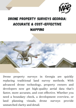
Drone Property Surveys Georgia: Accurate & Cost-Effective Mapping Drone property surveys in Georgia are quickly replacing traditional land survey methods. With advanced drone technology, property owners and developers now get high-quality aerial data that’s faster, more accurate, and cost-effective. Whether you need a boundary check, a development overview, or land planning visuals, unmatched clarity and detail. drone surveys provide
How Drone Surveys Work Our drones fly over the property using GPS-guided flight paths to capture high-resolution images and topographic data. This data is then converted into 2D maps, 3D models, or detailed elevation reports. These tools help you visualize your property like never before, offering insights critical for construction, landscaping, or real estate. Benefits of Drone Property Surveys Faster Results: No need to wait days or weeks—get data within hours. High Accuracy: GPS and sensor-based mapping ensure reliable outputs. Safe & Non-Invasive: No heavy machinery or disruption to your land. Versatile Use: Ideal for residential, commercial, and agricultural projects Serving All of Georgia At Map Drone Solutions, we specialize in drone property surveys across Georgia. Our team has experience in surveying small plots to large development sites.
We understand Georgia's local terrain, legal requirements, and how to deliver actionable data for your project. Get Started Today If you're in Georgia and need precise land mapping, a drone property survey is your best choice. From planning to delivery, we provide full support and clear reports tailored to your needs. Visit us today at Map Drone Solutions to request a quote and elevate your next project with accurate aerial surveys. Contact Us 404-680-6792 1625 Conley Rd, Conley, GA 30288 https://mapdronesolutions.com/