Download
1 / 5
0 likes | 31 Views
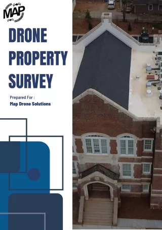
At Map Drone Solutions, we offer cutting-edge drone property survey services. Our advanced aerial technology provides precise and efficient property assessments, ideal for real estate, construction, and land management. With detailed imaging and data collection, we offer comprehensive insights into property conditions, boundaries, and potential developments. We provide innovative drone solutions that ensure accuracy, speed, and cost-effectiveness for your property evaluation process.<br><br>For More Information, Visit here: https://www.mapdronesolutions.com/drone-property-survey <br>

E N D
DRONE PROPERTY SURVEY Prepared For : Map Drone Solutions
ENHANCED EFFICIENCY Traditionally, property surveys involved time- consuming manual processes, often requiring teams of surveyors to traverse rugged terrain or inaccessible areas. With drones, however, this paradigm has shifted dramatically. Equipped with high-resolution cameras, LiDAR (Light Detection and Ranging) sensors, and GPS technology, drones can swiftly capture comprehensive aerial topographic data with unparalleled precision. This not only expedites the surveying process but also minimizes the need for human intervention in hazardous or challenging environments. As a result, projects that once took weeks or months to survey can now be completed in a fraction of the time, enabling developers to accelerate their timelines and optimize resource allocation. imagery and
SAFETY AND ACCESSIBILITY One of the most significant advantages of drone property surveys is their capacity to access remote or hazardous locations with minimal risk to human personnel. Whether it's rugged terrain, steep slopes, or unstable structures, drones can navigate challenging environments with ease, capturing detailed imagery and data without endangering human lives. This is particularly advantageous in construction projects where safety is paramount, as it allows developers to assess site conditions and monitor progress from a safe distance. Furthermore, drones can access areas that are otherwise inaccessible to traditional surveying equipment, such as rooftops, cliffs, or dense vegetation, providing comprehensive insights into the property's features and constraints.
ACCURATE DATA AND ANALYSIS Accurate data lies at the heart of informed decision-making in real estate development. Drones excel in capturing high-resolution imagery and precise topographic data, enabling stakeholders comprehensive understanding property's characteristics Whether it's measuring identifying drainage patterns, or assessing vegetation coverage, drones provide detailed insights that inform design decisions, mitigate risks, and optimize Moreover, the integration technologies such as LiDAR enables drones to generate 3D models and point clouds, facilitating sophisticated visualization techniques that enhance project planning and execution. to obtain of potential. elevation, a the and land project outcomes. advanced of analysis and
THANK YOU Contact us : 404-680-6792 mapdronesolutions@gmail.com 1625 Conley Rd #166 Conley, Ga 30288 www.mapdronesolutions.com