Download
1 / 34
350 likes | 755 Views
Evolution of Michigan from Northwest Territory to Statehood. . From 1787 to 1800 the lands now comprising Michigan were a part of the Northwest Territory. From 1800 to 1803 half of what is now the Lower Peninsula of Michigan and all of the Upper Peninsula were part of Indiana Territory. From 1803 to 1805 what is now Michigan was again part of the Northwest Territory which was smaller due to Ohio achieving statehood on March 1, 1803. From 1805 to 1836 Michigan Territory consisted of the Lower 9451

E N D
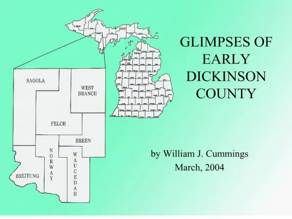
1. GLIMPSES OF EARLY DICKINSON COUNTY by William J. Cummings
March, 2004
2. Evolution of Michigan from Northwest Territory to Statehood
3. Michigan Territory Map, 1822
4. Wiskonsan and Iowa, 1838 This map, published in 1838, was given to Capt. Thomas Jefferson Cram, Corps of Topographical Engineers, War Department, by Congress when he was commissioned to determine the boundary between Michigan and Wisconsin in 1840. This map was inaccurate because, except for the southern shore of Lake Superior, the land had not yet been surveyed. Congress appropriated $3,000 for Cram�s survey. This map, published in 1838, was given to Capt. Thomas Jefferson Cram, Corps of Topographical Engineers, War Department, by Congress when he was commissioned to determine the boundary between Michigan and Wisconsin in 1840. This map was inaccurate because, except for the southern shore of Lake Superior, the land had not yet been surveyed. Congress appropriated $3,000 for Cram�s survey.
5. Michigan and Wiskonsan, 1840 Capt. Cram submitted his written report in December, 1840, along with this map showing his findings. Note the location of the Badwater Indian Village. President Martin Van Buren submitted the report to the Senate on February 1, 1841. Cram�s description of the �Menomonee� (Me-Ne-Ca-Ne) River is most interesting. The country adjacent to the upper part of the Menomonee [sic], for about thirty miles on both sides, has an exceedingly desolate appearance; all the timber, which was once pine, has been consumed by fire, as far as the eye can reach, all around on every side...Within the burnt district there is a part of the river called �Bad Water,� where there is an Indian village and planting-ground; the people of this village are called, in English, �Bad Water Indians.� Potatoes only are cultivated here; it is too far north for corn to ripen before the coming of frost.
Capt. Cram submitted his written report in December, 1840, along with this map showing his findings. Note the location of the Badwater Indian Village. President Martin Van Buren submitted the report to the Senate on February 1, 1841. Cram�s description of the �Menomonee� (Me-Ne-Ca-Ne) River is most interesting. The country adjacent to the upper part of the Menomonee [sic], for about thirty miles on both sides, has an exceedingly desolate appearance; all the timber, which was once pine, has been consumed by fire, as far as the eye can reach, all around on every side...Within the burnt district there is a part of the river called �Bad Water,� where there is an Indian village and planting-ground; the people of this village are called, in English, �Bad Water Indians.� Potatoes only are cultivated here; it is too far north for corn to ripen before the coming of frost.
7. Tom King Thomas �Tom/Wildcat� King, perhaps the best-known of the Indians who made Dickinson County their home, arrived in the area in the late 1860�s and established a trading post on the Menominee River at the site of the New York Farm, selling the trading post to Eli Wright in 1869. He resided at Chicagon Lake in Iron County for some time, but, according to the 1894 State of Michigan Census, the 56-year-old Indian was farming in Breitung Township, Dickinson County, with his wife Josephine and daughter Maggie. By 1900 they had moved to their Randville farm. King died February 16, 1910. Tom King�s Creek which crosses M-95 just south of Randville is named for him. Thomas �Tom/Wildcat� King, perhaps the best-known of the Indians who made Dickinson County their home, arrived in the area in the late 1860�s and established a trading post on the Menominee River at the site of the New York Farm, selling the trading post to Eli Wright in 1869. He resided at Chicagon Lake in Iron County for some time, but, according to the 1894 State of Michigan Census, the 56-year-old Indian was farming in Breitung Township, Dickinson County, with his wife Josephine and daughter Maggie. By 1900 they had moved to their Randville farm. King died February 16, 1910. Tom King�s Creek which crosses M-95 just south of Randville is named for him.
8. EXTRA! EXTRA!READ ALL ABOUT IT!
9. Menominee Joe and Jerome Dakota In the late 1870�s Tom King operated an �inn� for prospectors coming up the river on their way to Florence, on the Wisconsin side of the river near the Indian trail which led to Chicagon Lake. In addition, he operated a ferry across the Menominee River just above Twin Falls with Jerome Dakota. The ferry boat was propelled across by poling and a rope was anchored to pine trees on each side of the river. The usual rate for crossing was a dollar a head and three dollars for a team and wagon. Business was good until the increased traffic demanded a bridge. That put the ferry out of business.
In early February, 1902, Jerome Dakota, about eighty years old, spent the day in Iron Mountain and started for home late. He must have fallen asleep and was found frozen to death alongside the road the following morning. In the late 1870�s Tom King operated an �inn� for prospectors coming up the river on their way to Florence, on the Wisconsin side of the river near the Indian trail which led to Chicagon Lake. In addition, he operated a ferry across the Menominee River just above Twin Falls with Jerome Dakota. The ferry boat was propelled across by poling and a rope was anchored to pine trees on each side of the river. The usual rate for crossing was a dollar a head and three dollars for a team and wagon. Business was good until the increased traffic demanded a bridge. That put the ferry out of business.
In early February, 1902, Jerome Dakota, about eighty years old, spent the day in Iron Mountain and started for home late. He must have fallen asleep and was found frozen to death alongside the road the following morning.
10. EXTRA! EXTRA!READ ALL ABOUT IT!
11. Badwater Burial Ground
12. James S. Dickey
13. George Frederick Seibert
14. EXTRA! EXTRA!READ ALL ABOUT IT! The natural resources which brought �civilization� to the Dickinson County area were timber and iron ore deposits. The lumbermen had the great Menominee River and its tributaries to transport their logs to the boom companies in Menominee and Marinette, as their product floated to its destination during the spring river drives. But iron ore didn�t float and the only way to transport the mineral wealth was by rail.
With Michigan statehood [January 26, 1837] and the annexation of the western two-thirds of the Upper Peninsula from Wisconsin Territory, the United States government and the newly-formed state government recognized the importance of surveying new territory. Congress passed �An act to establish a new land district, and to provide for the sale of mineral lands in the State of Michigan� on March 1, 1847. J.W. Foster and J.D. Whitney, the United States Geologists who completed this survey, when describing Township 40, Range 30 (where Iron Mountain is located) noted: This, as far as known, is the most southern position of the iron, and of course nearest to the navigable waters of Lake Michigan. Its position, however, as will be seen, is far less favorable than that of the deposits in the vicinity of Lake Superior, and we do not, therefore, believe the iron will become of practical value, at least within a reasonable time. Deposits just north of Norway and the area between Randville and the Groveland Mine were also described in these early reports
No documentation has been found regarding work done on the Menominee Range Railroad in 1873. Unfortunately, the Panic of 1873, a nation-wide economic depression, occurred, resulting in the cessation of railroad building and exploring for iron ore until the economy began to recover several years later. The natural resources which brought �civilization� to the Dickinson County area were timber and iron ore deposits. The lumbermen had the great Menominee River and its tributaries to transport their logs to the boom companies in Menominee and Marinette, as their product floated to its destination during the spring river drives. But iron ore didn�t float and the only way to transport the mineral wealth was by rail.
With Michigan statehood [January 26, 1837] and the annexation of the western two-thirds of the Upper Peninsula from Wisconsin Territory, the United States government and the newly-formed state government recognized the importance of surveying new territory. Congress passed �An act to establish a new land district, and to provide for the sale of mineral lands in the State of Michigan� on March 1, 1847. J.W. Foster and J.D. Whitney, the United States Geologists who completed this survey, when describing Township 40, Range 30 (where Iron Mountain is located) noted: This, as far as known, is the most southern position of the iron, and of course nearest to the navigable waters of Lake Michigan. Its position, however, as will be seen, is far less favorable than that of the deposits in the vicinity of Lake Superior, and we do not, therefore, believe the iron will become of practical value, at least within a reasonable time. Deposits just north of Norway and the area between Randville and the Groveland Mine were also described in these early reports
No documentation has been found regarding work done on the Menominee Range Railroad in 1873. Unfortunately, the Panic of 1873, a nation-wide economic depression, occurred, resulting in the cessation of railroad building and exploring for iron ore until the economy began to recover several years later.
15. EXTRA! EXTRA!READ ALL ABOUT IT!
16. Railroad Gang, ca. 1877 This extremely early and unidentified photograph, although badly faded and spotted, may record the railroad gang which cut, graded and then laid the tracks from Powers to the new iron mines during the spring, summer and fall of 1877. Although the Menominee River Railroad branch cost $400,000 to construct, the Chicago & North-Western Railway Company recovered many times that amount as their trains carried millions of tons of ore from the Menominee Range mine to Escanaba. By June 1, 1877, the railroad was within three miles of the Breen Mine in Waucedah, and a wooden railway bridge with long, high approaches stretching nearly 500 feet was nearing completion. A portion of one of those approaches could be pictured in the background of this photograph. The somber men appear well-equipped with shovels, sledge hammers and pick-like hammers used to drive railroad spikes. In mid-May, wages were increased from $1.25 to $1.40 per day and board from $3.50 to $4.00 per week. This extremely early and unidentified photograph, although badly faded and spotted, may record the railroad gang which cut, graded and then laid the tracks from Powers to the new iron mines during the spring, summer and fall of 1877. Although the Menominee River Railroad branch cost $400,000 to construct, the Chicago & North-Western Railway Company recovered many times that amount as their trains carried millions of tons of ore from the Menominee Range mine to Escanaba. By June 1, 1877, the railroad was within three miles of the Breen Mine in Waucedah, and a wooden railway bridge with long, high approaches stretching nearly 500 feet was nearing completion. A portion of one of those approaches could be pictured in the background of this photograph. The somber men appear well-equipped with shovels, sledge hammers and pick-like hammers used to drive railroad spikes. In mid-May, wages were increased from $1.25 to $1.40 per day and board from $3.50 to $4.00 per week.
17. One Hundred Men Wanted
18. Menominee Iron Range Map
19. Chapin Mine, Iron Mountain, Spring, 1880 This photograph, the earliest known of the Chapin Mine, was probably taken in the spring of 1880, given the numerous frame buildings in the background, situated where East Chapin Lake now lies in downtown Iron Mountain. The tramway under construction apparently led to the proposed stockpile area from the primitive shaft, probably one of the seven shafts sunk on Section 30 during the late fall and winter of 1879-1880. The cable passing over the sheave affixed to the simple framework over the shaft probably connected to a hoisting apparatus which raised earth, rock and ore in the bucket resting near the shaft opening in the foreground as the shaft was sunk. The top of a ladder protrudes through an opening directly in front of the bucket, and another ladder lies on the ground. During the early years, ladders provided the miners with access to the mines. This photograph, the earliest known of the Chapin Mine, was probably taken in the spring of 1880, given the numerous frame buildings in the background, situated where East Chapin Lake now lies in downtown Iron Mountain. The tramway under construction apparently led to the proposed stockpile area from the primitive shaft, probably one of the seven shafts sunk on Section 30 during the late fall and winter of 1879-1880. The cable passing over the sheave affixed to the simple framework over the shaft probably connected to a hoisting apparatus which raised earth, rock and ore in the bucket resting near the shaft opening in the foreground as the shaft was sunk. The top of a ladder protrudes through an opening directly in front of the bucket, and another ladder lies on the ground. During the early years, ladders provided the miners with access to the mines.
20. Chapin Mine, Iron Mountain, 1880
21. Miner�s Strike Handbill
22. Ludington Mine Officials The miners maintained they were entitled to enough time in the middle of the day to change their clothes and eat dinner, feeling they took just enough time to do this and no more. They also felt that when Saturday night came, they had earned all the wages they received. Evidently notices were posted Thursday, November 15, and the miners left work in a body after reading them, threatening the life of Superintendent Cady. George E. Stockbridge, the Ludington Mine superintendent, was so maltreated he left town fearing for his life after being kicked, beaten and then further humiliated when someone spit in his face.
Saturday afternoon over 1,000 miners paraded through the streets with bands and banners, threatening to stop the pumps and burn the mining buildings. The miners maintained they were entitled to enough time in the middle of the day to change their clothes and eat dinner, feeling they took just enough time to do this and no more. They also felt that when Saturday night came, they had earned all the wages they received. Evidently notices were posted Thursday, November 15, and the miners left work in a body after reading them, threatening the life of Superintendent Cady. George E. Stockbridge, the Ludington Mine superintendent, was so maltreated he left town fearing for his life after being kicked, beaten and then further humiliated when someone spit in his face.
Saturday afternoon over 1,000 miners paraded through the streets with bands and banners, threatening to stop the pumps and burn the mining buildings.
23. 200 Block Stephenson Avenue, Jenkins Hotel On Tuesday, November 20, a special correspondent for The Florence Mining News reported: Iron Mountain is in a fever heat of excitement, mingled with fear. That a terrible crisis is imminent, is feared and anticipated by all. Just before noon to-day a special train arrived, bringing Messrs. Albert Conro and John H. Van Dyke, of Milwaukee, prominent members of the Menominee Mining Co., together with fifty-one of Pinkerton�s special police, from Chicago, armed with Winchester repeating rifles and a sheriff�s posse of fifteen citizens, from Menominee. These were immediately stationed about the Chapin and Ludington mines, where it was thought they would to the most good.
The miners had threatened to stop the pumps by 2 p.m. that day, and not withstanding the formidable array of well-armed and disciplined men, the incensed workmen succeeded an hour later in carrying out this dreaded move.
The miners have stopped the pumps in the face of everything and all believe that a decisive move to re-start them will result in bloodshed. The company must have the pumps started or lose thousands of dollars. This is the situation as a cloudy night, made doubly dark by a heavy fog, settles over the troubled town. Fear reigns in the breasts of all. The wildest rumors are afloat, one of which is that, the miners intend to sack and burn the town; another that they have decided to arm themselves and continue the aggressive...Public opinion is about equally divided as regards the affair. On Tuesday, November 20, a special correspondent for The Florence Mining News reported: Iron Mountain is in a fever heat of excitement, mingled with fear. That a terrible crisis is imminent, is feared and anticipated by all. Just before noon to-day a special train arrived, bringing Messrs. Albert Conro and John H. Van Dyke, of Milwaukee, prominent members of the Menominee Mining Co., together with fifty-one of Pinkerton�s special police, from Chicago, armed with Winchester repeating rifles and a sheriff�s posse of fifteen citizens, from Menominee. These were immediately stationed about the Chapin and Ludington mines, where it was thought they would to the most good.
The miners had threatened to stop the pumps by 2 p.m. that day, and not withstanding the formidable array of well-armed and disciplined men, the incensed workmen succeeded an hour later in carrying out this dreaded move.
The miners have stopped the pumps in the face of everything and all believe that a decisive move to re-start them will result in bloodshed. The company must have the pumps started or lose thousands of dollars. This is the situation as a cloudy night, made doubly dark by a heavy fog, settles over the troubled town. Fear reigns in the breasts of all. The wildest rumors are afloat, one of which is that, the miners intend to sack and burn the town; another that they have decided to arm themselves and continue the aggressive...Public opinion is about equally divided as regards the affair.
24. 300 Block Stephenson Avenue, Schuldes & C. On Wednesday, the pumps were again working. Sheriff Barclay had telegraphed for troops to Gov. Begole, at Lansing, about midnight on Tuesday.
On Thursday an additional force of fifty of Pinkerton�s special police, armed with Winchesters, arrived and on Friday another squad of thirteen came in, making in all an armed force of about one hundred and thirty in charge of the property. That day the miners caused considerable alarm by arming themselves, drilling and indulging in target practice. In addition to the Pinkertons, the Marquette militia was sent to Iron Mountain, returning home prior to the end of November, embarrassed by reports of bad conduct.
By the end of November, the mining company was paying off the single men in small squads. The plan was to pay the men off as soon as estimates could be had, discharge all single men and resume with all married men who were not leaders in the trouble. The leaders of the strike were reported to have left �for parts unknown.�
The Mining Journal noted the company had offered a $100 reward for the apprehension of a miner from Northern England named Dick Bold, who used inflammatory language during the heat of the strike, exemplified by the following: I have seen superintendents shot, I have seen captains hung. I have seen buildings in flames. Be quiet, boys, and keep your own counsel. Dead men tell no tales. Bold was apprehended, and at his trial in mid-February he was found guilty and sentenced to 15 months in the Detroit house of correction. On Wednesday, the pumps were again working. Sheriff Barclay had telegraphed for troops to Gov. Begole, at Lansing, about midnight on Tuesday.
On Thursday an additional force of fifty of Pinkerton�s special police, armed with Winchesters, arrived and on Friday another squad of thirteen came in, making in all an armed force of about one hundred and thirty in charge of the property. That day the miners caused considerable alarm by arming themselves, drilling and indulging in target practice. In addition to the Pinkertons, the Marquette militia was sent to Iron Mountain, returning home prior to the end of November, embarrassed by reports of bad conduct.
By the end of November, the mining company was paying off the single men in small squads. The plan was to pay the men off as soon as estimates could be had, discharge all single men and resume with all married men who were not leaders in the trouble. The leaders of the strike were reported to have left �for parts unknown.�
The Mining Journal noted the company had offered a $100 reward for the apprehension of a miner from Northern England named Dick Bold, who used inflammatory language during the heat of the strike, exemplified by the following: I have seen superintendents shot, I have seen captains hung. I have seen buildings in flames. Be quiet, boys, and keep your own counsel. Dead men tell no tales. Bold was apprehended, and at his trial in mid-February he was found guilty and sentenced to 15 months in the Detroit house of correction.
25. Freezing of D Shaft, Chapin Mine, 1888 Attempts at sinking a shaft in the swampy area of the Chapin property bordering the Ludington Mine had been attempted and abandoned as early as 1882, due to the excessive amount of water and the quicksand found there. However, the ore formation clearly indicated the rich Chapin deposit continued under this site, eventually developed as D shaft, the first location of the Cornish pumping engine. Attempts at sinking a shaft in the swampy area of the Chapin property bordering the Ludington Mine had been attempted and abandoned as early as 1882, due to the excessive amount of water and the quicksand found there. However, the ore formation clearly indicated the rich Chapin deposit continued under this site, eventually developed as D shaft, the first location of the Cornish pumping engine.
26. Diagram of Cornish Pumping Engine, ca.1892 By the time plans were formulated for sinking D shaft by the freezing process, the Chapin management had also decided to make this the new pump shaft, replacing the existing pumping system at the east end of the mine. By the time plans were formulated for sinking D shaft by the freezing process, the Chapin management had also decided to make this the new pump shaft, replacing the existing pumping system at the east end of the mine.
27. Original Building Housing Cornish Pumping Engine As early as February, 1896, scarcely three years after the Cornish pumping engine began operation at D shaft, an article in The Current predicted the huge plant would probably be removed so the pillar supporting it, containing more than a million tons of the best grade Chapin ore, could be mined.
Master Mechanic Frederick Richards headed the small force of men which began dismanteling the engine in mid-July, 1898. By that time ominous cracks had appeared in the pumping engine house due to the settling of the ground in the surrounding area, where circular sink holes appeared with increasing frequency. As soon as parts were removed from the engine, they were thoroughly �larded� and stored away for possible future use. As early as February, 1896, scarcely three years after the Cornish pumping engine began operation at D shaft, an article in The Current predicted the huge plant would probably be removed so the pillar supporting it, containing more than a million tons of the best grade Chapin ore, could be mined.
Master Mechanic Frederick Richards headed the small force of men which began dismanteling the engine in mid-July, 1898. By that time ominous cracks had appeared in the pumping engine house due to the settling of the ground in the surrounding area, where circular sink holes appeared with increasing frequency. As soon as parts were removed from the engine, they were thoroughly �larded� and stored away for possible future use.
28. C Ludington Shaft, 1912 The Oliver Iron Mining Company began sinking C Ludington shaft on May 6, 1903. Sinking was completed early in December, 1907. Erection of the Cornish pumping engine and plant began that year and was completed in 1908, after almost a decade in storage. Long known to be one of North America�s wettest mines, the Chapin was steadily producing from 2,800 to 3,000 gallons per minute at this time. The Oliver Iron Mining Company began sinking C Ludington shaft on May 6, 1903. Sinking was completed early in December, 1907. Erection of the Cornish pumping engine and plant began that year and was completed in 1908, after almost a decade in storage. Long known to be one of North America�s wettest mines, the Chapin was steadily producing from 2,800 to 3,000 gallons per minute at this time.
29. Cornish Pumping Engine Interior The original cost of the Cornish pumping engine in 1893, seen here inside the C Ludington Shaft engine house, was estimated at $82,500, and the total, including the pumps was estimated at $250,000. The original cost of the Cornish pumping engine in 1893, seen here inside the C Ludington Shaft engine house, was estimated at $82,500, and the total, including the pumps was estimated at $250,000.
30. Pewabic Mine, 1887
31. Pewabic Mine Accident Survivors, 1894 Mining accidents were common during the early years. Sometimes the victim was only mentioned by nationality in the newspapers of the time. At times there appeared to be little sensitivity by newspaper editors with headlines such as �Blown to Atoms,� recording a fatality due to an ill-timed explosion.
At 3 p.m. on Thursday, October 25, 1894, twelve miners in Iron Mountain�s Pewabic Mine were entombed while at work on the fourth level when a room above them collapsed. One of the miners, Peter Gabardi, was caught and crushed to death under the falling mass. However, the eleven miners pictured here were finally rescued between 6 and 7 p.m. Saturday, having been entombed for over 40 hours.
Note the �oilers� worn due to wet mining conditions and also the miner�s candlesticks on their hats which were used to light the individual miner�s work area within the mine. Mining accidents were common during the early years. Sometimes the victim was only mentioned by nationality in the newspapers of the time. At times there appeared to be little sensitivity by newspaper editors with headlines such as �Blown to Atoms,� recording a fatality due to an ill-timed explosion.
At 3 p.m. on Thursday, October 25, 1894, twelve miners in Iron Mountain�s Pewabic Mine were entombed while at work on the fourth level when a room above them collapsed. One of the miners, Peter Gabardi, was caught and crushed to death under the falling mass. However, the eleven miners pictured here were finally rescued between 6 and 7 p.m. Saturday, having been entombed for over 40 hours.
Note the �oilers� worn due to wet mining conditions and also the miner�s candlesticks on their hats which were used to light the individual miner�s work area within the mine.
32. William A. Holmes & Son Logging Crew, ca.1885
33. William A. Holmes & Son Logging Crew, 1886
34. EXTRA! EXTRA!READ ALL ABOUT IT!
35. Cook Shanty Interior, Camp Three, Breen Township, ca. 1915
36. Jauquet Brothers Logging Camp, February, 1905
37. Jauquet Brothers Sprinkler Sled
38. Mill Company Log Marks
39. Log Drive Camp on the Menominee River, ca. 1890
40. Log Jam on Menominee River, 1899
41. EXTRA! EXTRA!READ ALL ABOUT IT!
42. Map Dickinson County Formation
43. Donald M. Dickinson
44. Breen Township
45. Bartley Breen
46. EXTRA! EXTRA!READ ALL ABOUT IT!
47. Foster City - Morgan Cedar & Lumber Co., 1905 Foster City was established by lumberman Alonzo L. Foster in 1884. The November 7, 1885 edition of Norway�s The Current reported: A new station called Foster City has been opened on the Peninsula division of the C. & N.W. railroad. It is located about five miles from Metropolitan. A post office was established February 5, 1886, with Foster serving as postmaster.
The Morgan Lumber and Cedar Company made extensive alterations at its Foster City sawmill in the early spring of 1905, about the time this photograph was taken. A 40x50-foot addition housed the shingle mill equipped with two double-block machines and ten knot saws capable of producing 160,000 shingles per day. The main building, 50x120 feet, contained a bandsaw, resaw, edger, trimmer, tie machine and shingle bolt saw. The mill had the capacity of 45,000 feet of lumber per day. A planing mill and electric light plant completed the Foster City sawmill complex. Note the cone-shaped sawdust burner at the left, the lumber carts on the wooden tramways and the horse-drawn slab cart below. Foster City was established by lumberman Alonzo L. Foster in 1884. The November 7, 1885 edition of Norway�s The Current reported: A new station called Foster City has been opened on the Peninsula division of the C. & N.W. railroad. It is located about five miles from Metropolitan. A post office was established February 5, 1886, with Foster serving as postmaster.
The Morgan Lumber and Cedar Company made extensive alterations at its Foster City sawmill in the early spring of 1905, about the time this photograph was taken. A 40x50-foot addition housed the shingle mill equipped with two double-block machines and ten knot saws capable of producing 160,000 shingles per day. The main building, 50x120 feet, contained a bandsaw, resaw, edger, trimmer, tie machine and shingle bolt saw. The mill had the capacity of 45,000 feet of lumber per day. A planing mill and electric light plant completed the Foster City sawmill complex. Note the cone-shaped sawdust burner at the left, the lumber carts on the wooden tramways and the horse-drawn slab cart below.
48. Foster City - Morgan Cedar & Lumber Co., 1910
49. Foster City, Morgan Lumber Company Store, ca. 1910 Taken from �Boardinghouse Hill,� this photograph shows the Morgan Lumber and Cedar Company store in the foreground. Doors to the left of the store steps led into the basement storage area. The Chicago & North-Western Railway tracks passed close to the store for easy loading and unloading at the basement level and the company lumberyards were also located nearby. At the upper right St. Joseph�s Catholic Church, the settlement�s first Catholic church building, built in 1906, stands to the left of the Longfellow School. Taken from �Boardinghouse Hill,� this photograph shows the Morgan Lumber and Cedar Company store in the foreground. Doors to the left of the store steps led into the basement storage area. The Chicago & North-Western Railway tracks passed close to the store for easy loading and unloading at the basement level and the company lumberyards were also located nearby. At the upper right St. Joseph�s Catholic Church, the settlement�s first Catholic church building, built in 1906, stands to the left of the Longfellow School.
50. Foster City, Morgan Co. Store Meat Market, 1914
51. Foster City � Morgan Co. Store General Merchandise Department, 1914
52. Foster City Residents Returning from Picnic, ca.1901-1902
53. EXTRA! EXTRA!READ ALL ABOUT IT!
54. Hardwood - Parkinson
55. Hardwood � Saloon and Hotel, ca. 1909
56. Hylas � Oxen Used in Logging at Michael Kenny Farm
57. Breitung Township
58. Edward S. Breitung
59. EXTRA! EXTRA!READ ALL ABOUT IT!
60. EXTRA! EXTRA!READ ALL ABOUT IT!
61. EXTRA! EXTRA!READ ALL ABOUT IT!
62. EXTRA! EXTRA!READ ALL ABOUT IT!
63. Iron Mountain Chapin Mine Location,1880 In 1889, the Chapin miners were paid by check for the first time, and many were suspicious of the �little pink checks,� rushing to cash them at the two-year-old First National Bank. The bank, not notified of the change, was soon drained of cash, since the Chapin Mining Company�s monthly payroll exceeded the bank�s capital stock at that time. In 1889, the Chapin miners were paid by check for the first time, and many were suspicious of the �little pink checks,� rushing to cash them at the two-year-old First National Bank. The bank, not notified of the change, was soon drained of cash, since the Chapin Mining Company�s monthly payroll exceeded the bank�s capital stock at that time.
64. EXTRA! EXTRA!READ ALL ABOUT IT!
65. Rundle Bros. And Seibert�s Drug Store with Band, mid-1880�s
66. EXTRA! EXTRA!READ ALL ABOUT IT!
67. C. & N.W. Depot on Stephenson Avenue, ca. mid-1890�s
68. Evergreen Arch on East B Street, 1891
69. EXTRA! EXTRA!READ ALL ABOUT IT!
70. 300 Block of Stephenson Avenue with Hulst School Taken in the mid-1890�s, this view of the west side of the 300 block of South Stephenson Avenue includes the Swedish Mission Church on East Ludington Street at the left, the Nelson P. Hulst High School, built in 1892, near the center, and the Swedish Baptist Church on East A Street on the right. The Chicago & North-Western Railway Depot�s rooftop is in the foreground. Taken in the mid-1890�s, this view of the west side of the 300 block of South Stephenson Avenue includes the Swedish Mission Church on East Ludington Street at the left, the Nelson P. Hulst High School, built in 1892, near the center, and the Swedish Baptist Church on East A Street on the right. The Chicago & North-Western Railway Depot�s rooftop is in the foreground.
71. 200 Block of South Stephenson Avenue with First National Bank Taken in the mid-1890�s, this view of the west side of the 200 block of South Stephenson Avenue includes a portion of the north side of East Ludington Street showing the Wood Sandstone Block, built in 1891, which served as Iron Mountain�s City Hall from mid-December, 1900, until the city offices were moved into the former Koffman�s store building in 1992. The shaft at the left was a part of the Chapin Mine complex. The single-story white building to the right of center was the Brown Street School. A horse pulling a wagon has stopped for a drink at the watering trough carved from granite in the shape of a tree trunk across from the J.J. Cole store. A common cup on a chain served thirsty pedestrians, while dogs quenched their thirst from a small overflow basin near the fountain�s base. Note the elevated board sidewalks. Taken in the mid-1890�s, this view of the west side of the 200 block of South Stephenson Avenue includes a portion of the north side of East Ludington Street showing the Wood Sandstone Block, built in 1891, which served as Iron Mountain�s City Hall from mid-December, 1900, until the city offices were moved into the former Koffman�s store building in 1992. The shaft at the left was a part of the Chapin Mine complex. The single-story white building to the right of center was the Brown Street School. A horse pulling a wagon has stopped for a drink at the watering trough carved from granite in the shape of a tree trunk across from the J.J. Cole store. A common cup on a chain served thirsty pedestrians, while dogs quenched their thirst from a small overflow basin near the fountain�s base. Note the elevated board sidewalks.
72. William Jennings Bryan Speaking,1896 William Jennings Bryan arrived at Iron Mountain by special train on October 14, 1896, while campaigning for president on the Democratic ticket. Speaking to a crowd estimated at 5,000 by a reporter for The Range-Tribune from a stand erected for the occasion, Bryan outlined his silver money policy. Note the people watching from the rooftops, crowding the windows and even hanging form the telephone poles, eager to get a better look at the 36-year-old presidential candidate who was defeated by Republican William McKinley. William Jennings Bryan arrived at Iron Mountain by special train on October 14, 1896, while campaigning for president on the Democratic ticket. Speaking to a crowd estimated at 5,000 by a reporter for The Range-Tribune from a stand erected for the occasion, Bryan outlined his silver money policy. Note the people watching from the rooftops, crowding the windows and even hanging form the telephone poles, eager to get a better look at the 36-year-old presidential candidate who was defeated by Republican William McKinley.
73. West Ludington Street, mid-1890�s Taken in the late 1890�s, the camera faces northwest, showing several buildings on the north side of the 100 block of Iron Mountain�s West Ludington Street. The rooftop in the left foreground was Rundle�s hardware store and opera house. The Iron Mountain Post Office is now located here. In the upper right the First Presbyterian Church, built in 1884, can be seen at the northwest corner of West Brown Street and Carpenter Avenue. Taken in the late 1890�s, the camera faces northwest, showing several buildings on the north side of the 100 block of Iron Mountain�s West Ludington Street. The rooftop in the left foreground was Rundle�s hardware store and opera house. The Iron Mountain Post Office is now located here. In the upper right the First Presbyterian Church, built in 1884, can be seen at the northwest corner of West Brown Street and Carpenter Avenue.
74. EXTRA! EXTRA!READ ALL ABOUT IT!
75. EXTRA! EXTRA!READ ALL ABOUT IT!
76. West Side of Iron Mountain with Crystal Lake in Background
77. EXTRA! EXTRA!READ ALL ABOUT IT!
78. John Pipp�s Saloon, North Side
79. EXTRA! EXTRA!READ ALL ABOUT IT!
80. McKinley�s Memorial Procession, September19,1901
81. EXTRA! EXTRA!READ ALL ABOUT IT!
82. Thanksgiving Turkeys, Hoose & Eaton Meat Market, ca. 1900 Thanksgiving turkeys and holiday hams, as well as sides of beef and even venison, hang awaiting customers at the Hoose & Eaton Meat Market at 203 South Stephenson Avenue, Iron Mountain. In 1892 the firm was called Jay W. Hoose & Co., with Edward H. Eaton being the �& Co.� By 1895 the men were partners. Thomas Wills, who later ran this meat market alone and in partnership with William J. Carbis, stands second from the right with an �X� on his apron. Others pictured include Mrs. Eaton, left, Edward H. Eaton, Jay W. Hoose and George M. Guest. Thanksgiving turkeys and holiday hams, as well as sides of beef and even venison, hang awaiting customers at the Hoose & Eaton Meat Market at 203 South Stephenson Avenue, Iron Mountain. In 1892 the firm was called Jay W. Hoose & Co., with Edward H. Eaton being the �& Co.� By 1895 the men were partners. Thomas Wills, who later ran this meat market alone and in partnership with William J. Carbis, stands second from the right with an �X� on his apron. Others pictured include Mrs. Eaton, left, Edward H. Eaton, Jay W. Hoose and George M. Guest.
83. Sam Khoury�s Confectionery Store, Early 1900�s A fire which started in the rear of Sam Khoury�s confectionery store at 490 South Stehenson Avenue, on December 2, 1915, destroyed his business as well as the Parent Clothing Store (405) and John Carbis� real estate and employment office (407). In mid-August, 1916, Khoury purchased Charles E. Anderson�s grocery store at 202 East Ludington Street, enlarging the stock, adding a line of fruits, fine confectionery and cigars and tobacco. He planned to add a soda fountain the following season. This undated photograph shows Sam (left) and Abe Khoury behind the soda fountain either at Sam�s East Ludington store or one of the earlier shops on Stephenson Avenue. Note the elaborate soda fountain with polished spigots and an array or glassware. Confectionery items were probably displayed in the case upon which Abe�s left arm rested. Two customers are reflected in the mirror above the soda fountain. A fire which started in the rear of Sam Khoury�s confectionery store at 490 South Stehenson Avenue, on December 2, 1915, destroyed his business as well as the Parent Clothing Store (405) and John Carbis� real estate and employment office (407). In mid-August, 1916, Khoury purchased Charles E. Anderson�s grocery store at 202 East Ludington Street, enlarging the stock, adding a line of fruits, fine confectionery and cigars and tobacco. He planned to add a soda fountain the following season. This undated photograph shows Sam (left) and Abe Khoury behind the soda fountain either at Sam�s East Ludington store or one of the earlier shops on Stephenson Avenue. Note the elaborate soda fountain with polished spigots and an array or glassware. Confectionery items were probably displayed in the case upon which Abe�s left arm rested. Two customers are reflected in the mirror above the soda fountain.
84. Von Platen Sawmill, ca. 1910-1911 In March, 1910, Godfrey von Platen, of Boyne City, Michigan, together with his business manager, M.J. Fox, met with influential Iron Mountain businessmen to discuss plans for building a large sawmill in the city. The necessary arrangements for building the sawmill in the eastern sector of the city were made at once, and by mid-December lumber was being produced. Today the Midtown Mall and the Veterans Administration Hospital occupy this area.
The sawmill was 52 by 150 feet on a concrete foundation and two full stories high. It contained two band saws, a gang saw with steam feed and steam setting apparatus and a steam log roller. The engine house, 48 by 72 feet in size, contained the boiler plant and a 500 horse-power engine. Initially some 40 men were employed during the winter months with a prediction that the number would double by spring.
This early postcard view was probably taken shortly after the mill opened. The Von Platen-Fox Company, successors to the Von Platen Lumber Company, filed articles of incorporation in mid-August, 1920, with a capital stock of $2,500,000. In March, 1910, Godfrey von Platen, of Boyne City, Michigan, together with his business manager, M.J. Fox, met with influential Iron Mountain businessmen to discuss plans for building a large sawmill in the city. The necessary arrangements for building the sawmill in the eastern sector of the city were made at once, and by mid-December lumber was being produced. Today the Midtown Mall and the Veterans Administration Hospital occupy this area.
The sawmill was 52 by 150 feet on a concrete foundation and two full stories high. It contained two band saws, a gang saw with steam feed and steam setting apparatus and a steam log roller. The engine house, 48 by 72 feet in size, contained the boiler plant and a 500 horse-power engine. Initially some 40 men were employed during the winter months with a prediction that the number would double by spring.
This early postcard view was probably taken shortly after the mill opened. The Von Platen-Fox Company, successors to the Von Platen Lumber Company, filed articles of incorporation in mid-August, 1920, with a capital stock of $2,500,000.
85. EXTRA! EXTRA!READ ALL ABOUT IT!
86. John L. Buell
87. EXTRA! EXTRA!READ ALL ABOUT IT!
88. Quinnesec � Quinnesec Hotel
89. EXTRA! EXTRA!READ ALL ABOUT IT!
90. EXTRA! EXTRA!READ ALL ABOUT IT!
91. Buell�s Opera House - 1880 John Lane Buell�s opera house in Quinnesec, considered one of the finest in the Upper Peninsula, was located on the northeast corner of Quinnesec Avenue and Paint Street [now U.S. 2]. The opera house opened to the public Tuesday, December 30, 1879, and served as the social and cultural center of the village for many years. The second story contained a large dance floor and auditorium with a stage. In this photograph, probably taken in the summer of 1880, a sign in the left store front notes the Menominee Mining Company general offices were located within. In the window to the left of the right store front is the sign for Joseph Schaller, druggist, while the sign for Charles E. Steller�s jewelry shop appears in the right window of the same store front. Under the awning on the side is a restaurant, and next-door is the office of The Menominee Range, the county�s first newspaper. This photograph dates no later than the spring of 1881 when the newspaper was moved to Norway. The opera house burned August 23, 1925. John Lane Buell�s opera house in Quinnesec, considered one of the finest in the Upper Peninsula, was located on the northeast corner of Quinnesec Avenue and Paint Street [now U.S. 2]. The opera house opened to the public Tuesday, December 30, 1879, and served as the social and cultural center of the village for many years. The second story contained a large dance floor and auditorium with a stage. In this photograph, probably taken in the summer of 1880, a sign in the left store front notes the Menominee Mining Company general offices were located within. In the window to the left of the right store front is the sign for Joseph Schaller, druggist, while the sign for Charles E. Steller�s jewelry shop appears in the right window of the same store front. Under the awning on the side is a restaurant, and next-door is the office of The Menominee Range, the county�s first newspaper. This photograph dates no later than the spring of 1881 when the newspaper was moved to Norway. The opera house burned August 23, 1925.
92. EXTRA! EXTRA!READ ALL ABOUT IT!
93. Quinnesec � Pioneer School
94. EXTRA! EXTRA!READ ALL ABOUT IT!
95. Quinnesec � Garfield School Quinnesec�s Garfield School, formally opened December 23, 1897, replaced the Pioneer School which could no longer be used due to its proximity to the Cundy Mine shaft. The two-story building, located where the Breitung Township Hall now stands, contained four classrooms and a library which was located in the front portion of the building on the second floor. A picture of President Garfield hung in front of the large classroom on the first floor, called the assembly room. Two additional classrooms were located on this floor. When the school opened, classes from kindergarten through eighth grade were taught. Eighth grade graduates held their commencement exercises in Buell�s Opera House. Those wanting a high school education had to go to Iron Mountain. Quinnesec�s Garfield School, formally opened December 23, 1897, replaced the Pioneer School which could no longer be used due to its proximity to the Cundy Mine shaft. The two-story building, located where the Breitung Township Hall now stands, contained four classrooms and a library which was located in the front portion of the building on the second floor. A picture of President Garfield hung in front of the large classroom on the first floor, called the assembly room. Two additional classrooms were located on this floor. When the school opened, classes from kindergarten through eighth grade were taught. Eighth grade graduates held their commencement exercises in Buell�s Opera House. Those wanting a high school education had to go to Iron Mountain.
96. Quinnesec � Street Scene, 1903 This view of Quinnesec�s business district was taken in about 1903. The photographer was standing at Pine Street looking north on Quinnesec Avenue. Buell�s Opera House is the two-story brick building at the right. All of the buildings south of Paint Street were burned in the fire of May 18, 1906, with losses in excess of $75,000 suffered throughout the village. This view of Quinnesec�s business district was taken in about 1903. The photographer was standing at Pine Street looking north on Quinnesec Avenue. Buell�s Opera House is the two-story brick building at the right. All of the buildings south of Paint Street were burned in the fire of May 18, 1906, with losses in excess of $75,000 suffered throughout the village.
97. Quinnesec After the Fire, 1906
98. Norway Township - 1880
99. Norway Mine, May, 1886
100. EXTRA! EXTRA!READ ALL ABOUT IT!
101. Main Street (Old Town), Norway, ca.1908
102. EXTRA! EXTRA!READ ALL ABOUT IT!
103. Southeast View of Norway, ca. 1912
104. West Side of Nelson Street (Main Street), ca. 1914
105. EXTRA! EXTRA!READ ALL ABOUT IT!
106. Interior of John E. Eklund�s Jewelry Store, ca. 1907
107. Interior of Ramsdell�s Hardware & Crockery Store, ca. 1905
108. EXTRA! EXTRA!READ ALL ABOUT IT!
109. Norway High School, ca. 1908
110. Menominee River Brewing Company Beer Wagon, ca. 1914-1915
111. O.C. Lumber Co. Plant, Sturgeon Mills, ca. 1909 Originally known as Parmenter�s Mill, this sawmill settlement probably changed names after mid-November, 1896, when the O�Callaghan brothers (James, John and George), of Norway, purchased the mill. By early March, 1897, the organization at the Sturgeon River was named the O.C. Lumber Company.
The entire plant, consisting of the sawmill and planing mill, with all the machinery, was destroyed by fire on Friday, April 19, 1912. The loss was estimated at $30,000. The company had about 2,000,000 feet of lumber in the yard and planned to build a new mill at once, at a cost of $3,000. Originally known as Parmenter�s Mill, this sawmill settlement probably changed names after mid-November, 1896, when the O�Callaghan brothers (James, John and George), of Norway, purchased the mill. By early March, 1897, the organization at the Sturgeon River was named the O.C. Lumber Company.
The entire plant, consisting of the sawmill and planing mill, with all the machinery, was destroyed by fire on Friday, April 19, 1912. The loss was estimated at $30,000. The company had about 2,000,000 feet of lumber in the yard and planned to build a new mill at once, at a cost of $3,000.
112. Lewis Young Whitehead
113. EXTRA! EXTRA!READ ALL ABOUT IT!
114. Vulcan, Vulcan Hotel, 1880
115. Vulcan, Vulcan Mine, 1886
116. Vulcan, East Vulcan Mine, 1886
117. Felch Township - 1882
118. Alpheus Felch
119. EXTRA! EXTRA!READ ALL ABOUT IT!
120. EXTRA! EXTRA!READ ALL ABOUT IT!
121. Metropolitan Street Scene, 1902
122. Metropolitan, Rian Hotel, 1902
123. Metropolitan Store, Felch, ca.
124. EXTRA! EXTRA!READ ALL ABOUT IT!
125. Felch, Main Street, ca.1916
126. EXTRA! EXTRA!READ ALL ABOUT IT!
127. Theodore, Turkish Remedy Co.
128. Sagola Township - 1892
129. Channing Advertisement
130. John Parke Channing
131. EXTRA! EXTRA!READ ALL ABOUT IT!
132. Channing, Railroad Depot, ca. 1912
133. Round House and Train Yards at Channing, ca. 1909
134. EXTRA! EXTRA!READ ALL ABOUT IT!
135. Channing, Railroad Street, 1909
136. EXTRA! EXTRA!READ ALL ABOUT IT!
137. EXTRA! EXTRA!READ ALL ABOUT IT!
138. Channing, Railroad Street, 1910
139. EXTRA! EXTRA!READ ALL ABOUT IT!
140. EXTRA! EXTRA!READ ALL ABOUT IT!
141. Sagola With Stacked Lumber
142. Sagola Sawmill 1
143. Sagola Sawmill 1
144. Sagola Sawmill 2
145. EXTRA! EXTRA!READ ALL ABOUT IT!
146. Sagola Bicyclists, July 4, 1905
147. Waucedah Township - 1892
148. EXTRA! EXTRA!READ ALL ABOUT IT!
149. Waucedah,1881 This lithograph of Waucedah, published by J.J. Stoner, of Madison, Wisconsin, in 1881, is the only early view of the county�s easternmost settlement on the Chicago & North-Western Railway found to date. The Breen Mine (1) is just left of center and almost at the tree line. The Emmet Mine (2) is near the big tear on the right. The Waucedah House (3) is a two-story false-fronted building facing south on Broadway, the village�s main street. The Forest House (4) is across the street and west from the Waucedah House. The Town Hall (5) faces south on Broadway and is the third building from the left. The School House (6) is directly across the street from the Town Hall. The Post Office (7) is the log building next to the Waucedah House. The Menominee River Railroad Depot (8) is to the left of the train. A similar bird�s-eye view of Iron Mountain was published by Beck & Pauli, of Milwaukee, Wisconsin, in 1886, and views of Norway and Quinnesec were also published in the 1880�s. This lithograph of Waucedah, published by J.J. Stoner, of Madison, Wisconsin, in 1881, is the only early view of the county�s easternmost settlement on the Chicago & North-Western Railway found to date. The Breen Mine (1) is just left of center and almost at the tree line. The Emmet Mine (2) is near the big tear on the right. The Waucedah House (3) is a two-story false-fronted building facing south on Broadway, the village�s main street. The Forest House (4) is across the street and west from the Waucedah House. The Town Hall (5) faces south on Broadway and is the third building from the left. The School House (6) is directly across the street from the Town Hall. The Post Office (7) is the log building next to the Waucedah House. The Menominee River Railroad Depot (8) is to the left of the train. A similar bird�s-eye view of Iron Mountain was published by Beck & Pauli, of Milwaukee, Wisconsin, in 1886, and views of Norway and Quinnesec were also published in the 1880�s.
150. EXTRA! EXTRA!READ ALL ABOUT IT!
151. West Branch Township - 1908
152. Ralph Looking North
153. Ralph Looking South
154. Ralph RR. Platform with Deer
155. THE END
156. EXTRA! EXTRA!READ ALL ABOUT IT!
157. EXTRA! EXTRA!READ ALL ABOUT IT!
158. EXTRA! EXTRA!READ ALL ABOUT IT!
159. EXTRA! EXTRA!READ ALL ABOUT IT!
160. Horizontal Template
161. Horizontal Template
162. Vertical Template
163. EXTRA! EXTRA!READ ALL ABOUT IT!