Download
1 / 8
0 likes | 14 Views
The company started its journey in the year 1999 with a team of dedicated and true professional. We are specialists in accurate engineering set out for major projects. We have an array of modern equipment, software and expertise to deliver exactly what you require to make your project run successfully and accurately.

E N D
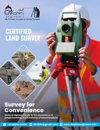
CERTIFIED LAND SURVEY Survey for Convenience National Highway Survey for the convenience of people travelling and installation of industrial plants. div100e@gmail.com www.dolphinengineers.com +91 96800 26609
ABOUT US After Having Exhaustive & distinguished Experience in Different Disciptires of topographic survey, wind energy plant survey, DGPS survey, water supply and gas pipe line survey, contour survey, national highway survey, bridge details survey, LAY OUT MARKING SURVEY, solar power plant survey etc. Our Organization Named "Dolphin Engineer" was established 1999. Aim of Organization is to Provide Quality Services with in the specified time using Highly Skilled, Qualified & Experienced Manpower in Infrastructure & other development Project in Civil Engineering, to the entire Satisfaction of the Client. Infrastructure & other development Project in Civil Engineering, to the entire Satisfaction of the Client. Our Clientage is Spread over many State of India including Rajasthan, Karnataka, Maharashtra, Uttar Pradesh, & Delhi DIRECTOR MESSAGE “ We invest wholeheartedly in the work that we do. We are focused on giving the exact survey result out of significant projects. We have a variety of modern equipment, programming, and aptitude to convey what you need to make your project run effectively and precisely. We work with a large number of designing and utilities sectors that include water, power, roadways, and railways with global footprints. After having full and well-known experience in all the fields, we provide you surveys like topographic, wind energy plant, water supply and gas pipeline, DGPS, Contour, National Highway, Bridge Details, Layout Marketing, Solar Power Plant. Rajesh Saxena Director “ WE NOW PROVIDE A FULL RANGE OF SURVEYING SERVICES THROUGHOUT INDIA.
Our Mission When our power of choice is untrammelled and nothing prevents our being able to do what we like best every pleasure to be welcomed. Our Vision When our power of choice is untrammelled and nothing prevents our being able to do what we like best every pleasure to be welcomed. Our Clients
OUR SERVICES TOPOGRAPHICAL SURVEY TOTAL STATION SURVEY A survey that measures the elevation points on a particular piece of land and presents them as a three-dimensional shape & shows all physical features of the property. We can perform Topographical surveys throughout the project (pre-bid or pre-start, progress, and final phase) to ensure accuracy not only against the architectural plans but also as a means of continuous monitoring of the quality of work we are performing. Differential Global Positioning System (DGPS) Surveying (land control and utility survey ) has been an essential part of the land survey service group. The land survey services provide all aspects of the survey profession. These includes – · Land control surveys for photogrammetric projects. · Airborne GPS · Differential GPS (DGPS) · Route and alignment surveys · Boundary and cadastral surveys · Monitoring projects under risky environmental circumstances · Mineral surveys · Construction and cross-section surveys (from road design to precision layout and quality control) THROUGHOUT INDIA. Rajesh Saxena Director WE NOW PROVIDE A FULL RANGE OF SURVEYING SERVICES
Auto Level Survey Auto level surveys are commonly used to complete cross-sectional and longitudinal surveys. This method requires a minimum of two field personnel. It is recommended that a base map be generated to indicate locations of cross- sectional and longitudinal surveys. ARIEL SURVEYS Drone Surveys Drone survey reduces the fieldwork and also helps in finding out the exact results. The results from this survey are essential for evaluation and planning. Drone survey helps in proper scanning of the field and also for gathering valuable information that reduces field-related issues. It also increases the safety of the team members. PHOTOGRAMMATIC SURVEYS Photogrammetry Survey is the science of making reliable measurements using photographs or digital photo imagery to locate features on or above the earth's surface.
WATER SURVEY BATHEMETRIC SURVEY Bathymetric surveys help in measuring the depth of the water body for collecting accurate information about the sea. This survey helps in gathering the information regarding underwater that is essential for preparing the map. There are various techniques used to measure the depth. MINES PLANT SURVEY Individual mines require adequate information to prevent inadvertent undercutting of installations and unplanned intersection of working. It is important to know the position of all points underground relative to every place on the surface, particularly for the management of emergency situations and rescues.
WE PROVIDE ACCURATE & PRECISE SURVEYS C-49, B-3 Vidhya Apartment, Paras Marg, Bapu Nagar, Tonk Road, Jaipur - 302020 (Raj.)