Download
1 / 4
0 likes | 2 Views
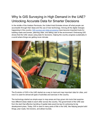
In the middle of the Arabian Peninsula, the United Arab Emirates shows off what people can accomplish through their ideas and the use of new technology. Among all the digital changes happening in this country, GIS surveys and data processing have become important tools for building roads and homes, planning cities, and taking care of the environment. Embracing GIS shows that the UAE values using data for decisions, helping the country progress sustainably in a world where things are getting more intricate.

E N D
Why Is GIS Surveying in High Demand in the UAE? Unlocking Accurate Data for Smarter Decisions In the middle of the Arabian Peninsula, the United Arab Emirates shows off what people can accomplish through their ideas and the use of new technology. Among all the digital changes happening in this country, GIS surveys and data processing have become important tools for building roads and homes, planning cities, and taking care of the environment. Embracing GIS shows that the UAE values using data for decisions, helping the country progress sustainably in a world where things are getting more intricate. The Evolution of GIS in the UAE started as a way to track and map important data for cities, and now it is used for almost all types of activities and services in the country. The technology started as simple ways to map areas and has grown into tools that examine how different areas relate to each other across the country. The government of the UAE saw from the start that effective handling of spatial data would be key for achieving its big development plans. Today, GIS is used in many parts of life in the UAE, like helping people build things, plan roads, find doctors, and attract tourists.
Applications Transforming the Nation The footprint of GIS survey and data processing covers different fields in the UAE. They make it possible for those working in urban planning to visualize, assess, and improve city designs before starting construction. GIS technology was used to design the Palm Jumeirah island in Dubai to provide strong structures and ensure that it does not harm the environment. Scientists in the field use GIS to look out for changes in the shape of dunes and to locate places that might turn into deserts. By having this data, officials can work more effectively to manage and protect water resources where there is a long-standing problem with not having enough water. Advanced-Data Collection Methods The accuracy of GIS applications is mostly determined by how good the data are that people gather. Data collection in the UAE uses important methods such as LiDAR, imaging via drones, and imagery from satellites to ensure the highest level of accuracy. With mobile GIS, teams can catch data live and prevent mistakes made by humans. showing how committed they are to data, the city’s Smart Geospatial Contact Center uses AI to check and correct geographical information used in different systems. The focus on data accuracy has made the UAE a leader in geospatial intelligence in the region. Digital Transformation and Integration It is not just the use of GIS that makes the UAE unique, but also how they connect GIS with different digital tools. By using GIS data, the country’s efforts to become a smart city create well-connected urban areas where different complimentary systems and services are together. The Roads and Transport Authority in Dubai uses GIS to improve traffic management, cut down on congestion, and set up future transportation systems. As another example, telecom companies use precision mapping so that underground operations during maintenance and construction are less likely to disrupt visitors or everyday usage.
Overcoming Challenges Through Innovation Certain problems arise when GIS surveys and data processing are used in the UAE. Difficult desert conditions influence the tasks conducted by oilfield workers and the performance of equipment. Fast growth in cities means that spatial databases must be updated often to remain precise. As a result, people have devised new ways to tackle these issues. Companies in the UAE have both designed heat-resistant tools and developed new techniques for surveying deserts. Initiatives from the government, including the UAE Spatial Data Infrastructure, have helped to ensure standards for data sharing and compatibility, making the whole national spatial data system more unified. Building Local Expertise Understanding that the impact of technology depends on learning, the UAE has focused on developing GIS experts within the country. Colleges and universities offer courses in geospatial sciences, and there are professional certification courses available for already-employed individuals. As a result, the knowledge is shared and helps build lasting resources within the Emirates.
The Road Ahead When we think about the future, GIS survey and data processing in the UAE will include emerging technologies such as artificial intelligence and blockchain to make both data analysis and security better. They will help the country achieve vital objectives, like ensuring enough food and adapting to climate change. By embracing GIS in the UAE, the country has demonstrated that using spatial intelligence can help strengthen, organize, and sustain a society. With the help of GIS, Emirati agencies can now study and survey the regions of Abu Dhabi and Dubai, while mapping how the economy moves toward knowledge-work. Accurate Survey UAE provides precise land, building, and construction surveys using advanced technology, ensuring reliable results for projects across the UAE. If you would like to learn more about GIS survey and data processing, you can visit the page.