Download
1 / 30
300 likes | 461 Views
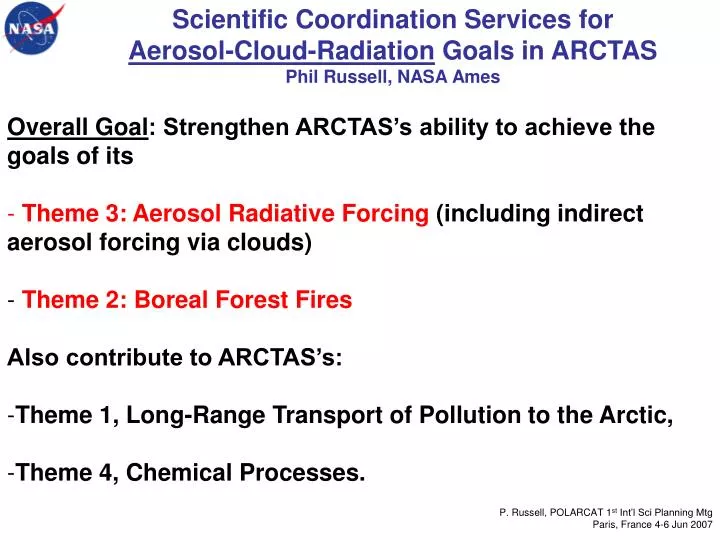
Scientific Coordination Services for Aerosol-Cloud-Radiation Goals in ARCTAS Phil Russell, NASA Ames. Overall Goal : Strengthen ARCTAS’s ability to achieve the goals of its Theme 3: Aerosol Radiative Forcing (including indirect aerosol forcing via clouds) Theme 2: Boreal Forest Fires

E N D
Scientific Coordination Services for Aerosol-Cloud-Radiation Goals in ARCTASPhil Russell, NASA Ames • Overall Goal: Strengthen ARCTAS’s ability to achieve the goals of its • Theme 3:Aerosol Radiative Forcing (including indirect aerosol forcing via clouds) • Theme 2: Boreal Forest Fires • Also contribute to ARCTAS’s: • Theme 1, Long-Range Transport of Pollution to the Arctic, • Theme 4, Chemical Processes. P. Russell, POLARCAT 1st Int’l Sci Planning Mtg Paris, France 4-6 Jun 2007
Scientific Coordination Services for Aerosol-Cloud-Radiation Goals in ARCTAS We expect thatthis work will also contribute to achieving the following POLARCAT objectives: • Determine the vertical layering of Arctic pollution and the optical properties of Arctic aerosol particles. • Characterize the direct radiative effects within pollution layers in the Arctic. • Investigate interactions of aerosols with clouds and their impact on radiative forcing. • Quantify albedo changes of snow and ice surfaces and resulting radiative effects due to deposition of black carbon from anthropogenic and biomass burning sources. • Study impact of boreal forest fire emissions on the composition of the troposphere and on soot deposition. • Determine the fate and effects of material injected by pyro-convection. • Validate aerosol, trace gas, and cloud products of space observations from polar orbital satellites. P. Russell, POLARCAT 1st Int’l Sci Planning Mtg Paris, France 4-6 Jun 2007
ARCTAS strategyfor enabling exploitation of NASA satellite data to improve understanding of arctic atmospheric composition and climate* ** ** ** *Source: ARCTAS White Paper **+ clouds & radiation P. Russell, POLARCAT 1st Int’l Sci Planning Mtg Paris, France 4-6 Jun 2007
King Air King Air P-3 P-3 P. Russell, POLARCAT 1st Int’l Sci Planning Mtg Paris, France 4-6 Jun 2007
Expected Flight Patterns for Aerosol-Cloud-Radiation Goals in ARCTAS King Air P-3 P. Russell, POLARCAT 1st Int’l Sci Planning Mtg Paris, France 4-6 Jun 2007
The NASA P-3 P. Russell, POLARCAT 1st Int’l Sci Planning Mtg Paris, France 4-6 Jun 2007
P. Russell, POLARCAT 1st Int’l Sci Planning Mtg Paris, France 4-6 Jun 2007
Expected Payload for P-3 in ARCTAS* *Depends on proposals, selection, funding
J31 in INTEX-B/MILAGRO: Instrument Locations AATS-14 SSFR POS RSP NavMet CAR
Brief summary of scientific objective(s) Horizontal and vertical structure of Arctic Haze and high-lat. biomass burning aerosol Properties of Arctic aerosol in the vicinity of clouds Direct radiative effects of Arctic Haze and high-lat. biomass burning aerosol from flux and AOD gradient method, dependence of radiative forcing on surface albedo Spectral single scattering albedo of Arctic Haze and high-lat. biomass burning aerosol Validation of satellite retrievals of Arctic aerosol properties
POLARCAT/ARCTAS Science ObjectivesSolar Spectral Irradiance Solar Spectral Flux Radiometer (SSFR): • Up- and downward irradiance 380 nm to 2100 nm • 8-12 nm spectral resolution • 1 Hz sampling • 3-5% absolute accuracy; 0.5% precision • Experience operating in the ARCTAS environment: FIRE SHEBA and MPACE Objectives/Measurements • Surface spectral albedo, area-averaged and along flight track • Characterize surface radiation budget in Arctic and quantify aerosol perturbations. Aerosol forcing, absorption, and single scattering albedo. • Retrievals of cloud droplet radius and optical depth; aerosol indirect effect • Test/validation/comparison with satellite cloud retrievals (MODIS), aerosol effects on remote sensing of clouds.
AIRBORNE BRDF AND AEROSOL MEASUREMENTS FOR THE ARCTAS CAMPAIGN Charles K. Gatebe1,2 and Michael D. King2 1University of Maryland, Baltimore County 2NASA Goddard Space Flight Center P. Russell, POLARCAT 1st Int’l Sci Planning Mtg Paris, France 4-6 Jun 2007
CAR Science Goals in ARCTAS: Measure spectral directional reflectance over Arctic sea ice (snow covered, melt-season & tundra) and clouds. • Derive surface BRDF and column aerosol optical properties of different atmospheric layers from combined data sets: CAR, AATS and/or AERONET over the Arctic sea ice and clouds. • Compare with in situ measurements of aerosol optical properties and validate satellite retrievals. P. Russell, POLARCAT 1st Int’l Sci Planning Mtg Paris, France 4-6 Jun 2007
Bidirectional Reflectance Measurements: Previous Experiments Locations and Experiments ❑ Snow-covered sea ice and tundra – Lead Experiment (LEADEX), April 1992 ❑ Melt-season sea ice and snow-free tundra – Arctic Radiation Measurements in Column Atmosphere-surface System (ARMCAS), June 1995 – First ISCCP Radiation Experiment-Arctic Cloud Experiment (FIRE-ACE), May-June 1998 ❑ Arctic stratus clouds – FIRE-ACE, May-June 1998 P. Russell, POLARCAT 1st Int’l Sci Planning Mtg Paris, France 4-6 Jun 2007
NASA King Air B200 Deployment Plans for ARCTAS NASA LaRC Chris Hostetler John Hair Richard Ferrare Anthony Cook David Harper Michael Pitts Yongxiang Hu David Flittner Columbia Univ/NASA/GISS Brian Cairns University of Maryland Baltimore County Vanderlei Martins Juying Warner
Platform/Location • Platform • NASA Langley King Air B-200 • 27-28 kft nominal flight altitude • ~60 science flight hours each for spring and summer deployments July July April • Fairbanks, Alaska?; Deadhorse, Alaska? (~330 km ESE of Barrow) • Help support DOE ARM ISDAC mission • Cold Lake, Alberta • Near center of historical fire region
Determination of Aerosol Type Extinction; AOT (532 nm) (b) Extinction; AOT (532 nm) Extinction/Backscatter Ratio Aerosol types inferred from HSRL measurements Over Mexico City (MC) during INTEX-B/MILAGRO Depolarization • West side of MC basin • High extinction/backscatter ratio, low depolarization: urban pollution • East side of MC basin • Low extinction/backscatter ratio, high depolarization: dust
Science Objectives Map vertical and horizontal distribution of aerosols Use profiles of extinction, backscatter, and depolarization to characterize the vertical distribution of aerosol optical properties and type Determine relative contribution of various aerosol types to aerosol extinction and optical depth (e.g. pollution, smoke from boreal fires, etc.) Determine vertical location of aerosols in relation to clouds and PBL Assess aerosol model transport predictions Provide vertical context for in situ and remote sensing measurements on the DC-8, J-31 and/or P-3 Compare aerosol extinction and optical depth measurements with satellite, airborne, and/or ground based sensors Assess satellite (MODIS, MISR) retrievals of aerosol optical depth Validate CALIOP lidar on the CALIPSO satellite Investigate active–passive retrieval techniques of aerosol optical and microphysical properties HSRL + MODIS CALIPSO + MODIS HSRL + RSP CALIPSO + POLDER HSRL + LAABS + RSP/HySPAR future satellite mission concept Investigate new remote sensing methods for retrieving cloud drop size Investigate combined use of lidar and hyperspectral imager for understanding marine productivity
Planned Instruments Hosteter, Hair, et al. (LaRC) Independently measures aerosol/cloud extinction and backscatter at 532 nm Includes Backscatter channels at 1064 nm Polarization sensitivity at 532 and 1064 nm Measurement capabilities Extensive measurements Backscatter at 532 and 1064 nm Extinction at 532 nm Intensive measurements Color ratio (or Angstrom coeff.) for backscatter (β1064/ β532) Extinction-to-backscatter ratio at 532 nm Depolarization at 532 and 1064 nm High Spectral Resolution Lidar (HSRL) Research Scanning Polarimeter (RSP) • Cairns (Columbia/NASA/GISS) • Measures total and linearly polarized reflectance in 9 spectral bands (412 – 2.25 mm) • Retrieval of Stokes parameters • Aerosol retrievals • Optical depth • Size distribution • Refractive index • Cloud retrievals • Optical depth • Effective radius, variance of cloud droplet size distribution • Cloud top and base heights • Liquid water path and droplet number distribution • Digital Camera (LaRC) • provide frequent (1-2 sec) images for providing context of the HSRL measurements relative to clouds
Possible Instruments HyperSpectralPolarimeter for Aerosol Retrievals (HySPAR) • Flittner, Hu (LaRC) • Full stokes vector (including circular polarization) • Continuous spectral coverage from 412 to 865 nm at 20 nm spectral resolution • Multi-angle viewing geometry: +/- 60º along flight vector • Measurements to investigate combined active-passive aerosol retrievals Hyperspectral Imaging System • Warner (UMBC) • 512 spectral bands between 300-1050 nm • CCD • Measurements for ocean color Langley Airborne A-band Spectrometer (LAABS) Rainbow Camera • Pitts (LaRC) • Spectrum of upwelling radiances in the oxygen A-band (760-770 nm) • 0.03 nm spectral resolution • Measurements to investigate: • combined active-passive aerosol retrievals • Photon path length statistics (clear and cloudy) • Martins (UMBC/NASA/GSFC) • Single wavelength camera measures 6 polarization angles to observe diffraction pattern of cloud rainbow • Retrievals of cloud drop effective radius, variance
P-3 flights will be coordinated with: • Satellite overflights:A-Train and other satellites (including Aura, Aqua, CALIPSO, CloudSat, PARASOL, and Terra), • Other aircraft: ARCTAS DC-8 and B-200, & possibly aircraft from other agencies (e.g., NOAA P-3, DOE G-1), • Measurements from ground sites: • Measurements of snow and ice albedo as affected by simultaneously measured soot (Warren, Clarke, Grenfell) • Radiometric and lidar measurements by AERONET, MPLNET, and other providers, including the DOE North Slope of Alaska site and the University of Alaska. P. Russell, POLARCAT 1st Int’l Sci Planning Mtg Paris, France 4-6 Jun 2007
40 km Lidar image in April 1986: Vertical Structure of Arctic Haze Chuck Brock, NOAA ESRL NASA-GISS 2007 NEED DELIBERATE AND COORDINATED STRATEGY for linking in-situ profile data to plume and column properties • Extremely laminar transport • Sloping thin layers • Strong gradients vertically & horizontally • Frequently decoupled surface layer • (relevance of surface statistics?) • Highest concentrations may be aloft • Diamond dust and stratus near surface Treffeisen et al. SAGE II observations suggest maximum vertical extent in March-April.
Low altitude horizontal transect at time of satellite overpass for sat sensor validation J31 flight patterns:Coordinated satellite, in-situ and radiative missions OMI/Aura MODIS/Aqua POLDER/Parasol MISR, MODIS/Terra B200 DC-8 C-130 J-31
Aerosol extinction comparison from coordinated flights by J31 (AATS), Be200 (HSRL), & C130 (in situ) HSRL (532 nm) AATS (519 nm) Hi GEAR (550 nm) [Hair et al.] [Hair, Hostettler, Ferrare, Redemann, Livingston, Clarke, et al.]
Science Objectives: Support ARCTAS and/or POLARCAT activities by providing MPLNET data and analysis from our arctic sites Barrow, BNZ (Fairbanks), Horsund (Svalbard), Thule, Eureka (2), Resolute Bay, Sodankyla (Finland), and sub arctic sites in Russia and Estonia. An additional Arctic AERONET site at the new Tiski station in Siberia has been proposed. Funding from NASA HQ is required for this instrument (above baseline AERONET budget), and has been “promised” from HQ. If the site is online in time for this effort, we will also provide data from Tiski. I’ll consider modest field AERONET support of these activities.
Anchorage (spring) Fairbanks (spring) Keflavik (spring) Grand Forks Kiruna (spring) Edmonton (summer) Thule (spring) POTENTIAL ARCTAS BASES AND NOMINAL DC-8 RANGES Range rings signify 4 hours out and back with full profiling for the DC-8. These range circles also reasonably describe the reach of the P-3 over 8 hours (based on the TRACE-P transit from Hawaii to Wake Island).
1. Surface spectral albedo, area-averaged and along flight track • Example of SSFR measured albedo and retrieved surface albedo for MILAGRO: T0 (2 SZA), T2 (1 SZA) • For the conversion SSFR albedo surface albedo, we need AOT between the surface and the aircraft. • Collaboration: HSRL (extinction profiles), AERONET (AOT, SSA?, g?), aerosol in situ measurements? • With HSRL measurements, can resolve surface albedo along flight track. Uncertainty (3-5%) gets larger if aerosol (AOT, SSA, g) is not sufficiently constrained. • Comparison with MODIS albedo product under way. MISR? • Separation of cloud features from underlying surface. 2. Radiation budget; aerosol forcing, absorption • In conjunction with AATS-14 measurements, we have measured aerosol forcing, aerosol forcing efficiency, and aerosol absorption over land and over sea, for moderate surface albedo. We are hoping to do the same over ice surfaces and the open sea using: • low level horizontal leg under aerosol gradient • vertical profile (e.g., spiral) • parallel low-level and high-level leg • Currently working on aerosol + 3D cloud effects broadband spectral spiral 2 spiral 1 Example from MILAGRO: Resolve aerosol forcing along flight track If we had had only the low-level leg, we would have had ONE average value ONLY
3. Retrieval of cloud thermodynamic phase, optical depth and effective radius SSFR MIDAS FSSP • Example from ICARTT 2004 • From flight legs above cloud layer, retrieve cloud water phase, optical depth and effective radius • From flight legs below cloud layer, water phase and optical depth. • Potential for identifying/quantifying mixed phase clouds 4. Test/validation/comparison with satellite cloud retrievals • Compare SSFR cloud retrievals with MODIS retrievals • Examine effects of aerosol layers and surface albedo on MODIS cloud retrievals.
HSRL Data Products • Aerosol scattering ratio (aerosol/molecular backscatter) (532, 1064 nm) (Δx ~ 1 km, Δz ~ 60 m) • Aerosol backscatter coefficient at 532, 1064 nm (Δx ~ 1 km, Δz ~ 60 m) • Aerosol extinction coefficient at 532 nm (Δx ~ 6 km, Δz ~ 300 m) • Aerosol wavelength dependence (532/1064) (i.e. Angstrom exponent for aerosol backscatter) (similar to backscatter color ratio) • Total depolarization (532, 1064 nm) (Δx ~ 1 km, Δz ~ 60 m) • Aerosol extinction/backscatter ratio (“lidar ratio”) (532 nm) (Δx ~ 6 km, Δz ~ 300 m) • Aerosol depolarization (532, 1064 nm) (Δx ~ 1 km, Δz ~ 60 m) • Real-time display of aerosol backscatter, depolarization to help guide other aircraft Extensive – depend on aerosol amount and type Intensive – depend on aerosol type Desired External Data • Temperature profile • RH, f(RH) • Aerosol size distribution (under ambient RH, if possible) • Absorption/scattering coefficients • Aerosol composition • Aerosol refractive index • Satellite measurements