Download

1 / 24
240 likes | 345 Views
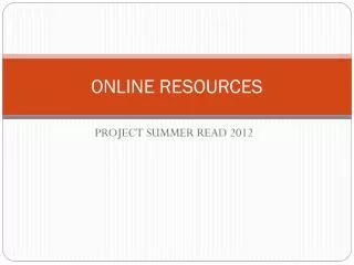
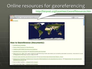
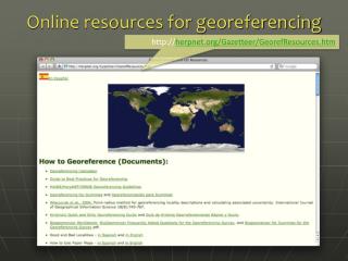
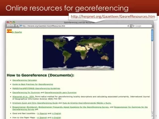
Online resources for georeferencing. http://herpnet.org/Gazetteer/GeorefResources.htm. Other g eoreferencing resources. http://www.canadensys.net/georeferencing. LatLong Crosshairs for Google Maps. http://www.canadensys.net/activities/development/latlong-crosshairs. Google Maps.

E N D
Online resources for georeferencing http://herpnet.org/Gazetteer/GeorefResources.htm Georeferencing workshop - Online resources - 2011.05.21
Other georeferencing resources http://www.canadensys.net/georeferencing
LatLong Crosshairs for Google Maps http://www.canadensys.net/activities/development/latlong-crosshairs
Google Maps • http://maps.google.com • Web mapping service application by Google • Search & directions • Free text search, depends on zoom level • Directions for travelling by car, bike, public transport and foot • Data compiled from different sources • Maps • Datum: WGS84 • Views: map, satellite (= aerial photography), terrain, Google Street View + various layers of information • Data compiled from different sources (indicated at the bottom of each map)
Google Maps – Search Search with suggestions Previous searches Report a problem Georeferencing workshop - Online resources - 2011.05.21
Google Maps – Views Maps Satellite Terrain (under ‘Map’) Earth (plugin required) Georeferencing workshop - Online resources - 2011.05.21
Google Maps – Street View Street View Georeferencing workshop - Online resources - 2011.05.21
Google Maps – Street View I collected here Georeferencing workshop - Online resources - 2011.05.21
Google Maps – Shapes Georeferencing workshop - Online resources - 2011.05.21
Google Maps – Get coordinates • Requires widgets or additional plugins: • Activate LatLng Marker in Google Maps Labs • Use this page (French/English): http://bit.ly/universimmedia • Use the Canadensys LatLong Crosshairs bookmarklet (does not work in Internet Explorer): http://www.canadensys.net/latlong-crosshairs • Use Distance Measurement Tool to measure extent • Use My places to save markers, create maps and share with others (including kml import) Georeferencing workshop - Online resources - 2011.05.21
Google Maps – Get coordinates My places Google Maps Labs LatLng Marker Right-click and‘Drop LatLng Marker’ (activate in ‘Labs’ first) Georeferencing workshop - Online resources - 2011.05.21
Google Maps – Get coordinates Canadensysbookmarklet Click to toggle Crosshairs Pan map to change position Click to get coordinates
Google Maps – Measure extent Distance Measurement Tool (activate in ‘Labs’ first) Georeferencing workshop - Online resources - 2011.05.21
Google Earth • http://earth.google.com • 3D globe desktop application • Same data as Google Maps • Datum: WGS84 • No map or terrain view • Similar functionalities as Google Maps • Search more limited than Google Maps (no suggestions) • Right-click and choose ‘Get Info’ for coordinates • Use ruler to measure extent • Several coordinate formats • Numerous information layers (format: kml)
ACME Mapper • http://mapper.acme.com/ • Google Maps interface • Datum: WGS84 (& NAD27) • Map, satellite, hybrid and terrain • Topo, DOQ, NEXRAD and Mapnik • Free text search not dependent on zoom level • Markers cannot be moved, but new markers can be placed at crosshairs (click ‘Mark’) • Several coordinate formats for each marker + heading and distance from crosshairs • Saves all markers automatically
GEOnet Names Server (GNS) • http://earth-info.nga.mil/gns/html/ • Worldwide data from NGA andUS BGN • NIMA = National Imagery andMapping Agency • Datum: WGS84 • Degrees minutes seconds,precision to nearest minute • Feature type • Used as a source for many gazetteers • For US data, use Geographic Names Information System (GNIS): http://geonames.usgs.gov/pls/gnispublic/
Falling Rain • http://www.fallingrain.com • Worldwide gazetteer for citiesand towns • Great for hard to find localities,especially outside US • Datum: WGS84 • Degrees minutes (seconds), based on NIMA • Browse to find locality (no search) • Provides hierarchy, alternative names, topo maps, altitude, weather information and location of nearby towns in nautical miles (nm). Use Georef. Calc. to translate nm into kilometers. • Example: Qaryeh-ye Gol`alam, Velayat-e Lowgar, AF
Getty Thesaurus of Geographic Names (TGN) • http://bit.ly/Getty-TGN • Worldwide gazetteer byThe Getty • Useful for finding alternativeand old names • Feature types • Geographical hierarchy • Degrees minutes or no coordinates! Use recent name and search in Google Maps • Example: New Amsterdam, US
FuzzyG – JRC Fuzzy Gazetteer • http://dma.jrc.it/services/fuzzyg/ • Worldwide gazetteer designed for bad spelling. • Useful for finding alternative, doubtful spelling and old names • Feature types, by continent • Degrees minutes or no coordinates • Use recent name and then search in Google Maps • Example: Narobi instead of Nairobi, Africa
UTM & MTM • UTM = Universal Tranverse Mercator • Divides earth in 60 UTM zones = 6 degrees per zone • Datum: WGS84 and others • Notation: Zone Easting Northing = 17N 630084 4833438 • Zone includes hemisphere (17N) or latitude band (17T): MGRS • Default extent: 30m (if recorded with GPS receiver) • http://www.dmap.co.uk/utmworld.htm • UTM Calculator: http://bit.ly/bdxn37 • MTM = Modified Tranverse Mercator • Used in Canada: zones are 3 degrees, different codes, false easting and scale, etc. • UTM/MTM Calculator: http://bit.ly/utmmtm
Public Land Survey System (PLSS) • Mainly used in the West, Midwest and some Southern states in the US • Uses Township-Range-Section (TRS):T13N-R14E-S15, Arizona, Coconino County • Graphical Locator: http://www.esg.montana.edu/gl/ • Translates TRS in decimal degrees • Datum: NAD27 • Determine state and meridian:http://bit.ly/bSouTw • For extents: http://manisnet.org/GeorefGuide.html
Other tools • Wikimedia Commons Atlas of the World – • An organized and commented collection of geographical, political, and historical maps • Statoids: http://www.statoids.com/ • Information about administrative divisions (provinces, counties) and their history, area, population, codes, etc. • No coordinates! • Similar: CIA World Factbookhttp://bit.ly/dDtT1i • GPS Visualizer: http://www.gpsvisualizer.com/ • Use to translate a file with coordinates into kml or a picture • Similar: http://www.simplemappr.net/ for publications • See http://bit.ly/herpnet-georef-resources for more…
Other tools: CartoDB • http://cartodb.com • Online geospatial database by Vizzuality • Useful for visualizing your data • Drag and drop CSV upload • Easy customization of your map • Share and embed your map • Powerful development tools • Free account = 5 tables / 5MB of data
Links • Google Maps: maps.google.com • LatLong crosshairs: www.canadensys.net/latlong-crosshairs • Hard to find localities: www.fallingrain.com • Old & alt. names: bit.ly/Getty-TGN • UTM map: www.dmap.co.uk/utmworld.htm • UTM calculator: bit.ly/bdxn37 • Other tools: bit.ly/herpnet-georef-resources