Download
1 / 9
90 likes | 198 Views
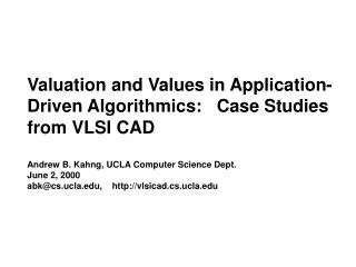
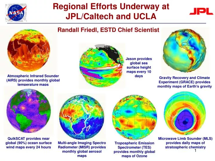
Regional Efforts Underway at JPL/Caltech and UCLA. Randall Friedl, ESTD Chief Scientist. Jason provides global sea surface height maps every 10 days. 2.8m/Year. Atmospheric Infrared Sounder (AIRS) provides monthly global temperature maps.

E N D
Regional Efforts Underway at JPL/Caltech and UCLA Randall Friedl, ESTD Chief Scientist Jason provides global sea surface height maps every 10 days 2.8m/Year Atmospheric Infrared Sounder (AIRS) provides monthly global temperature maps Gravity Recovery and Climate Experiment (GRACE) provides monthly maps of Earth’s gravity QuikSCAT provides near global (90%) ocean surface wind maps every 24 hours Microwave Limb Sounder (MLS) provides daily maps of stratospheric chemistry Multi-angle Imaging Spectro Radiometer (MISR) provides monthly global aerosol maps Tropospheric Emission Spectrometer (TES) provides monthly global maps of Ozone
JPL Earth Science Focuses on Space-Based Measurements • Enabling Science • Project science leadership • Retrieval algorithm development • Science Instrument development • Doing Science • Data analysis and modeling • Peer-reviewed publications • Bridge to the Community 12% Science R&A 27% Project Science Projects/Missions 55% Technology 6% NASA Focus Areas within JPL Atmos.Comp Science budget % Climate Solid Earth Weather Carbon Water
Increasing Focus on Regional Scale Increasing number of passive and active instruments can resolve local and regional scale processes
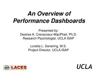
Major Uncertainties Regarding Regional Change Model simulations of the changes in annual mean surface air temperature (left) and precipitation (right) for Southern/Central California (35-37N; 119-121W) relative to a climatology calculated for the period 1900-1999.
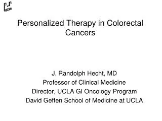
UCLA Earth Science Focuses on Modeling and Data Analysis Hurricane Katrina Ice/snow mixing ratio fields at 300 mb (4 km WRF simulation, R. Fovell, 2007) • Departmental Focus • GCM and Climate Modeling • Aerosols and Clouds in Climate • Mesoscale Modeling and Prediction • Air-Sea Interactions • Coastal Oceanography • Air Pollution & Atmospheric Chemistry • Remote Sensing & Radiation • Land-Atmosphere Interactions • Biogeochemical Cycle
Addressing California Climate Challenges through Research Partnerships • The UCLA/JPL Joint Institute for Earth System Science and Engineering (JIFRESSE) is a new partnership model (created May, 2006) • Located at UCLA (includes Director, Chief Operating Officer, 2 Adjunct Professors) • Promotes exchanges between faculty, students and researchers • Joint funding • Focuses on understanding regional impacts of climate change, through both modeling and observations • Contributes to robust predictions of California’s future environmental conditions, including air quality, snowpack and fresh water
JIFRESSE Strategy • The overall plan seeks to • Develop modeling tools for understanding regional scale response to climate change • Validate the modeling tools with available observational data • Develop techniques for observations of climate and environmental processes at the required spatial and temporal resolutions. • The initial plan for the joint institute is to focus on four Earth System Science and Engineering thrust areas, namely: • 1. Coupled Model Development - Remote Sensing Data Analysis • 2. Ecosystem Sensitivity Studies and Applications • 3. Air Quality and Climate Sensitivity Studies and Applications • 4. Sensor and Sensor Web Development
Developing A Validated Regional Climate Model Global (left) and southwest US (middle) surface air temperature for Jan 1999 from the National Center for Atmospheric Research 20th century climate simulation contribution to the IPCC’s 4th Assessment. (right) MODIS-derived surface skin temperature and false-color images at 1km resolution for a region in California for midday June 3, 2005.
Regional Model Under Development Schematic representation of the coupled regional Earth System model configuration, including advanced modeling components for the Atmosphere (WRF), Land Surface (SSiB), Chemical Transport and Air Quality (CMAQ) and through a future activity the Ocean (ROMS).